Paper, binding, full colour print; 40.5 x 29.5 cm, 84 pp.; scale: 1:100,000; title on cover sheet: ‘ISTORISKI ATALAS / OSLOBODILAČKOG RATA / NARODA JUGOSLAVIJE / 1941-1945’
Purchased in 1993
HPM-32981
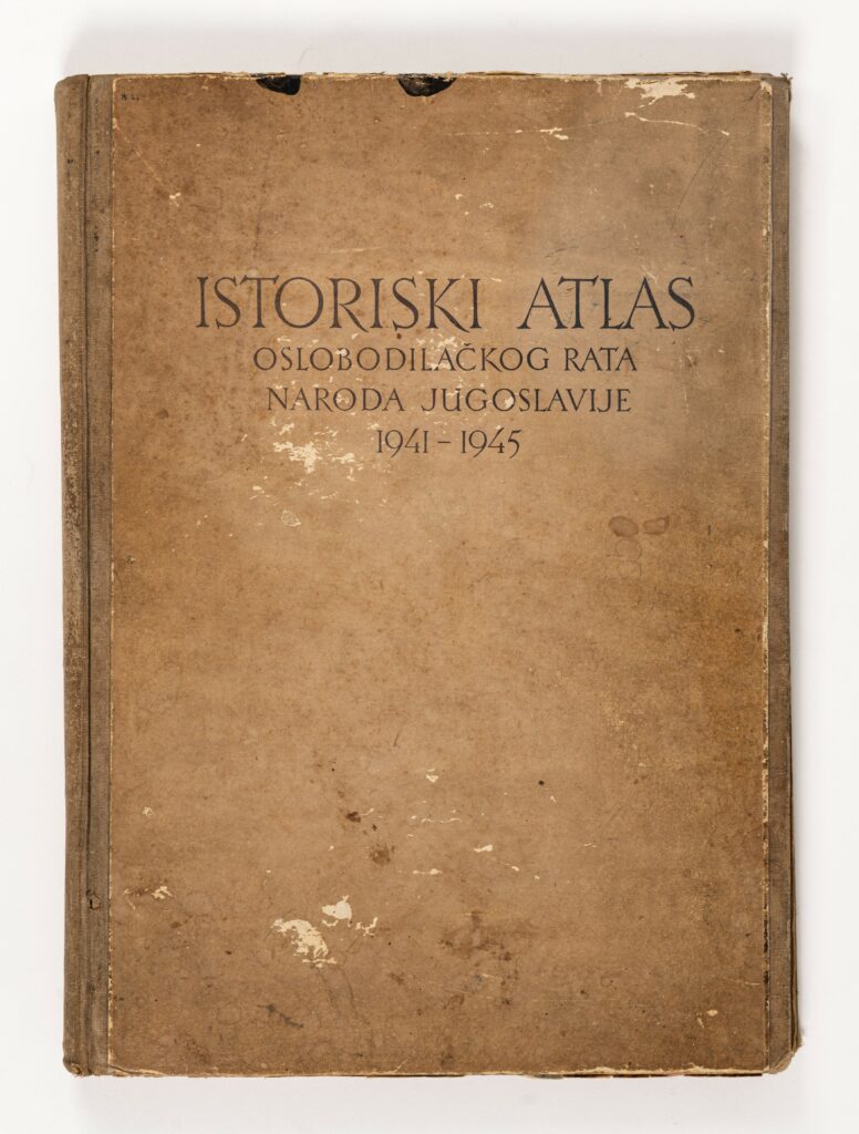
This atlas contains 41 maps depicting the development and flow of the most important military operations and events of the People’s Liberation War in Yugoslavia during World War II. The cartographical depictions are supplemented with keys and textual explanations, chronologically following the war events in the period from 1941 to 1945, such as the territorial division of the Kingdom of Yugoslavia, the deployment of Partisan detachments, depictions of territories liberated and partly liberated by Partisan units, the Seven Enemy Offensives, and the liberation of individual towns and cities. The last pages of the atlas contain: an overview map of the Federal People’s Republic of Yugoslavia in 1:2,000,000 scale with explanations and military statistical data and human losses, a table of contents, and cartographical corrections.

This atlas contains 41 maps depicting the development and flow of the most important military operations and events of the People’s Liberation War in Yugoslavia during World War II. The cartographical depictions are supplemented with keys and textual explanations, chronologically following the war events in the period from 1941 to 1945, such as the territorial division of the Kingdom of Yugoslavia, the deployment of Partisan detachments, depictions of territories liberated and partly liberated by Partisan units, the Seven Enemy Offensives, and the liberation of individual towns and cities. The last pages of the atlas contain: an overview map of the Federal People’s Republic of Yugoslavia in 1:2,000,000 scale with explanations and military statistical data and human losses, a table of contents, and cartographical corrections.
This atlas contains 41 maps depicting the development and flow of the most important military operations and events of the People’s Liberation War in Yugoslavia during World War II. The cartographical depictions are supplemented with keys and textual explanations, chronologically following the war events in the period from 1941 to 1945, such as the territorial division of the Kingdom of Yugoslavia, the deployment of Partisan detachments, depictions of territories liberated and partly liberated by Partisan units, the Seven Enemy Offensives, and the liberation of individual towns and cities. The last pages of the atlas contain: an overview map of the Federal People’s Republic of Yugoslavia in 1:2,000,000 scale with explanations and military statistical data and human losses, a table of contents, and cartographical corrections.
This atlas contains 41 maps depicting the development and flow of the most important military operations and events of the People’s Liberation War in Yugoslavia during World War II. The cartographical depictions are supplemented with keys and textual explanations, chronologically following the war events in the period from 1941 to 1945, such as the territorial division of the Kingdom of Yugoslavia, the deployment of Partisan detachments, depictions of territories liberated and partly liberated by Partisan units, the Seven Enemy Offensives, and the liberation of individual towns and cities. The last pages of the atlas contain: an overview map of the Federal People’s Republic of Yugoslavia in 1:2,000,000 scale with explanations and military statistical data and human losses, a table of contents, and cartographical corrections.
This atlas contains 41 maps depicting the development and flow of the most important military operations and events of the People’s Liberation War in Yugoslavia during World War II. The cartographical depictions are supplemented with keys and textual explanations, chronologically following the war events in the period from 1941 to 1945, such as the territorial division of the Kingdom of Yugoslavia, the deployment of Partisan detachments, depictions of territories liberated and partly liberated by Partisan units, the Seven Enemy Offensives, and the liberation of individual towns and cities. The last pages of the atlas contain: an overview map of the Federal People’s Republic of Yugoslavia in 1:2,000,000 scale with explanations and military statistical data and human losses, a table of contents, and cartographical corrections.
This atlas contains 41 maps depicting the development and flow of the most important military operations and events of the People’s Liberation War in Yugoslavia during World War II. The cartographical depictions are supplemented with keys and textual explanations, chronologically following the war events in the period from 1941 to 1945, such as the territorial division of the Kingdom of Yugoslavia, the deployment of Partisan detachments, depictions of territories liberated and partly liberated by Partisan units, the Seven Enemy Offensives, and the liberation of individual towns and cities. The last pages of the atlas contain: an overview map of the Federal People’s Republic of Yugoslavia in 1:2,000,000 scale with explanations and military statistical data and human losses, a table of contents, and cartographical corrections.
This atlas contains 41 maps depicting the development and flow of the most important military operations and events of the People’s Liberation War in Yugoslavia during World War II. The cartographical depictions are supplemented with keys and textual explanations, chronologically following the war events in the period from 1941 to 1945, such as the territorial division of the Kingdom of Yugoslavia, the deployment of Partisan detachments, depictions of territories liberated and partly liberated by Partisan units, the Seven Enemy Offensives, and the liberation of individual towns and cities. The last pages of the atlas contain: an overview map of the Federal People’s Republic of Yugoslavia in 1:2,000,000 scale with explanations and military statistical data and human losses, a table of contents, and cartographical corrections.
This atlas contains 41 maps depicting the development and flow of the most important military operations and events of the People’s Liberation War in Yugoslavia during World War II. The cartographical depictions are supplemented with keys and textual explanations, chronologically following the war events in the period from 1941 to 1945, such as the territorial division of the Kingdom of Yugoslavia, the deployment of Partisan detachments, depictions of territories liberated and partly liberated by Partisan units, the Seven Enemy Offensives, and the liberation of individual towns and cities. The last pages of the atlas contain: an overview map of the Federal People’s Republic of Yugoslavia in 1:2,000,000 scale with explanations and military statistical data and human losses, a table of contents, and cartographical corrections.
This atlas contains 41 maps depicting the development and flow of the most important military operations and events of the People’s Liberation War in Yugoslavia during World War II. The cartographical depictions are supplemented with keys and textual explanations, chronologically following the war events in the period from 1941 to 1945, such as the territorial division of the Kingdom of Yugoslavia, the deployment of Partisan detachments, depictions of territories liberated and partly liberated by Partisan units, the Seven Enemy Offensives, and the liberation of individual towns and cities. The last pages of the atlas contain: an overview map of the Federal People’s Republic of Yugoslavia in 1:2,000,000 scale with explanations and military statistical data and human losses, a table of contents, and cartographical corrections.
This atlas contains 41 maps depicting the development and flow of the most important military operations and events of the People’s Liberation War in Yugoslavia during World War II. The cartographical depictions are supplemented with keys and textual explanations, chronologically following the war events in the period from 1941 to 1945, such as the territorial division of the Kingdom of Yugoslavia, the deployment of Partisan detachments, depictions of territories liberated and partly liberated by Partisan units, the Seven Enemy Offensives, and the liberation of individual towns and cities. The last pages of the atlas contain: an overview map of the Federal People’s Republic of Yugoslavia in 1:2,000,000 scale with explanations and military statistical data and human losses, a table of contents, and cartographical corrections.
This atlas contains 41 maps depicting the development and flow of the most important military operations and events of the People’s Liberation War in Yugoslavia during World War II. The cartographical depictions are supplemented with keys and textual explanations, chronologically following the war events in the period from 1941 to 1945, such as the territorial division of the Kingdom of Yugoslavia, the deployment of Partisan detachments, depictions of territories liberated and partly liberated by Partisan units, the Seven Enemy Offensives, and the liberation of individual towns and cities. The last pages of the atlas contain: an overview map of the Federal People’s Republic of Yugoslavia in 1:2,000,000 scale with explanations and military statistical data and human losses, a table of contents, and cartographical corrections.
This atlas contains 41 maps depicting the development and flow of the most important military operations and events of the People’s Liberation War in Yugoslavia during World War II. The cartographical depictions are supplemented with keys and textual explanations, chronologically following the war events in the period from 1941 to 1945, such as the territorial division of the Kingdom of Yugoslavia, the deployment of Partisan detachments, depictions of territories liberated and partly liberated by Partisan units, the Seven Enemy Offensives, and the liberation of individual towns and cities. The last pages of the atlas contain: an overview map of the Federal People’s Republic of Yugoslavia in 1:2,000,000 scale with explanations and military statistical data and human losses, a table of contents, and cartographical corrections.
This atlas contains 41 maps depicting the development and flow of the most important military operations and events of the People’s Liberation War in Yugoslavia during World War II. The cartographical depictions are supplemented with keys and textual explanations, chronologically following the war events in the period from 1941 to 1945, such as the territorial division of the Kingdom of Yugoslavia, the deployment of Partisan detachments, depictions of territories liberated and partly liberated by Partisan units, the Seven Enemy Offensives, and the liberation of individual towns and cities. The last pages of the atlas contain: an overview map of the Federal People’s Republic of Yugoslavia in 1:2,000,000 scale with explanations and military statistical data and human losses, a table of contents, and cartographical corrections.
This atlas contains 41 maps depicting the development and flow of the most important military operations and events of the People’s Liberation War in Yugoslavia during World War II. The cartographical depictions are supplemented with keys and textual explanations, chronologically following the war events in the period from 1941 to 1945, such as the territorial division of the Kingdom of Yugoslavia, the deployment of Partisan detachments, depictions of territories liberated and partly liberated by Partisan units, the Seven Enemy Offensives, and the liberation of individual towns and cities. The last pages of the atlas contain: an overview map of the Federal People’s Republic of Yugoslavia in 1:2,000,000 scale with explanations and military statistical data and human losses, a table of contents, and cartographical corrections.
This atlas contains 41 maps depicting the development and flow of the most important military operations and events of the People’s Liberation War in Yugoslavia during World War II. The cartographical depictions are supplemented with keys and textual explanations, chronologically following the war events in the period from 1941 to 1945, such as the territorial division of the Kingdom of Yugoslavia, the deployment of Partisan detachments, depictions of territories liberated and partly liberated by Partisan units, the Seven Enemy Offensives, and the liberation of individual towns and cities. The last pages of the atlas contain: an overview map of the Federal People’s Republic of Yugoslavia in 1:2,000,000 scale with explanations and military statistical data and human losses, a table of contents, and cartographical corrections.
This atlas contains 41 maps depicting the development and flow of the most important military operations and events of the People’s Liberation War in Yugoslavia during World War II. The cartographical depictions are supplemented with keys and textual explanations, chronologically following the war events in the period from 1941 to 1945, such as the territorial division of the Kingdom of Yugoslavia, the deployment of Partisan detachments, depictions of territories liberated and partly liberated by Partisan units, the Seven Enemy Offensives, and the liberation of individual towns and cities. The last pages of the atlas contain: an overview map of the Federal People’s Republic of Yugoslavia in 1:2,000,000 scale with explanations and military statistical data and human losses, a table of contents, and cartographical corrections.
This atlas contains 41 maps depicting the development and flow of the most important military operations and events of the People’s Liberation War in Yugoslavia during World War II. The cartographical depictions are supplemented with keys and textual explanations, chronologically following the war events in the period from 1941 to 1945, such as the territorial division of the Kingdom of Yugoslavia, the deployment of Partisan detachments, depictions of territories liberated and partly liberated by Partisan units, the Seven Enemy Offensives, and the liberation of individual towns and cities. The last pages of the atlas contain: an overview map of the Federal People’s Republic of Yugoslavia in 1:2,000,000 scale with explanations and military statistical data and human losses, a table of contents, and cartographical corrections.
This atlas contains 41 maps depicting the development and flow of the most important military operations and events of the People’s Liberation War in Yugoslavia during World War II. The cartographical depictions are supplemented with keys and textual explanations, chronologically following the war events in the period from 1941 to 1945, such as the territorial division of the Kingdom of Yugoslavia, the deployment of Partisan detachments, depictions of territories liberated and partly liberated by Partisan units, the Seven Enemy Offensives, and the liberation of individual towns and cities. The last pages of the atlas contain: an overview map of the Federal People’s Republic of Yugoslavia in 1:2,000,000 scale with explanations and military statistical data and human losses, a table of contents, and cartographical corrections.
This atlas contains 41 maps depicting the development and flow of the most important military operations and events of the People’s Liberation War in Yugoslavia during World War II. The cartographical depictions are supplemented with keys and textual explanations, chronologically following the war events in the period from 1941 to 1945, such as the territorial division of the Kingdom of Yugoslavia, the deployment of Partisan detachments, depictions of territories liberated and partly liberated by Partisan units, the Seven Enemy Offensives, and the liberation of individual towns and cities. The last pages of the atlas contain: an overview map of the Federal People’s Republic of Yugoslavia in 1:2,000,000 scale with explanations and military statistical data and human losses, a table of contents, and cartographical corrections.
This atlas contains 41 maps depicting the development and flow of the most important military operations and events of the People’s Liberation War in Yugoslavia during World War II. The cartographical depictions are supplemented with keys and textual explanations, chronologically following the war events in the period from 1941 to 1945, such as the territorial division of the Kingdom of Yugoslavia, the deployment of Partisan detachments, depictions of territories liberated and partly liberated by Partisan units, the Seven Enemy Offensives, and the liberation of individual towns and cities. The last pages of the atlas contain: an overview map of the Federal People’s Republic of Yugoslavia in 1:2,000,000 scale with explanations and military statistical data and human losses, a table of contents, and cartographical corrections.
This atlas contains 41 maps depicting the development and flow of the most important military operations and events of the People’s Liberation War in Yugoslavia during World War II. The cartographical depictions are supplemented with keys and textual explanations, chronologically following the war events in the period from 1941 to 1945, such as the territorial division of the Kingdom of Yugoslavia, the deployment of Partisan detachments, depictions of territories liberated and partly liberated by Partisan units, the Seven Enemy Offensives, and the liberation of individual towns and cities. The last pages of the atlas contain: an overview map of the Federal People’s Republic of Yugoslavia in 1:2,000,000 scale with explanations and military statistical data and human losses, a table of contents, and cartographical corrections.
This atlas contains 41 maps depicting the development and flow of the most important military operations and events of the People’s Liberation War in Yugoslavia during World War II. The cartographical depictions are supplemented with keys and textual explanations, chronologically following the war events in the period from 1941 to 1945, such as the territorial division of the Kingdom of Yugoslavia, the deployment of Partisan detachments, depictions of territories liberated and partly liberated by Partisan units, the Seven Enemy Offensives, and the liberation of individual towns and cities. The last pages of the atlas contain: an overview map of the Federal People’s Republic of Yugoslavia in 1:2,000,000 scale with explanations and military statistical data and human losses, a table of contents, and cartographical corrections.
This atlas contains 41 maps depicting the development and flow of the most important military operations and events of the People’s Liberation War in Yugoslavia during World War II. The cartographical depictions are supplemented with keys and textual explanations, chronologically following the war events in the period from 1941 to 1945, such as the territorial division of the Kingdom of Yugoslavia, the deployment of Partisan detachments, depictions of territories liberated and partly liberated by Partisan units, the Seven Enemy Offensives, and the liberation of individual towns and cities. The last pages of the atlas contain: an overview map of the Federal People’s Republic of Yugoslavia in 1:2,000,000 scale with explanations and military statistical data and human losses, a table of contents, and cartographical corrections.
This atlas contains 41 maps depicting the development and flow of the most important military operations and events of the People’s Liberation War in Yugoslavia during World War II. The cartographical depictions are supplemented with keys and textual explanations, chronologically following the war events in the period from 1941 to 1945, such as the territorial division of the Kingdom of Yugoslavia, the deployment of Partisan detachments, depictions of territories liberated and partly liberated by Partisan units, the Seven Enemy Offensives, and the liberation of individual towns and cities. The last pages of the atlas contain: an overview map of the Federal People’s Republic of Yugoslavia in 1:2,000,000 scale with explanations and military statistical data and human losses, a table of contents, and cartographical corrections.
This atlas contains 41 maps depicting the development and flow of the most important military operations and events of the People’s Liberation War in Yugoslavia during World War II. The cartographical depictions are supplemented with keys and textual explanations, chronologically following the war events in the period from 1941 to 1945, such as the territorial division of the Kingdom of Yugoslavia, the deployment of Partisan detachments, depictions of territories liberated and partly liberated by Partisan units, the Seven Enemy Offensives, and the liberation of individual towns and cities. The last pages of the atlas contain: an overview map of the Federal People’s Republic of Yugoslavia in 1:2,000,000 scale with explanations and military statistical data and human losses, a table of contents, and cartographical corrections.
This atlas contains 41 maps depicting the development and flow of the most important military operations and events of the People’s Liberation War in Yugoslavia during World War II. The cartographical depictions are supplemented with keys and textual explanations, chronologically following the war events in the period from 1941 to 1945, such as the territorial division of the Kingdom of Yugoslavia, the deployment of Partisan detachments, depictions of territories liberated and partly liberated by Partisan units, the Seven Enemy Offensives, and the liberation of individual towns and cities. The last pages of the atlas contain: an overview map of the Federal People’s Republic of Yugoslavia in 1:2,000,000 scale with explanations and military statistical data and human losses, a table of contents, and cartographical corrections.
This atlas contains 41 maps depicting the development and flow of the most important military operations and events of the People’s Liberation War in Yugoslavia during World War II. The cartographical depictions are supplemented with keys and textual explanations, chronologically following the war events in the period from 1941 to 1945, such as the territorial division of the Kingdom of Yugoslavia, the deployment of Partisan detachments, depictions of territories liberated and partly liberated by Partisan units, the Seven Enemy Offensives, and the liberation of individual towns and cities. The last pages of the atlas contain: an overview map of the Federal People’s Republic of Yugoslavia in 1:2,000,000 scale with explanations and military statistical data and human losses, a table of contents, and cartographical corrections.
This atlas contains 41 maps depicting the development and flow of the most important military operations and events of the People’s Liberation War in Yugoslavia during World War II. The cartographical depictions are supplemented with keys and textual explanations, chronologically following the war events in the period from 1941 to 1945, such as the territorial division of the Kingdom of Yugoslavia, the deployment of Partisan detachments, depictions of territories liberated and partly liberated by Partisan units, the Seven Enemy Offensives, and the liberation of individual towns and cities. The last pages of the atlas contain: an overview map of the Federal People’s Republic of Yugoslavia in 1:2,000,000 scale with explanations and military statistical data and human losses, a table of contents, and cartographical corrections.
This atlas contains 41 maps depicting the development and flow of the most important military operations and events of the People’s Liberation War in Yugoslavia during World War II. The cartographical depictions are supplemented with keys and textual explanations, chronologically following the war events in the period from 1941 to 1945, such as the territorial division of the Kingdom of Yugoslavia, the deployment of Partisan detachments, depictions of territories liberated and partly liberated by Partisan units, the Seven Enemy Offensives, and the liberation of individual towns and cities. The last pages of the atlas contain: an overview map of the Federal People’s Republic of Yugoslavia in 1:2,000,000 scale with explanations and military statistical data and human losses, a table of contents, and cartographical corrections.
This atlas contains 41 maps depicting the development and flow of the most important military operations and events of the People’s Liberation War in Yugoslavia during World War II. The cartographical depictions are supplemented with keys and textual explanations, chronologically following the war events in the period from 1941 to 1945, such as the territorial division of the Kingdom of Yugoslavia, the deployment of Partisan detachments, depictions of territories liberated and partly liberated by Partisan units, the Seven Enemy Offensives, and the liberation of individual towns and cities. The last pages of the atlas contain: an overview map of the Federal People’s Republic of Yugoslavia in 1:2,000,000 scale with explanations and military statistical data and human losses, a table of contents, and cartographical corrections.
This atlas contains 41 maps depicting the development and flow of the most important military operations and events of the People’s Liberation War in Yugoslavia during World War II. The cartographical depictions are supplemented with keys and textual explanations, chronologically following the war events in the period from 1941 to 1945, such as the territorial division of the Kingdom of Yugoslavia, the deployment of Partisan detachments, depictions of territories liberated and partly liberated by Partisan units, the Seven Enemy Offensives, and the liberation of individual towns and cities. The last pages of the atlas contain: an overview map of the Federal People’s Republic of Yugoslavia in 1:2,000,000 scale with explanations and military statistical data and human losses, a table of contents, and cartographical corrections.
This atlas contains 41 maps depicting the development and flow of the most important military operations and events of the People’s Liberation War in Yugoslavia during World War II. The cartographical depictions are supplemented with keys and textual explanations, chronologically following the war events in the period from 1941 to 1945, such as the territorial division of the Kingdom of Yugoslavia, the deployment of Partisan detachments, depictions of territories liberated and partly liberated by Partisan units, the Seven Enemy Offensives, and the liberation of individual towns and cities. The last pages of the atlas contain: an overview map of the Federal People’s Republic of Yugoslavia in 1:2,000,000 scale with explanations and military statistical data and human losses, a table of contents, and cartographical corrections.
This atlas contains 41 maps depicting the development and flow of the most important military operations and events of the People’s Liberation War in Yugoslavia during World War II. The cartographical depictions are supplemented with keys and textual explanations, chronologically following the war events in the period from 1941 to 1945, such as the territorial division of the Kingdom of Yugoslavia, the deployment of Partisan detachments, depictions of territories liberated and partly liberated by Partisan units, the Seven Enemy Offensives, and the liberation of individual towns and cities. The last pages of the atlas contain: an overview map of the Federal People’s Republic of Yugoslavia in 1:2,000,000 scale with explanations and military statistical data and human losses, a table of contents, and cartographical corrections.
This atlas contains 41 maps depicting the development and flow of the most important military operations and events of the People’s Liberation War in Yugoslavia during World War II. The cartographical depictions are supplemented with keys and textual explanations, chronologically following the war events in the period from 1941 to 1945, such as the territorial division of the Kingdom of Yugoslavia, the deployment of Partisan detachments, depictions of territories liberated and partly liberated by Partisan units, the Seven Enemy Offensives, and the liberation of individual towns and cities. The last pages of the atlas contain: an overview map of the Federal People’s Republic of Yugoslavia in 1:2,000,000 scale with explanations and military statistical data and human losses, a table of contents, and cartographical corrections.
This atlas contains 41 maps depicting the development and flow of the most important military operations and events of the People’s Liberation War in Yugoslavia during World War II. The cartographical depictions are supplemented with keys and textual explanations, chronologically following the war events in the period from 1941 to 1945, such as the territorial division of the Kingdom of Yugoslavia, the deployment of Partisan detachments, depictions of territories liberated and partly liberated by Partisan units, the Seven Enemy Offensives, and the liberation of individual towns and cities. The last pages of the atlas contain: an overview map of the Federal People’s Republic of Yugoslavia in 1:2,000,000 scale with explanations and military statistical data and human losses, a table of contents, and cartographical corrections.
This atlas contains 41 maps depicting the development and flow of the most important military operations and events of the People’s Liberation War in Yugoslavia during World War II. The cartographical depictions are supplemented with keys and textual explanations, chronologically following the war events in the period from 1941 to 1945, such as the territorial division of the Kingdom of Yugoslavia, the deployment of Partisan detachments, depictions of territories liberated and partly liberated by Partisan units, the Seven Enemy Offensives, and the liberation of individual towns and cities. The last pages of the atlas contain: an overview map of the Federal People’s Republic of Yugoslavia in 1:2,000,000 scale with explanations and military statistical data and human losses, a table of contents, and cartographical corrections.
This atlas contains 41 maps depicting the development and flow of the most important military operations and events of the People’s Liberation War in Yugoslavia during World War II. The cartographical depictions are supplemented with keys and textual explanations, chronologically following the war events in the period from 1941 to 1945, such as the territorial division of the Kingdom of Yugoslavia, the deployment of Partisan detachments, depictions of territories liberated and partly liberated by Partisan units, the Seven Enemy Offensives, and the liberation of individual towns and cities. The last pages of the atlas contain: an overview map of the Federal People’s Republic of Yugoslavia in 1:2,000,000 scale with explanations and military statistical data and human losses, a table of contents, and cartographical corrections.
This atlas contains 41 maps depicting the development and flow of the most important military operations and events of the People’s Liberation War in Yugoslavia during World War II. The cartographical depictions are supplemented with keys and textual explanations, chronologically following the war events in the period from 1941 to 1945, such as the territorial division of the Kingdom of Yugoslavia, the deployment of Partisan detachments, depictions of territories liberated and partly liberated by Partisan units, the Seven Enemy Offensives, and the liberation of individual towns and cities. The last pages of the atlas contain: an overview map of the Federal People’s Republic of Yugoslavia in 1:2,000,000 scale with explanations and military statistical data and human losses, a table of contents, and cartographical corrections.
This atlas contains 41 maps depicting the development and flow of the most important military operations and events of the People’s Liberation War in Yugoslavia during World War II. The cartographical depictions are supplemented with keys and textual explanations, chronologically following the war events in the period from 1941 to 1945, such as the territorial division of the Kingdom of Yugoslavia, the deployment of Partisan detachments, depictions of territories liberated and partly liberated by Partisan units, the Seven Enemy Offensives, and the liberation of individual towns and cities. The last pages of the atlas contain: an overview map of the Federal People’s Republic of Yugoslavia in 1:2,000,000 scale with explanations and military statistical data and human losses, a table of contents, and cartographical corrections.
This atlas contains 41 maps depicting the development and flow of the most important military operations and events of the People’s Liberation War in Yugoslavia during World War II. The cartographical depictions are supplemented with keys and textual explanations, chronologically following the war events in the period from 1941 to 1945, such as the territorial division of the Kingdom of Yugoslavia, the deployment of Partisan detachments, depictions of territories liberated and partly liberated by Partisan units, the Seven Enemy Offensives, and the liberation of individual towns and cities. The last pages of the atlas contain: an overview map of the Federal People’s Republic of Yugoslavia in 1:2,000,000 scale with explanations and military statistical data and human losses, a table of contents, and cartographical corrections.