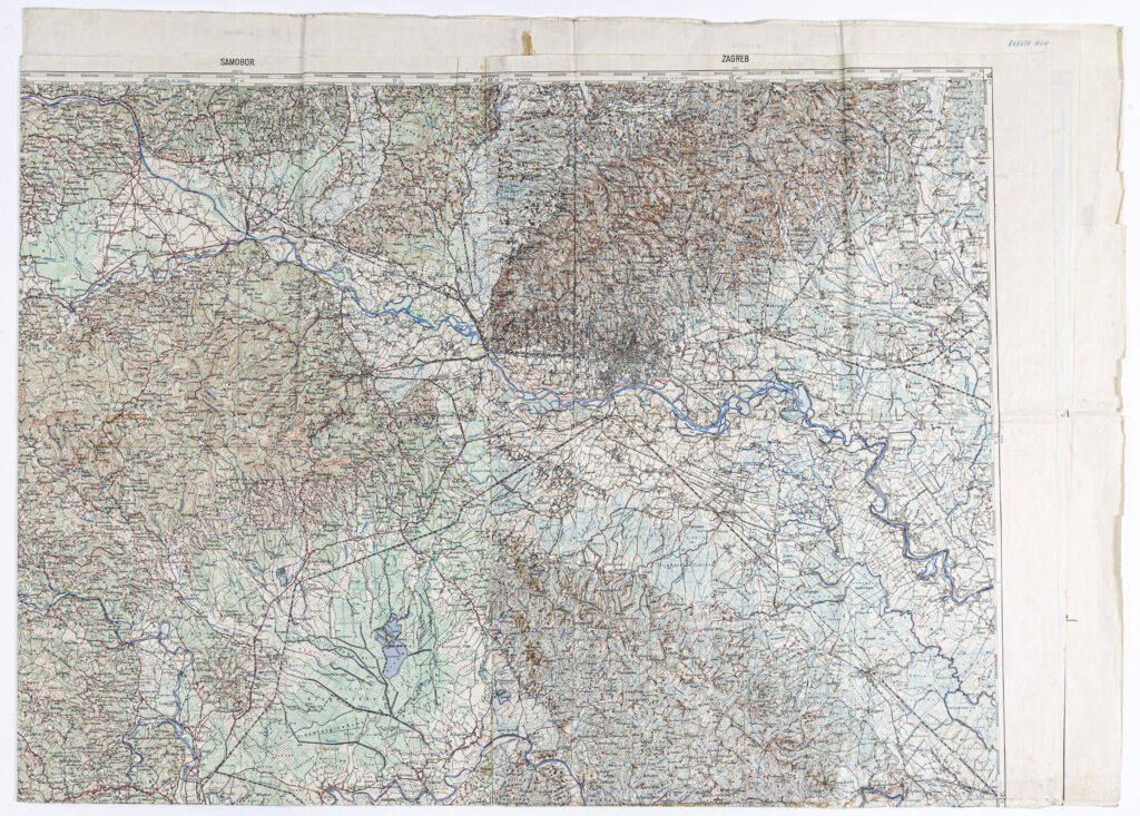
‘Cerknica’–‘Novo Mesto’–‘Zagreb’–‘Samobor’–‘Sušak’–‘Ogulin’ Sheet from the Topographic Map of the Kingdom of Yugoslavia
Military Geographical Institute,
Belgrade,
1932
Paper, full colour print; 117 × 165,5 cm;
scale: 1:100,000;
below frame: ‘Reambulirao, iscrtao i reprodukovao Vojni geografski Institut Kraljevine Jugoslavije / Reambulirano 1929 - 30 g. Reprodukovano 1832 g.’; ‘Reambulirao, iscrtao i reprodukovao Vojni Geografski Institut Kraljevine Jugoslavije / Reambulirano 1929 - 30 g. Reprodukovano 1931 g.’; ‘Reambulirao, iscrtao i reprodukovao Vojni Geografski Institut Kraljevine Jugoslavije / Reambulirano 1930 g. Reprodukovano 1932 g.’
Six sheets (‘Cerknica’, ‘Novo Mesto’, ‘Samobor’, ‘Zagreb’, ‘Sušak’, and ‘Ogulin’), extracted from a detailed topographic map of the Kingdom of Yugoslavia made in 1:100,000 scale from 1926 to 1935, and combined into a single topographic map.
Izvori / literatura: first publication
error: Sadržaj je zaštićen!
Hrvatski povijesni muzej
‘Cerknica’–‘Novo Mesto’–‘Zagreb’–‘Samobor’–‘Sušak’–‘Ogulin’ Sheet from the Topographic Map of the Kingdom of Yugoslavia
Description:
Six sheets (‘Cerknica’, ‘Novo Mesto’, ‘Samobor’, ‘Zagreb’, ‘Sušak’, and ‘Ogulin’), extracted from a detailed topographic map of the Kingdom of Yugoslavia made in 1:100,000 scale from 1926 to 1935, and combined into a single topographic map.
Inventory number:
HPM-101978
‘Cerknica’–‘Novo Mesto’–‘Zagreb’–‘Samobor’–‘Sušak’–‘Ogulin’ Sheet from the Topographic Map of the Kingdom of Yugoslavia
Description:
Six sheets (‘Cerknica’, ‘Novo Mesto’, ‘Samobor’, ‘Zagreb’, ‘Sušak’, and ‘Ogulin’), extracted from a detailed topographic map of the Kingdom of Yugoslavia made in 1:100,000 scale from 1926 to 1935, and combined into a single topographic map.