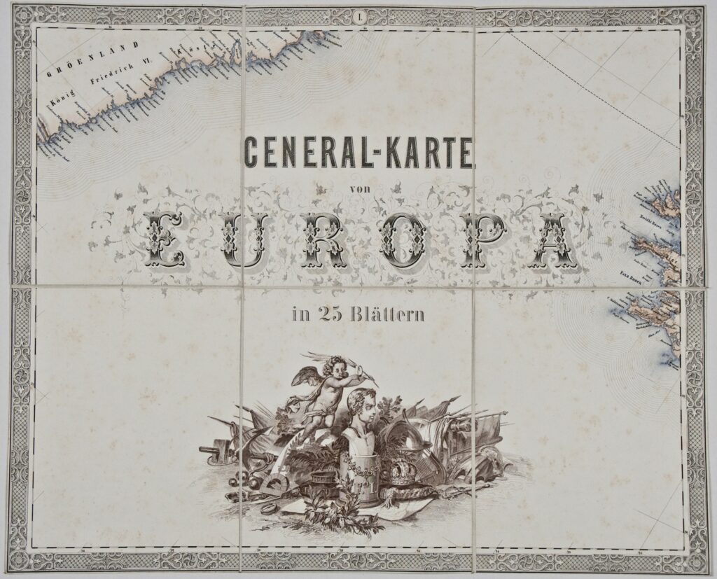
Container: cardboard, glued; maps, paper on canvas, full colour print; 40,5 × 49,5 cm; scale: 1:2,592,000; on volume cover: ‘J.SCHEDA / GENERAL-KARTE / VON / EUROPA’; title on cover sheet: ‘GENERAL-KARTE / von / EUROPA / in 25 Blättern’; volume contains a sheet with a dedication to Emperor Ferdinand I
Received from the 16th Imperial and Royal Varaždin Infantry Regiment
HPM/PMH-9872 – HPM/PMH-9896
This almost complete copy of a volume of a general map of Europe consists of 24 cartographical sheets depicting European countries (sheet XVIII, which among other things depicts the Croatian lands, is missing). The Cartographical Collection’s holdings contain another copy of this Scheda’s map published in 1845–1847, with additional plans of Vienna, Rome, St Petersburg, and Naples as well as a geological map of the Austrian Empire depicting large parts of the neighbouring countries (HPM/PMH-18959–18981). The list of map sheets is as follows:
I. Map title sheet with a bust of the Austrian Emperor and Hungarian-Croatian king Ferdinand I, with the cartographical depiction below the bust. Flags, weapons, a globe, and cartographic aids are depicted left and right of an allegorical depiction of an angel in flight.
II. Iceland
III. Northern Scandinavia
IV. White Sea
V. Siberia
VI. Title sheet with map data and a dedication to Emperor Ferdinand I: ‘To His Imperial and Royal Apostolic Majesty Ferdinand I, Austrian emperor, with the deep respect of Josef Scheda, major in the Imperial and Royal Austrian engineer geographical detachment, chief of the military department of the Geographical Institute, bearer of several prestigious decorations, owner of a large gold medal awarded for art and science regarding Austria, Prussia, Hanover, and Saxony, member of the geographical association for Berlin, Darmstadt, and Vienna.’ (trans.)
VII. Northern Ireland and Scotland
VIII. The Baltic
IX. Part of Russia from Moscow to St Petersburg
X. Part of Russia around the Urals
XI. Atlantic Ocean
XII. Western and Central Europe
XIII. Central Europe
XIV. Southern Russia along the Dnieper River and the northern Sea of Azov
XV. Part of Russia with the northern Caspian Sea
XVI. Portugal and northwestern Spain
XVII. Northwestern Mediterranean
XVIII. Missing; Italy, Kingdoms of Croatia and Slavonia, Croatian-Slavonian Military Border, Kingdom of Dalmatia, and southeastern Europe
XIX. Black Sea
XX. Parts of Russia, the Ottoman Empire, and the Persian Empire (Iran)
XXI. Northwestern Africa (Morocco) and part of the Sahara. The sheet also contains a map key, list of abbreviations, and note on language.
XXII. North Africa (Algeria and Tunisia) with tables depicting various units of length (Austrian, German, Italian, and Russian miles, and French leagues)
XXIII. Part of northern Africa and the southern Mediterranean.
XXIV. Eastern Mediterranean
XXV. Part of the Middle East with parts of the Arabian and Syrian Deserts. A table with general statistical data on the natural-geographical and social-geographical characteristics of European lands can be found near the bottom of the sheet.