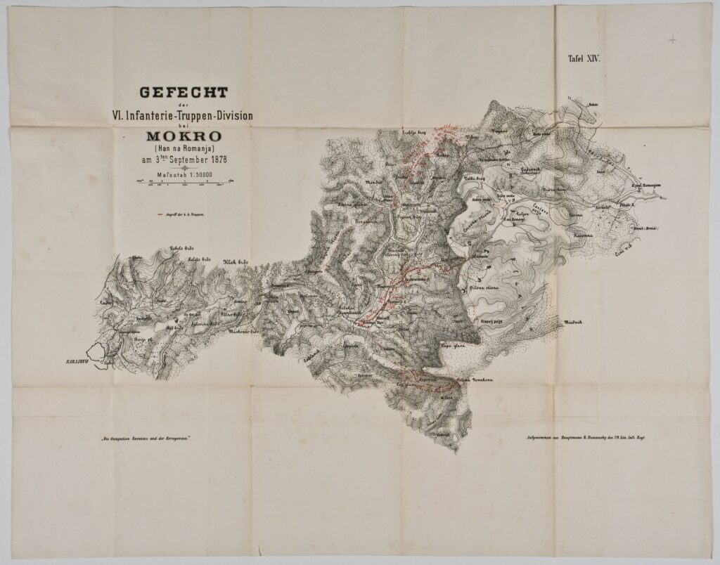
Map of the Battle near Mokro in Bosnia and Herzegovina, 1878
Recorded by: R. Domansky,
Imperial and Royal Military Geographical Institute,
Vienna,
1878
Paper, print; 48,8 × 61,8 cm;
scale: 1:50,000;
u. l.: title: ‘GEFECHT / der / VI. Infanterie-Truppen-Division / bei / MOKRO / (Han na Romanja) / am 3ten September 1878’; u. r.: label: ‘Tafel XIV.’; l. l.: note: ‘Die Occupation Bosniens und der Hercegovina’; l. r.: note on author: ‘Aufgenommen von Hauptmann R. Domansky des 29. Lin. Inft. Regt.’
Inherited from the Archaeology and History Department of the National Museum in Zagreb
Map depicting the battle and positions of the Austro-Hungarian VI Infantry Troop Division near the village Mokro (at the foot of the Romanija mountain) in Bosnia and Herzegovina on 3 September 1878, during the occupation of Bosnia and Herzegovina.
Izvori / literatura: first publication
error: Sadržaj je zaštićen!
Hrvatski povijesni muzej
Map of the Battle near Mokro in Bosnia and Herzegovina, 1878
Description:
Map depicting the battle and positions of the Austro-Hungarian VI Infantry Troop Division near the village Mokro (at the foot of the Romanija mountain) in Bosnia and Herzegovina on 3 September 1878, during the occupation of Bosnia and Herzegovina.