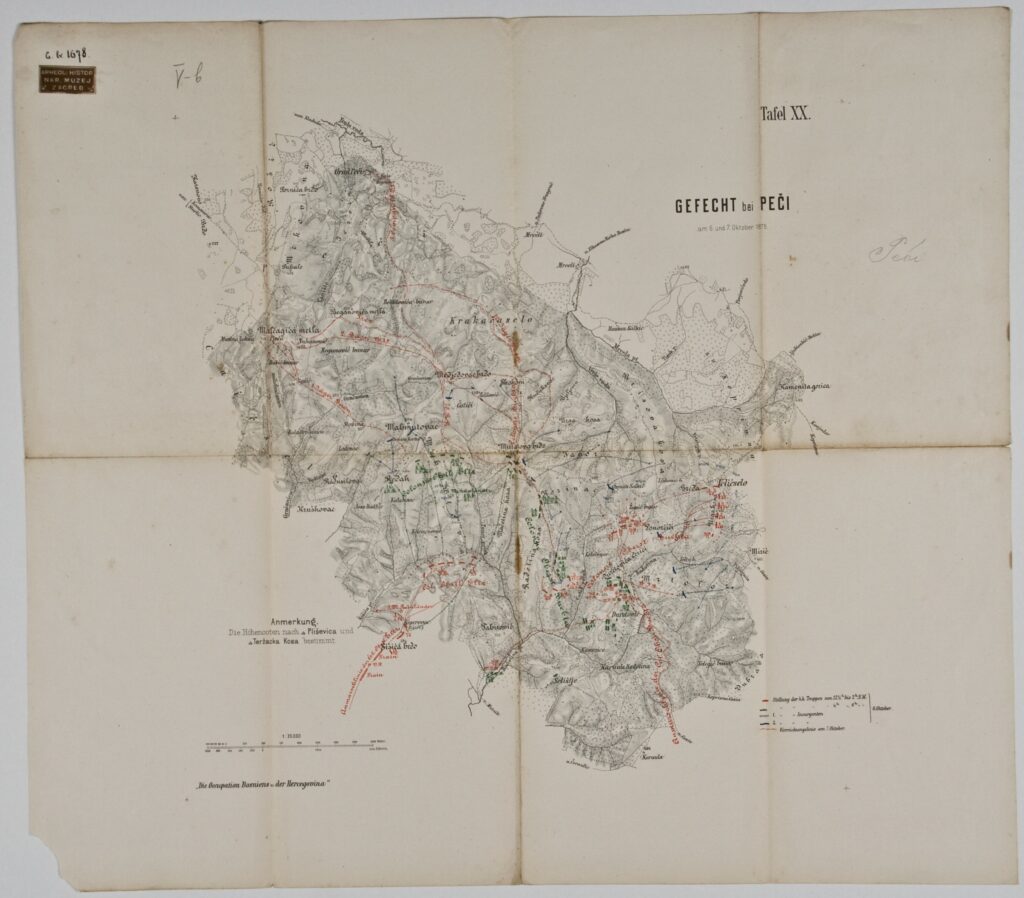
Map of the Battle near the Village Peć, 6–7 October 1878
Imperial and Royal Military Geographical Institute,
Vienna,
1878
Paper, print; 46,5 × 52,8 cm;
scale: 1:25,000;
u. r.: title: ‘GEFECHT bei PEČI / am 6. und 7. Oktober 1878.’ and label: ‘Tafel XX.’; u. l.: stamp with provenance: ‘ARHEOL.-HISTOR. / NAR. MUZEJ / ZAGREB’; l. l.: note on elevation labels: ‘Anmerkung. / Die Hohencoten nach Pliševica und / Teržacka Kosa bestimmt.’ with note: ‘Die Occupation Bosniens und der Hercegovina’; l. l.: map key
Inherited from the Archaeology and History Department of the National Museum in Zagreb
Map of the battle near the village Peć on 6–7 October 1878, with marked positions of the Austro-Hungarian and rebel armies during the occupation of Bosnia and Herzegovina. The establishment of peace in the Krajina area between the river Una and the Croatian border was entrusted to Austro-Hungarian major general Rheinländer, who, after capturing Bihać in September 1878, went to the southeastern part of the country in order to pursue the rebels who had fled the town. On 7 October 1878, Rheinländer’s army defeated the rebel army gathered from the villages surrounding Peć, and captured Peć and Pecka Gora.
Izvori / literatura: Tominac: 2020, p. 265
error: Sadržaj je zaštićen!
Hrvatski povijesni muzej
Map of the Battle near the Village Peć, 6–7 October 1878
Description:
Map of the battle near the village Peć on 6–7 October 1878, with marked positions of the Austro-Hungarian and rebel armies during the occupation of Bosnia and Herzegovina. The establishment of peace in the Krajina area between the river Una and the Croatian border was entrusted to Austro-Hungarian major general Rheinländer, who, after capturing Bihać in September 1878, went to the southeastern part of the country in order to pursue the rebels who had fled the town. On 7 October 1878, Rheinländer’s army defeated the rebel army gathered from the villages surrounding Peć, and captured Peć and Pecka Gora.