Imperial and Royal Military Geographical Institute,
Vienna,
from 1850 to 1900
Paper, print; 47,3 × 56,3 cm;
scale: 1:2,880;
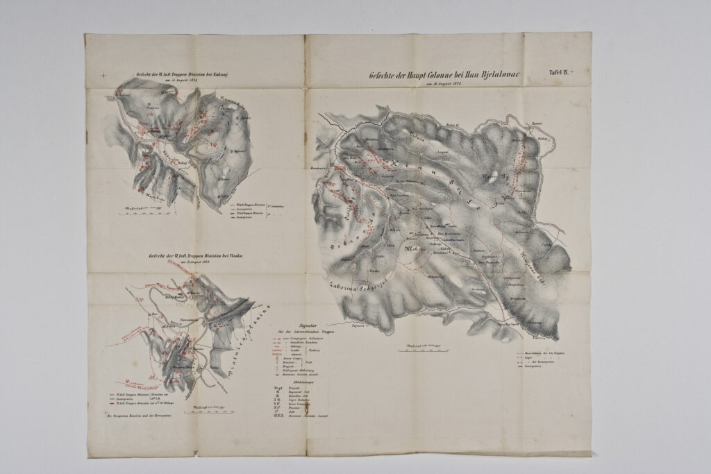
map title: ‘Croquis des Gefechtsfeldes / auf den / Majevica planina.’; u. r.: sheet label: ‘Tafel XVII.’; l. r.: note: ‘Die Occupation Bosniens u der Hercegovina.’; l. l.: map key; stamp with provenance: ‘ARHEOL.-HISTOR. / NAR. MUZEJ / ZAGREB’.
Inherited from the Archaeology and History Department of the National Museum in Zagreb
Map with a depiction of the front on the Majevica mountain, with marked positions of the Austro-Hungarian and rebel armies during the Austro-Hungarian occupation of Bosnia and Herzegovina in 1878.
Izvori / literatura: first publication
error: Sadržaj je zaštićen!
Hrvatski povijesni muzej
Map of the Front on Majevica Mountain in 1878
Description:
Map with a depiction of the front on the Majevica mountain, with marked positions of the Austro-Hungarian and rebel armies during the Austro-Hungarian occupation of Bosnia and Herzegovina in 1878.