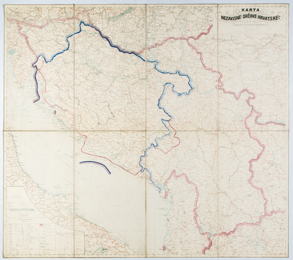
Paper on canvas, full colour print, manuscript; 77 x 86.5 cm; scale: 1:100,000; u. r.: written by hand over the map’s original title: ‘KARTA / NEZAVISNE DRŽAVE HRVATSKE-.’; l. l.: hypsometric tint scale and map key
Found in the Museum
HPM-98945
The national borders of the Independent State of Croatia, including the Sandžak territory, were drawn by hand on this detailed map of the Kingdom of Yugoslavia and its neighbouring provinces from 1935. Following the Treaties of Rome of May 1941, the border between the Kingdom of Italy and the Independent State of Croatia was defined, and a large part of the Adriatic coast and its hinterland were ceded to Italy. This area was known as the First Zone, and was marked on the map by hand.
The national borders of the Independent State of Croatia, including the Sandžak territory, were drawn by hand on this detailed map of the Kingdom of Yugoslavia and its neighbouring provinces from 1935. Following the Treaties of Rome of May 1941, the border between the Kingdom of Italy and the Independent State of Croatia was defined, and a large part of the Adriatic coast and its hinterland were ceded to Italy. This area was known as the First Zone, and was marked on the map by hand.