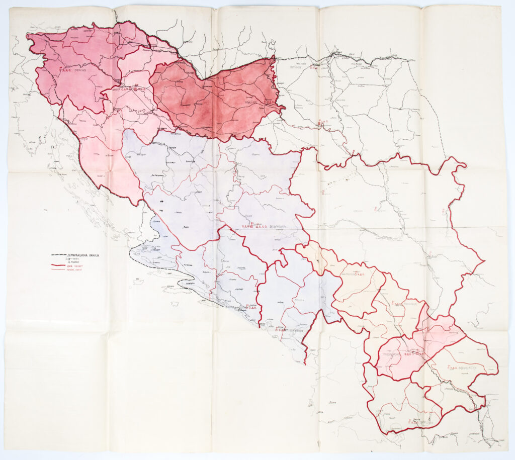
Map of the Kingdom of Serbs, Croats and Slovenes depicting the military-administrative division into 33 districts. ‘Demarcation lines’, ‘divisional districts’, and ‘regimental districts’ are marked on the map. Certain banate (banovina) names from the time of the Kingdom of Yugoslavia were later added by hand. Following the regulation of King Alexander Karađorđević of 26 June 1922 on the division of the country into districts, Croatian territory was divided into the following six districts: Srijem (Vukovar), Osijek (Osijek), Zagreb (Zagreb), Littoral-Krajina (Karlovac), Dubrovnik (Dubrovnik), and Split (Split). The Međimurje area, with its Croatian population, was annexed to the Maribor District (Slovenia), the Bay of Kotor to the Zeta District (Montenegro), and the island of Krk, formerly an administrative part of Istria, to the Split District.
Izvori / literatura: Boban: 1992, pp. 23–24
error: Sadržaj je zaštićen!
Hrvatski povijesni muzej
Map of the Military-Administrative Division of the Kingdom of Serbs, Croats and Slovenes
Description:
Map of the Kingdom of Serbs, Croats and Slovenes depicting the military-administrative division into 33 districts. ‘Demarcation lines’, ‘divisional districts’, and ‘regimental districts’ are marked on the map. Certain banate (banovina) names from the time of the Kingdom of Yugoslavia were later added by hand. Following the regulation of King Alexander Karađorđević of 26 June 1922 on the division of the country into districts, Croatian territory was divided into the following six districts: Srijem (Vukovar), Osijek (Osijek), Zagreb (Zagreb), Littoral-Krajina (Karlovac), Dubrovnik (Dubrovnik), and Split (Split). The Međimurje area, with its Croatian population, was annexed to the Maribor District (Slovenia), the Bay of Kotor to the Zeta District (Montenegro), and the island of Krk, formerly an administrative part of Istria, to the Split District.