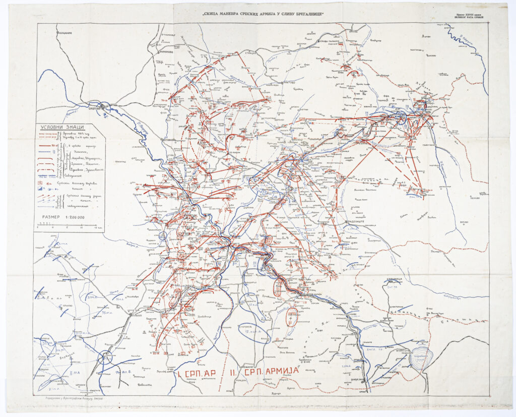
Paper, lithography; 69.5 x 85.7 cm; scale: 1:200,000; title above sketch frame: ‘SKICA MANEVARA SRPSKIH ARMIJA U SLIVU BREGALNICE’; u. r.: note: ‘PRILOG XXVIII KNJIZI / VELIKOG RATA SRBIJE’; map key along sketch edge; below sketch frame: ‘REPRODUKTOVANO U VOJNOGEOGRAFSKOM INSTITUTU, BEOGRAD’
Found in the Museum
HPM/PMH-16382
Map depicting the movements of the Serbian royal army in the area of the drainage basin of the river Bregalnica in North Macedonia during its retreat towards Corfu and Thessalonica in 1915/1916, during World War I. During the evacuation and relocation to Kragujevac, Vranje, Ćuprija, and Kraljevo in 1915, the Military Geographical Institute worked intensely on printing new maps (e.g. the Map of the Yugoslav Lands in 1:200,000 scale). Towards the end of that year, the Institute and the Serbian Army’s High Command were evacuated towards Shköder. Immediately after arrival, they began to form and organise a cartographical workshop, where four map sections depicting the Albanian Littoral in 1:150,000 scale were printed. The staff, as well as the logistical part of the Military Geographical Institute, soon set off towards the Greek island of Corfu via Shëngjin (then Medova, Albania). Upon arriving on the island, they rented printing presses because almost all of the Institute’s property had been lost or destroyed. The first maps produced in the new cartographical workshop were sections of a map of the lands of southeastern Europe in 1:200,000 scale. In 1916, a photo section was established in Thessalonica under the administration of the Military Geographical Institute, and encompassed 13 painters, 10 photographers, and 6 projectionists. The Thessalonica cartographical workshop was the only specialised institution of that sort on the Thessalonica Front, and produced over 1,500 map prints in a few years. In the 1914–1918 period, the Institute produced maps of all the areas where Serbian units were deployed in the Balkan theatre, and, in the later stages of the war, emphasis was put on making maps of the Thessalonica Front, i.e. the area of Corfu and Thessalonica; this was also the first time that aerial photography was used. From the end of the war to early January 1919, the cartographical workshop of the Military Geographical Institute was returned by rail from Thessalonica to Belgrade via Dubrovnik.

Map depicting the movements of the Serbian royal army in the area of the drainage basin of the river Bregalnica in North Macedonia during its retreat towards Corfu and Thessalonica in 1915/1916, during World War I. During the evacuation and relocation to Kragujevac, Vranje, Ćuprija, and Kraljevo in 1915, the Military Geographical Institute worked intensely on printing new maps (e.g. the Map of the Yugoslav Lands in 1:200,000 scale). Towards the end of that year, the Institute and the Serbian Army’s High Command were evacuated towards Shköder. Immediately after arrival, they began to form and organise a cartographical workshop, where four map sections depicting the Albanian Littoral in 1:150,000 scale were printed. The staff, as well as the logistical part of the Military Geographical Institute, soon set off towards the Greek island of Corfu via Shëngjin (then Medova, Albania). Upon arriving on the island, they rented printing presses because almost all of the Institute’s property had been lost or destroyed. The first maps produced in the new cartographical workshop were sections of a map of the lands of southeastern Europe in 1:200,000 scale. In 1916, a photo section was established in Thessalonica under the administration of the Military Geographical Institute, and encompassed 13 painters, 10 photographers, and 6 projectionists. The Thessalonica cartographical workshop was the only specialised institution of that sort on the Thessalonica Front, and produced over 1,500 map prints in a few years. In the 1914–1918 period, the Institute produced maps of all the areas where Serbian units were deployed in the Balkan theatre, and, in the later stages of the war, emphasis was put on making maps of the Thessalonica Front, i.e. the area of Corfu and Thessalonica; this was also the first time that aerial photography was used. From the end of the war to early January 1919, the cartographical workshop of the Military Geographical Institute was returned by rail from Thessalonica to Belgrade via Dubrovnik.