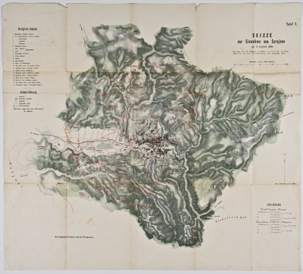
Map ‘Sketch of the Siege of Sarajevo on 19 August 1878’
Recorded and drawn by: Johann Roskiewicz,
Imperial and Royal Military Geographical Institute,
Vienna,
1878
Paper, full colour print; 55,5 × 61,8 cm;
scale: 1:2,880;
u. r.: label: ‘Tafel X.’ and title: ‘SKIZZE / zur Einnahme von Sarajevo / am 19. August 1878.’; note on author and terrain recording below title: ‘(Nach einem vom Joh. Roskiewicz k.k. Hauptm. Im G. Q. M. Stbe. im- Monate / Oktober 1862 und April 1863 aufgenommenen und gezeichneten Plane.)’; u. l. and l. r.: map keys; l. l.: note: ‘Die Ocupation Bosniens und der Hercegovina’
Inherited from the Archaeology and History Department of the National Museum in Zagreb
Map of the siege and capture of Sarajevo on 19 August 1878, depicting the deployment of Austro-Hungarian army units under the command of Josip, Baron Filipović, during the occupation of Bosnia and Herzegovina. The city was defended by between five and six thousand rebels, mostly Muslims and Orthodox, under the command of Muhamed Hadžijamaković.
Izvori / literatura: Tominac: 2020, p. 251
error: Sadržaj je zaštićen!
Hrvatski povijesni muzej
Map ‘Sketch of the Siege of Sarajevo on 19 August 1878’
Description:
Map of the siege and capture of Sarajevo on 19 August 1878, depicting the deployment of Austro-Hungarian army units under the command of Josip, Baron Filipović, during the occupation of Bosnia and Herzegovina. The city was defended by between five and six thousand rebels, mostly Muslims and Orthodox, under the command of Muhamed Hadžijamaković.