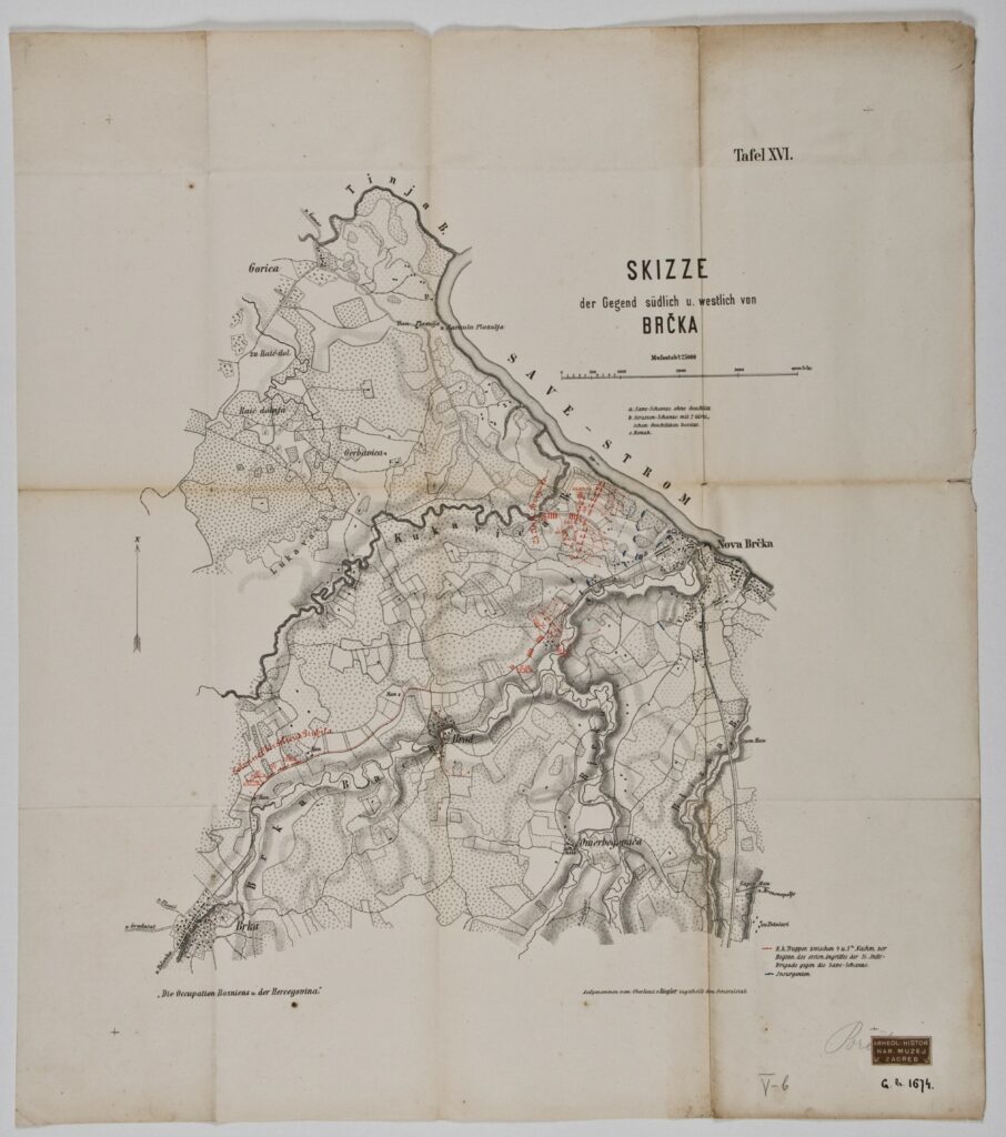
Map ‘Sketch of the Southern and Western Part of Brčko’
Recorded by: Ziegler,
Imperial and Royal Military Geographical Institute,
Vienna,
from 1850 to 1900
Paper, print; 55 × 49 cm;
scale: 1:25,000;
title: ‘SKIZZE / der Gegend südlich u. westlich von / BRČKA’; u. r.: sheet label: ‘Tafel XVI.’; l. l.: note: ‘Die Occupation Bosniens u. der Hercegovina’; l. r.: map key and data about terrain recorder: ‘Aufgenommen vom Oberlient v. Ziegler, zugetheilt dem Generalstab.’; stamp with provenance: ‘ARHEOL.-HISTOR. / NAR. MUZEJ / ZAGREB’
Inherited from the Archaeology and History Department of the National Museum in Zagreb
The positions of Austro-Hungarian and rebel units during the Austro-Hungarian occupation of Bosnia and Herzegovina in 1878 are marked on this map of the southern and western part of the city of Brčko on the right bank of the Sava river. The Austro-Hungarian forces faced strong rebel resistance in Brčko and the Bosanska Krajina region from 12 to 17 September 1878.
Izvori / literatura: Tominac: 2020, p. 252
error: Sadržaj je zaštićen!
Hrvatski povijesni muzej
Map ‘Sketch of the Southern and Western Part of Brčko’
Description:
The positions of Austro-Hungarian and rebel units during the Austro-Hungarian occupation of Bosnia and Herzegovina in 1878 are marked on this map of the southern and western part of the city of Brčko on the right bank of the Sava river. The Austro-Hungarian forces faced strong rebel resistance in Brčko and the Bosanska Krajina region from 12 to 17 September 1878.