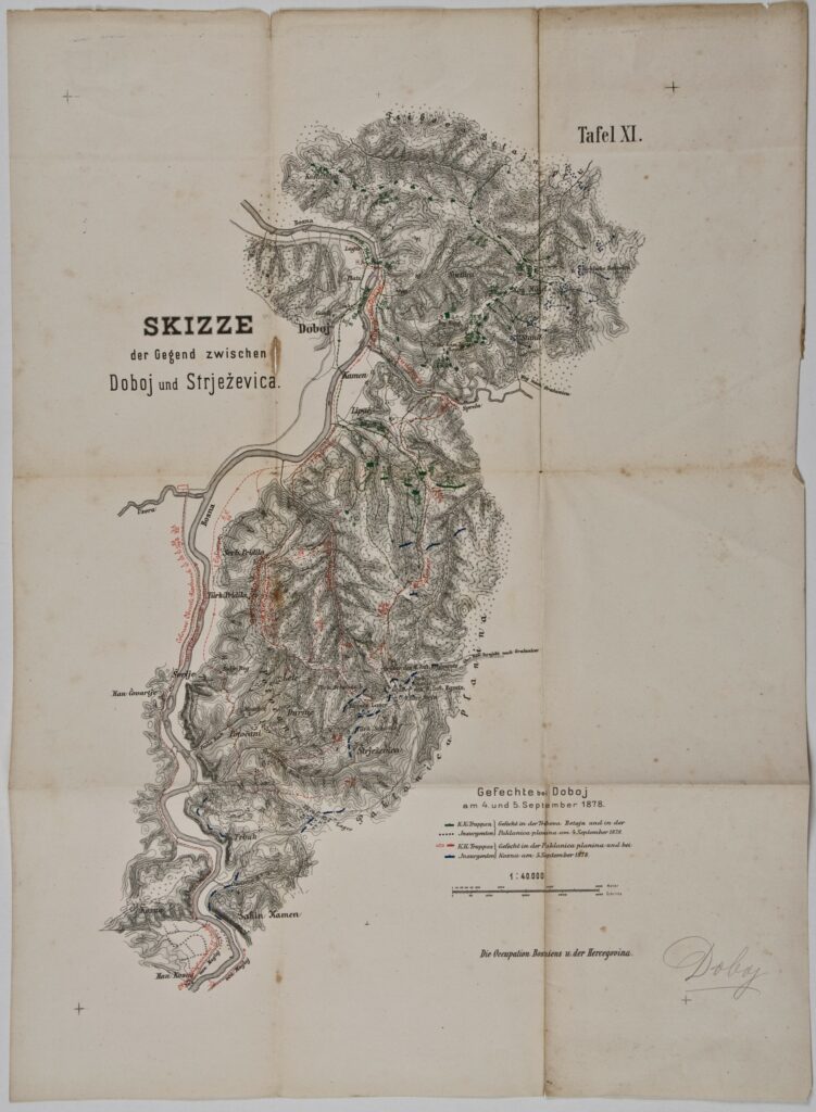
Paper, print; 55,5 × 40,3 cm; scale: 1:40,000; u. r.: sheet label: ‘Tafel XI.’; plan title: ‘SKIZZE / der Gegend zwischen / Doboj und Strježevica.’; l. r.: map key and note: ‘Der Occupation Bosniens u. der Hercegovina.’; stamp with provenance on reverse of map: ‘ARHEOL.-HISTOR. / NAR. MUZEJ / ZAGREB’.
Inherited from the Archaeology and History Department of the National Museum in Zagreb
HPM/PMH-9642
Map of the surroundings of Doboj and Strježevica with a depiction of the battle near Doboj on 4 and 5 September 1878, also showing the units and deployments of the Austro-Hungarian and rebel armies during the Austro-Hungarian occupation of Bosnia and Herzegovina in 1878. On 5 September 1878, the Austro-Hungarian army drove the rebels south of Doboj, towards Maglaj, and in that way allowed the road traffic important for northern Bosnia to resume.
Map of the surroundings of Doboj and Strježevica with a depiction of the battle near Doboj on 4 and 5 September 1878, also showing the units and deployments of the Austro-Hungarian and rebel armies during the Austro-Hungarian occupation of Bosnia and Herzegovina in 1878. On 5 September 1878, the Austro-Hungarian army drove the rebels south of Doboj, towards Maglaj, and in that way allowed the road traffic important for northern Bosnia to resume.