Overview Road Map of the Austro-Hungarian Monarchy
Imperial and Royal Military Geographical Institute (?),
Vienna,
1913
Paper, full colour print; 72 × 92 cm;
scale: undefined;
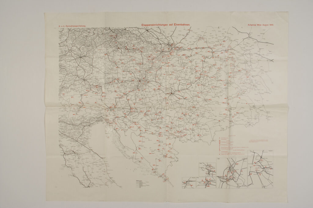
u. l.: ‘k.u.k. zentraltransportleitung’; upper middle: ‘Ettapeneinrichtungen auf Eisenbahnen.’; u. r.: ‘Aufgelogt Mitte August 1915.’; l. r. and lower middle: map key
This overview road map was most likely produced according to the bases of the topographic maps of the Imperial and Royal Military Geographical Institute in Vienna, for the needs of transporting military forces by rail during the activation of a war plan. Along its lower right corner, the map contains smaller communication plans of the cities Trieste (‘Triest’), Vienna (‘Wien’), Bratislava (‘Poszony’), Prague (‘Prag’), and Budapest.
Izvori / literatura: first publication
error: Sadržaj je zaštićen!
Hrvatski povijesni muzej
Overview Road Map of the Austro-Hungarian Monarchy
Description:
This overview road map was most likely produced according to the bases of the topographic maps of the Imperial and Royal Military Geographical Institute in Vienna, for the needs of transporting military forces by rail during the activation of a war plan. Along its lower right corner, the map contains smaller communication plans of the cities Trieste (‘Triest’), Vienna (‘Wien’), Bratislava (‘Poszony’), Prague (‘Prag’), and Budapest.