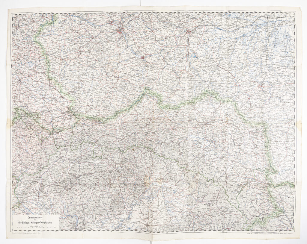
Overview Topographic Map of the Eastern Front of World War I
Publisher: k.u.k. Universitätsbuchandlung R. Lechner (W. Müller); co-publisher and producer: Imperial and Royal Military Geographical Institute,
Vienna,
from 1914 to 1916
Paper, full colour print; 82,7 × 105,5 cm;
scale: 1:750,000;
l. r.: map title: ‘Übersichtskarte / des / nördlichen Kriegsschauplatzes.’; ‘Ausgeführt im k. u. k. Militärgeographischen Institut in Wien.’; l. l.: ‘Verlag der k. u. k. Hof- und Universitätsbuchhandlung R. Lechner (W. Müller), Wien, I., Graben 31.’
Overview topographic map of the ‘Northern’ (Eastern) Front during World War I, including parts of Hungary, Poland, and Galicia, from Breslau (today Wrocław) in the west to Brody in the east, and from Warsaw in the north to Budapest in the south. The map’s publication year is unmarked, but it is estimated to have been between 1914 and 1916.
Izvori / literatura: first publication
error: Sadržaj je zaštićen!
Hrvatski povijesni muzej
Overview Topographic Map of the Eastern Front of World War I
Description:
Overview topographic map of the ‘Northern’ (Eastern) Front during World War I, including parts of Hungary, Poland, and Galicia, from Breslau (today Wrocław) in the west to Brody in the east, and from Warsaw in the north to Budapest in the south. The map’s publication year is unmarked, but it is estimated to have been between 1914 and 1916.