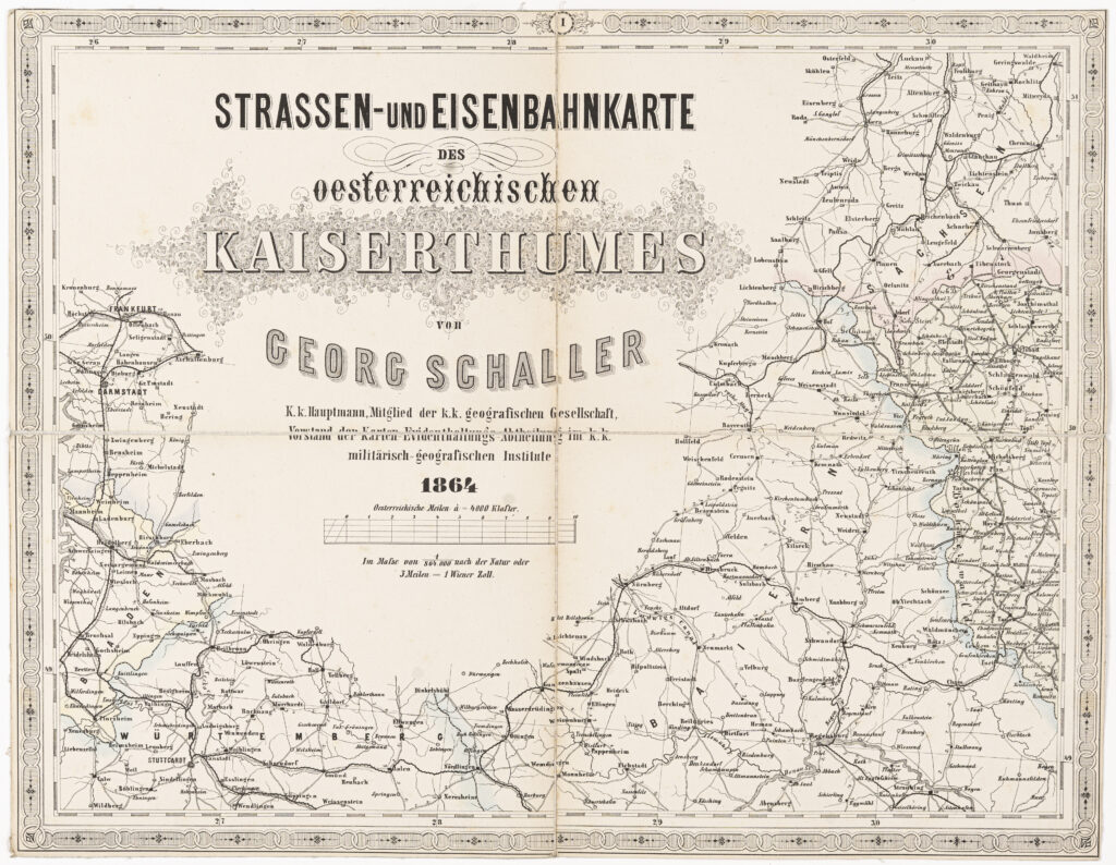
Container: cardboard, glued, map: paper on canvas, print; 32,6 × 42,3 cm; scale: 1:864,000; title: ‘STRASSEN-UND EISENBAHNKARTE / DES / oesterreichischen / KAISERTHUMES / von / GEORG SCHALLER / K.k. Hauptmann, Mitglied der k.k.geografischen Gesellschaft, / Vorstand der Karten-Evidenthaltungs-Abtheilung im k.k. / militärisch=geografischen Institute / 1864’
Received from the 16th Imperial and Royal Varaždin Infantry Regiment
HPM/PMH-9856 – HPM/PMH-9870
This road map consists of 15 sheets and shows the road and railway routes on the territory of the Austrian Empire. The traffic network on the territory of the Triune Kingdom of Croatia, Slavonia and Dalmatia is depicted on sheets no. X and XIV: civilian Slavonia and part of the Croatian-Slavonian Military Border with Osijek, an important traffic hub for the southern part of the Kingdom of Hungary (sheet no. X), and central Dalmatia with the cities Zadar and Split (sheet no. XIV). The borders of the Austrian Empire are marked on the map in various colours. The sheets depicting the other traffic relations between the lands of the Empire are as follows:
Title sheet I: Eger – Nürnberg (Nuremberg)
Sheet II: Dresden – Breslau (today Wrocław) – Prag (today Prague) – Brünn (today Brno)
Sheet III: Krakau (today Krakóv) – Teschen (today Czieszyn)
Sheet IV: map key; Broody (today Brody) – Lemberg (today Lviv)
Sheet V: München (today Munich) – Bregenz – Innsbruck
Sheet VI: Linz – Wien (today Vienna) – Raab (today Győr) – Gratz (today Graz)
Sheet VII: Kaschau (today Košice) – Komorn (today Komárno) – Debrecin-Ofen-Pesth (today Debrecen-Budapest)
Sheet VIII: Czernowitz (today Chernivtsi) – Klausenburg (today Cluj-Napoca)
Sheet IX: Verona – Udine – Mailand (today Milan) – Venedig (today Venice) – Bologna
Sheet X: missing
Sheet XI: Fünfkirchen (today Pécs) – Esseg (today Osijek) – Temesvar (today Timişoara) – Peterwardein (today Petrovaradin)
Sheet XII: Hermannstadt (today Sibiu) – Kronstadt (today Braşov) – Bukarest (today Bucharest) – Crajowa (today Craiova)
Sheet XIII: missing
Sheet XIV: altitude table; Zara (today Zadar) – Travnik – Spalato (today Split)
Sheet XV: altitude table; Serajevo (today Sarajevo) – Cattero (today Kotor)
Sheet XVI: list of railway routes in the Austrian Empire with distances expressed in Austrian miles
Sheet XVII: missing
Sheet XVIII: table with list of households and inhabitants of cities according to the 1857 census