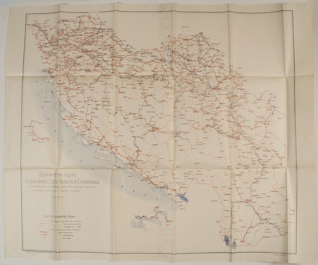
Road Map of the Kingdom of Serbs, Croats and Slovenes
Military Geographical Institute,
Belgrade,
1921
Paper, full colour print; 95,5 × 116 cm;
scale: 1:750,000;
l. l.: title in Cyrillic script: ‘Daljinarna karta / Kraljevine Srba, Hrvata i Slovenaca / Sa kilometarskim rastojanjima između najpotrebnijih mesta na / suvozenim, željezničkim i vodenim putovima.’; l. l.: ‘Izrađeno u Etapnom odseku Saobraćajnog Odelenja Gl. Đ. Štaba.’; l. r.: ‘VOJNO GEOGRAFSKI INSTITUT’; map contains key with certain distances