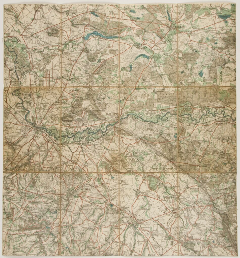
This special topographic map sheet depicts central Bohemia, with towns such as Neu-Kolin (today Kolín), Kuttenberg (today Kutná Hora), Elbeteinitz (today Týnec nad Labem), Časlau, (today Čáslav), Chlumec, etc.
Izvori / literatura: first publication
error: Sadržaj je zaštićen!
Hrvatski povijesni muzej
Topographic Map of Central Bohemia
Description:
This special topographic map sheet depicts central Bohemia, with towns such as Neu-Kolin (today Kolín), Kuttenberg (today Kutná Hora), Elbeteinitz (today Týnec nad Labem), Časlau, (today Čáslav), Chlumec, etc.