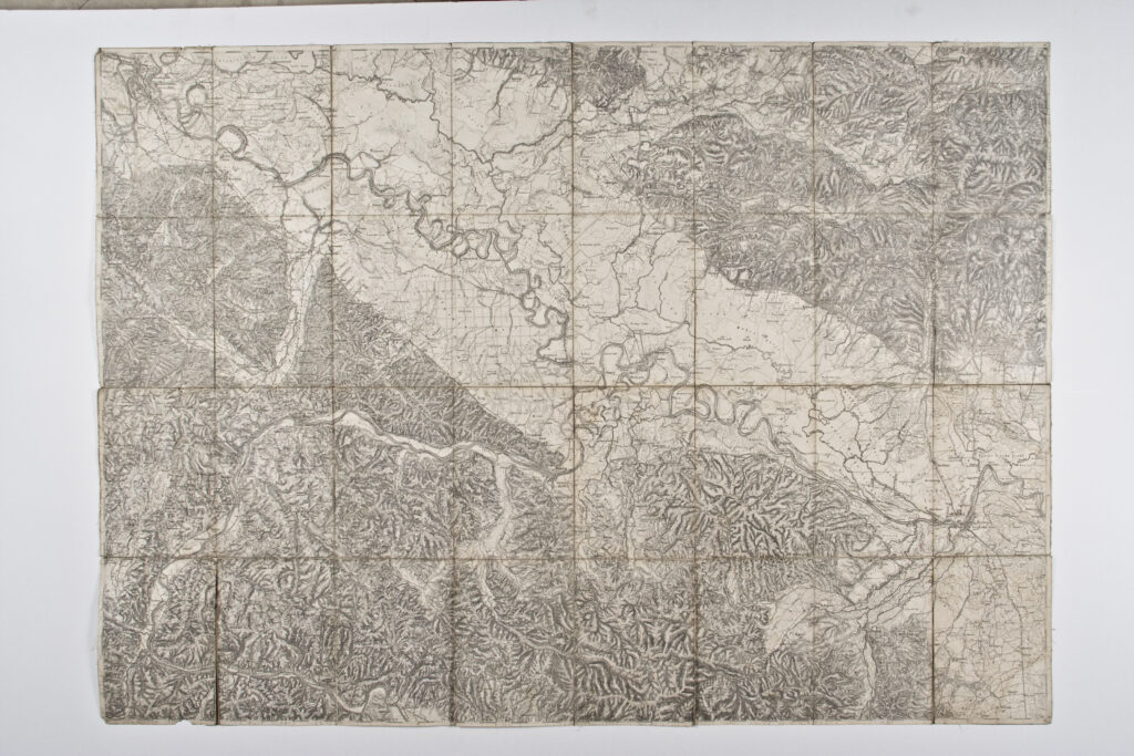
Special (topographic) map sheet depicting the Banovina area from Sisak and Sunja in the north to Stara Gradiška in the south. Along with elevation differences, the map depicts the river network of the Sava and the lower course of the Una.
Izvori / literatura: first publication
error: Sadržaj je zaštićen!
Hrvatski povijesni muzej
Topographic Map of Sisak and Sunja
Description:
Special (topographic) map sheet depicting the Banovina area from Sisak and Sunja in the north to Stara Gradiška in the south. Along with elevation differences, the map depicts the river network of the Sava and the lower course of the Una.