Imperial and Royal Military Geographical Institute,
Vienna,
from 1850 to 1900
Paper on canvas, lithography; from 64.5 x 67.7 cm to 65 x 68 cm; ;
scale: expressed in paces (1,500 paces);
u. l.: ‘Blatt I.’, ‘Blatt III.’, ‘Blatt V.’
Inherited from the War Archive and Museum of the ISC
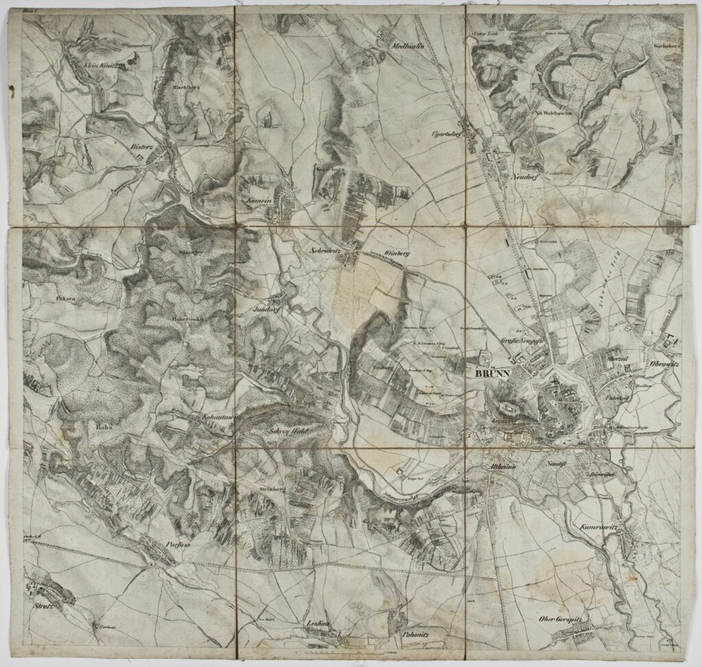
Topographic map sheets of various dimensions depicting southeastern Bohemia, with towns and villages such as Brno, Kowalowitz (today Kovalovice), Strz’ellitz (today Střelice), and Medritz (today Mödřice).
Izvori / literatura: first publication
error: Sadržaj je zaštićen!
Hrvatski povijesni muzej
Topographic Map of Southeastern Bohemia
Description:
Topographic map sheets of various dimensions depicting southeastern Bohemia, with towns and villages such as Brno, Kowalowitz (today Kovalovice), Strz’ellitz (today Střelice), and Medritz (today Mödřice).
Inventory number:
HPM/PMH-19766
Topographic Map of Southeastern Bohemia
Description:
Topographic map sheets of various dimensions depicting southeastern Bohemia, with towns and villages such as Brno, Kowalowitz (today Kovalovice), Strz’ellitz (today Střelice), and Medritz (today Mödřice).
Inventory number:
HPM/PMH-19772
Topographic Map of Southeastern Bohemia
Description:
Topographic map sheets of various dimensions depicting southeastern Bohemia, with towns and villages such as Brno, Kowalowitz (today Kovalovice), Strz’ellitz (today Střelice), and Medritz (today Mödřice).