Paper, full colour print; from 45 x 64 cm to 67.2 x 49.2 cm; scale: 1:200,000; title and sheet nomenclature in upper middle; l. l.: map key; lower middle: ‘K.u.k. militär-geographisches Institut. / Vervielfältigung vorbehalten.’; l. r.: notes regarding spelling and toponyms on individual sheets; round stamp on reverse of individual sheets: ‘NEZAVISNA DRŽAVA HRVATSKA / MINISTARSTVO ORUŽANIH SNAGA / RATNI ARHIV’
Found in the Museum
HPM/PMH-22916 – HPM/PMH-22918, HPM/PMH-7477, HPM/PMH-10038, HPM/PMH-11957 – HPM/PMH-11958, HPM/PMH-11965, HPM/PMH-22919 – HPM/PMH-22920, HPM/PMH-22930, HPM/PMH-22932 – HPM/PMH-22933/b
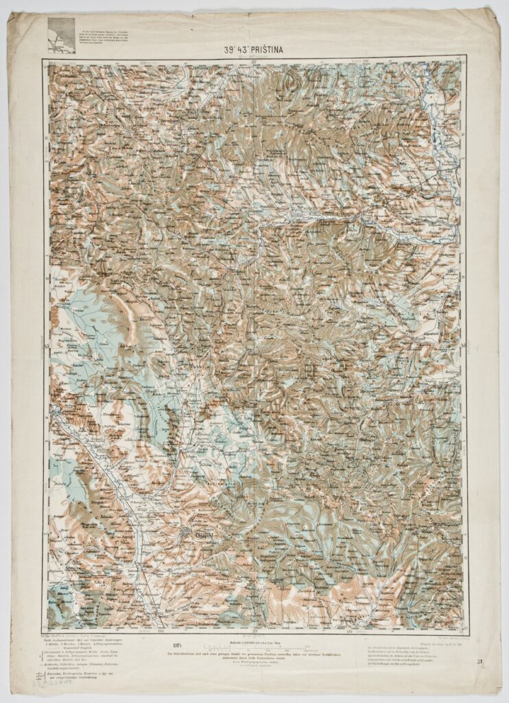
These twelve individual sheets of a topographic overview map in 1:200,000 scale depict central and southeastern Europe. The individual map sheets (e.g. the sheet ‘ZENGG’, HPM/PMH-9597) were produced during the third, or Franz-Josephinian, topographic survey (1869–1887), using a special map of the Austro-Hungarian Monarchy (‘Spezialkarte der Osterreichisch-Ungarischen Monarchie’). The toponyms on the map were written in the languages then in use in the depicted lands. The sheets contain additional linguistic and orthographic explanations for other languages, e.g. German, Turkish, Albanian, Bulgarian, etc. The map sheets are as follows:

These twelve individual sheets of a topographic overview map in 1:200,000 scale depict central and southeastern Europe. The individual map sheets (e.g. the sheet ‘ZENGG’, HPM/PMH-9597) were produced during the third, or Franz-Josephinian, topographic survey (1869–1887), using a special map of the Austro-Hungarian Monarchy (‘Spezialkarte der Osterreichisch-Ungarischen Monarchie’). The toponyms on the map were written in the languages then in use in the depicted lands. The sheets contain additional linguistic and orthographic explanations for other languages, e.g. German, Turkish, Albanian, Bulgarian, etc. The map sheets are as follows:
These twelve individual sheets of a topographic overview map in 1:200,000 scale depict central and southeastern Europe. The individual map sheets (e.g. the sheet ‘ZENGG’, HPM/PMH-9597) were produced during the third, or Franz-Josephinian, topographic survey (1869–1887), using a special map of the Austro-Hungarian Monarchy (‘Spezialkarte der Osterreichisch-Ungarischen Monarchie’). The toponyms on the map were written in the languages then in use in the depicted lands. The sheets contain additional linguistic and orthographic explanations for other languages, e.g. German, Turkish, Albanian, Bulgarian, etc. The map sheets are as follows:
These twelve individual sheets of a topographic overview map in 1:200,000 scale depict central and southeastern Europe. The individual map sheets (e.g. the sheet ‘ZENGG’, HPM/PMH-9597) were produced during the third, or Franz-Josephinian, topographic survey (1869–1887), using a special map of the Austro-Hungarian Monarchy (‘Spezialkarte der Osterreichisch-Ungarischen Monarchie’). The toponyms on the map were written in the languages then in use in the depicted lands. The sheets contain additional linguistic and orthographic explanations for other languages, e.g. German, Turkish, Albanian, Bulgarian, etc. The map sheets are as follows:
These twelve individual sheets of a topographic overview map in 1:200,000 scale depict central and southeastern Europe. The individual map sheets (e.g. the sheet ‘ZENGG’, HPM/PMH-9597) were produced during the third, or Franz-Josephinian, topographic survey (1869–1887), using a special map of the Austro-Hungarian Monarchy (‘Spezialkarte der Osterreichisch-Ungarischen Monarchie’). The toponyms on the map were written in the languages then in use in the depicted lands. The sheets contain additional linguistic and orthographic explanations for other languages, e.g. German, Turkish, Albanian, Bulgarian, etc. The map sheets are as follows:
These twelve individual sheets of a topographic overview map in 1:200,000 scale depict central and southeastern Europe. The individual map sheets (e.g. the sheet ‘ZENGG’, HPM/PMH-9597) were produced during the third, or Franz-Josephinian, topographic survey (1869–1887), using a special map of the Austro-Hungarian Monarchy (‘Spezialkarte der Osterreichisch-Ungarischen Monarchie’). The toponyms on the map were written in the languages then in use in the depicted lands. The sheets contain additional linguistic and orthographic explanations for other languages, e.g. German, Turkish, Albanian, Bulgarian, etc. The map sheets are as follows:
These twelve individual sheets of a topographic overview map in 1:200,000 scale depict central and southeastern Europe. The individual map sheets (e.g. the sheet ‘ZENGG’, HPM/PMH-9597) were produced during the third, or Franz-Josephinian, topographic survey (1869–1887), using a special map of the Austro-Hungarian Monarchy (‘Spezialkarte der Osterreichisch-Ungarischen Monarchie’). The toponyms on the map were written in the languages then in use in the depicted lands. The sheets contain additional linguistic and orthographic explanations for other languages, e.g. German, Turkish, Albanian, Bulgarian, etc. The map sheets are as follows:
These twelve individual sheets of a topographic overview map in 1:200,000 scale depict central and southeastern Europe. The individual map sheets (e.g. the sheet ‘ZENGG’, HPM/PMH-9597) were produced during the third, or Franz-Josephinian, topographic survey (1869–1887), using a special map of the Austro-Hungarian Monarchy (‘Spezialkarte der Osterreichisch-Ungarischen Monarchie’). The toponyms on the map were written in the languages then in use in the depicted lands. The sheets contain additional linguistic and orthographic explanations for other languages, e.g. German, Turkish, Albanian, Bulgarian, etc. The map sheets are as follows:
These twelve individual sheets of a topographic overview map in 1:200,000 scale depict central and southeastern Europe. The individual map sheets (e.g. the sheet ‘ZENGG’, HPM/PMH-9597) were produced during the third, or Franz-Josephinian, topographic survey (1869–1887), using a special map of the Austro-Hungarian Monarchy (‘Spezialkarte der Osterreichisch-Ungarischen Monarchie’). The toponyms on the map were written in the languages then in use in the depicted lands. The sheets contain additional linguistic and orthographic explanations for other languages, e.g. German, Turkish, Albanian, Bulgarian, etc. The map sheets are as follows:
These twelve individual sheets of a topographic overview map in 1:200,000 scale depict central and southeastern Europe. The individual map sheets (e.g. the sheet ‘ZENGG’, HPM/PMH-9597) were produced during the third, or Franz-Josephinian, topographic survey (1869–1887), using a special map of the Austro-Hungarian Monarchy (‘Spezialkarte der Osterreichisch-Ungarischen Monarchie’). The toponyms on the map were written in the languages then in use in the depicted lands. The sheets contain additional linguistic and orthographic explanations for other languages, e.g. German, Turkish, Albanian, Bulgarian, etc. The map sheets are as follows:
These twelve individual sheets of a topographic overview map in 1:200,000 scale depict central and southeastern Europe. The individual map sheets (e.g. the sheet ‘ZENGG’, HPM/PMH-9597) were produced during the third, or Franz-Josephinian, topographic survey (1869–1887), using a special map of the Austro-Hungarian Monarchy (‘Spezialkarte der Osterreichisch-Ungarischen Monarchie’). The toponyms on the map were written in the languages then in use in the depicted lands. The sheets contain additional linguistic and orthographic explanations for other languages, e.g. German, Turkish, Albanian, Bulgarian, etc. The map sheets are as follows:
These twelve individual sheets of a topographic overview map in 1:200,000 scale depict central and southeastern Europe. The individual map sheets (e.g. the sheet ‘ZENGG’, HPM/PMH-9597) were produced during the third, or Franz-Josephinian, topographic survey (1869–1887), using a special map of the Austro-Hungarian Monarchy (‘Spezialkarte der Osterreichisch-Ungarischen Monarchie’). The toponyms on the map were written in the languages then in use in the depicted lands. The sheets contain additional linguistic and orthographic explanations for other languages, e.g. German, Turkish, Albanian, Bulgarian, etc. The map sheets are as follows:
These twelve individual sheets of a topographic overview map in 1:200,000 scale depict central and southeastern Europe. The individual map sheets (e.g. the sheet ‘ZENGG’, HPM/PMH-9597) were produced during the third, or Franz-Josephinian, topographic survey (1869–1887), using a special map of the Austro-Hungarian Monarchy (‘Spezialkarte der Osterreichisch-Ungarischen Monarchie’). The toponyms on the map were written in the languages then in use in the depicted lands. The sheets contain additional linguistic and orthographic explanations for other languages, e.g. German, Turkish, Albanian, Bulgarian, etc. The map sheets are as follows: