Imperial and Royal Military Geographical Institute,
Vienna,
from 1901 to 1950
Paper, print; 49,5 × 71 cm;
scale: 1:75,000;
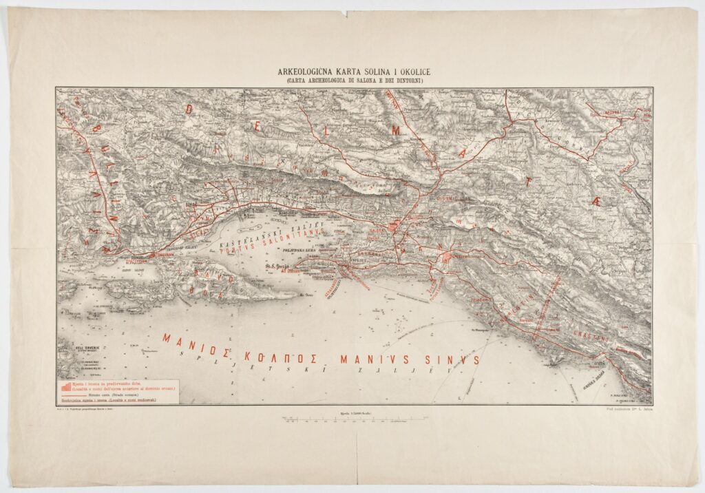
map key and bilingual title above map frame: ‘ARKEOLOGIČNA KARTA SOLINA I OKOLICE / (CARTA ARCHEOLOGICA DI SALONA E DEI DINTORNI)’; l. l.: ‘Kod c. i k. Vojničkoga geografičnoga Zavoda u Beču.’ and map key; l. r.: ‘Pod nadzorom Dra L. Jelića.’
Archaeological sites from classical antiquity, such as Salona (today’s Solin) and Epetion (today’s Stobreč), medieval toponyms, and former Roman roads in Dalmatia are depicted on this archaeological map of Solin and its surroundings.
Izvori / literatura: first publication
error: Sadržaj je zaštićen!
Hrvatski povijesni muzej
Archaeological Map of Solin and its Surroundings
Description:
Archaeological sites from classical antiquity, such as Salona (today’s Solin) and Epetion (today’s Stobreč), medieval toponyms, and former Roman roads in Dalmatia are depicted on this archaeological map of Solin and its surroundings.