Container: cardboard, glued; map, paper on canvas, print; overview sheet 24.8 x 27.1 cm; map sheets 38.7 x 52.7 cm; scale: 1:3,024,000; overview sheet title: ‘SKELETT / für die Zusammenstellung der Blätter von der General Karte von Central-Asien.’; sheet with map title: ‘General-Karte / von / CENTRAL-ASIEN / bearbeitet nach den besten und neuesten / RUSSISCHEN u ENGLISCHEN QUELLEN / im / K.K. milit. geografischen Institute in Wien / 1874.’ and map key
Found in the Museum
HPM/PMH-9614 – HPM/PMH-9626
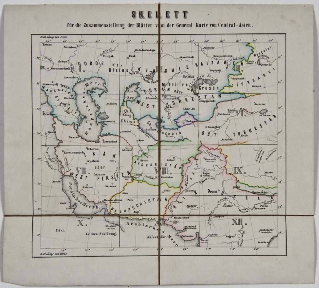
This general map of Central Asia was made according to ‘the best and newest Russian and English cartographical sources’, with the following division and depictions on sheets I to XII:
I. Northern part of the Caspian Sea, Astrakhan, Cauconia, and the Land of the Don Cossacks
II. Northern Part of the Aral Sea and Lake Baikal and Kirgizstan
III. Dzungaria, Mongolia, and the eastern part of Lake Baikal
IV. Central and southern part of the Caspian Sea, the Caucasus, and parts of Iran, the Ottoman Empire, and Turkmenistan
V. The Karakum and Bukhara Deserts and the Turan Plain
VI. Eastern Turkestan
VII. Central and southern Iran, part of the Persian Gulf, and part of the Arabian Peninsula
VIII. Afghanistan
IX. Kashmir, the Himalayas, Tibet, Nepal, and part of India
X. Southern and western part of the Persian Gulf
XI. Arabian Sea, southern Baluchistan, and western India
XII. India