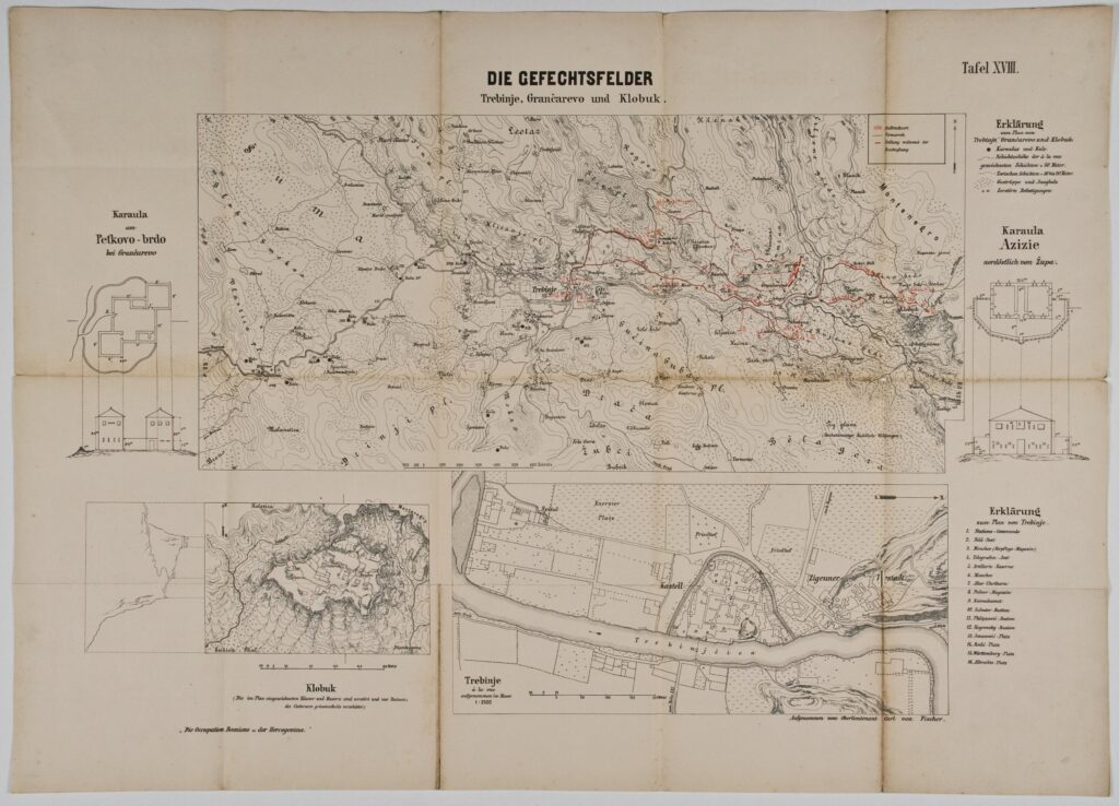
Map of the Front near Trebinje, Grančarevo, and Klobuk in 1878
Recorded by: Karl Fischer, publisher: Imperial and Royal Military Geographical Institute,
Vienna,
from 1850 to 1900
Paper, print; 49.8 x 69.6 cm;
scale: 1:25,000;
map title: ‘DIE GEFECHTSFELDER / Trebinje, Grančarevo und Klobuk.’; u. r.: sheet label: ‘Tafel XVIII.’; l. l.: note: ‘Die Occupation Bosniens u der Hercegovina.’; l. r.: note on author: ‘Aufgenommen von Oberlieutenant Carl von Fischer.’; floor plan of the border post on Petkovo Brdo (Grančarevo) along right map edge; map key and floor plan of the border post Azizie (Župa) along right map edge; stamp with provenance on reverse of map: ‘ARHEOL.-HISTOR. / NAR. MUZEJ / ZAGREB’.
Inherited from the Archaeology and History Department of the National Museum in Zagreb
War map with depictions of the front near Trebinje and Klobuk, with marked positions of the units of the Austro-Hungarian and rebel armies during the Austro-Hungarian occupation of Bosnia and Herzegovina in 1878, floor plans of the fortifications of Azizie (Župa) and on Petkovo Brdo (Grančarevo), plus a plan of Trebinje.
Izvori / literatura: first publication
error: Sadržaj je zaštićen!
Hrvatski povijesni muzej
Map of the Front near Trebinje, Grančarevo, and Klobuk in 1878
Description:
War map with depictions of the front near Trebinje and Klobuk, with marked positions of the units of the Austro-Hungarian and rebel armies during the Austro-Hungarian occupation of Bosnia and Herzegovina in 1878, floor plans of the fortifications of Azizie (Župa) and on Petkovo Brdo (Grančarevo), plus a plan of Trebinje.