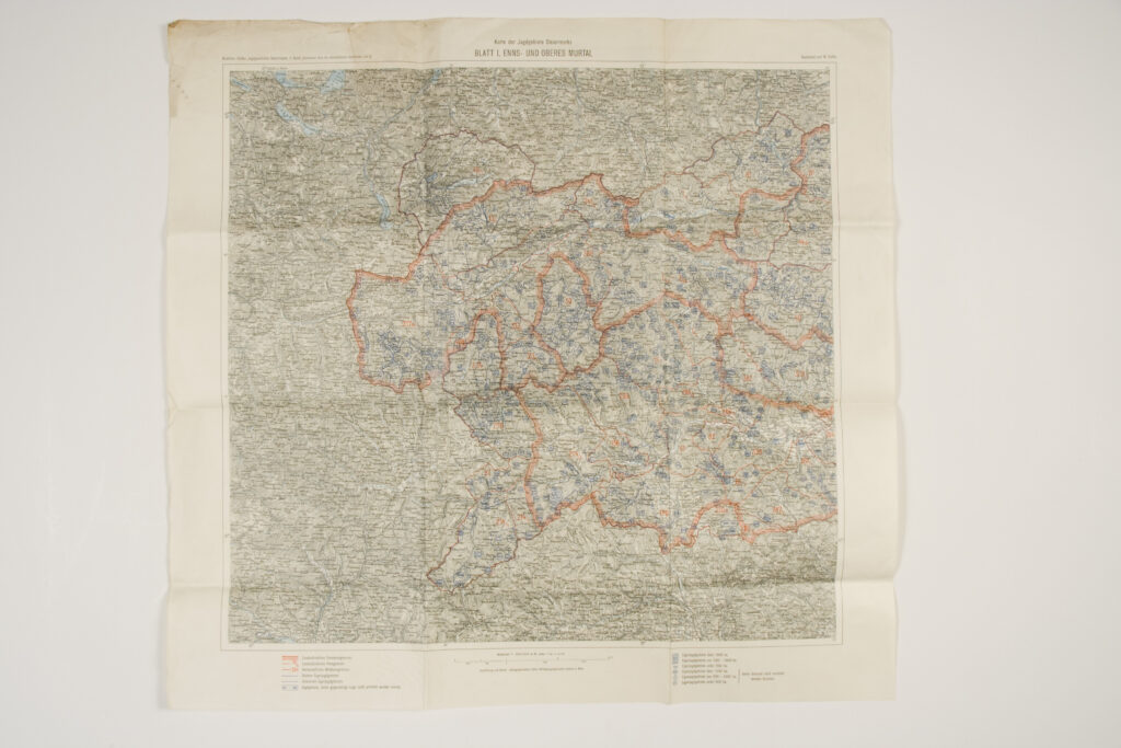
Paper, full colour print; 68 × 71 cm; scale: 1:200,000; map titles: ‘Karte der Jagdebiete Steiermarks / BLATT I. ENNS- UND OBERES MURTAL’, ‘Karte der Jagdebiete Steiermarks / BLAT II. MÜRZ UND MITTLERES MURTAL’; u .l.: ‘Bachofen – Hoffer, Jagdgeschichte Steiermarks, II. Band (Historischer Atlas der öesterreichischen Alpenländer, Lief. 4)’; u. r.: ‘Bearbeitet von W. Hoffer.’; lower middle: ‘Ausführung und Druck: Kartographisches, früher Militargeographisches Institut un Wien’; l. l. and l. r.: map key
Inherited from the War Archive and Museum of the ISC
HPM/PMH-24822 – HPM/PMH-24823
This map of the Styrian hunting district, which consists of two sheets showing the hunting districts of Upper and Lower Styria, is marked with forest borders, wild animal habitat borders, borders of limited hunting areas, unsafe hunting ground borders, hunting districts with undefined borders, and state borders. The map also contains a list of Austrian hunting grounds from 500 to over 1,000 hectares. The map sheets made and printed by the Cartographical Institute (the successor of the Imperial and Royal Military Geographical Institute) were adopted from the ‘Historical Atlas of the Austrian Alpine Lands’, published in Vienna in 1929.

This map of the Styrian hunting district, which consists of two sheets showing the hunting districts of Upper and Lower Styria, is marked with forest borders, wild animal habitat borders, borders of limited hunting areas, unsafe hunting ground borders, hunting districts with undefined borders, and state borders. The map also contains a list of Austrian hunting grounds from 500 to over 1,000 hectares. The map sheets made and printed by the Cartographical Institute (the successor of the Imperial and Royal Military Geographical Institute) were adopted from the ‘Historical Atlas of the Austrian Alpine Lands’, published in Vienna in 1929.
This map of the Styrian hunting district, which consists of two sheets showing the hunting districts of Upper and Lower Styria, is marked with forest borders, wild animal habitat borders, borders of limited hunting areas, unsafe hunting ground borders, hunting districts with undefined borders, and state borders. The map also contains a list of Austrian hunting grounds from 500 to over 1,000 hectares. The map sheets made and printed by the Cartographical Institute (the successor of the Imperial and Royal Military Geographical Institute) were adopted from the ‘Historical Atlas of the Austrian Alpine Lands’, published in Vienna in 1929.