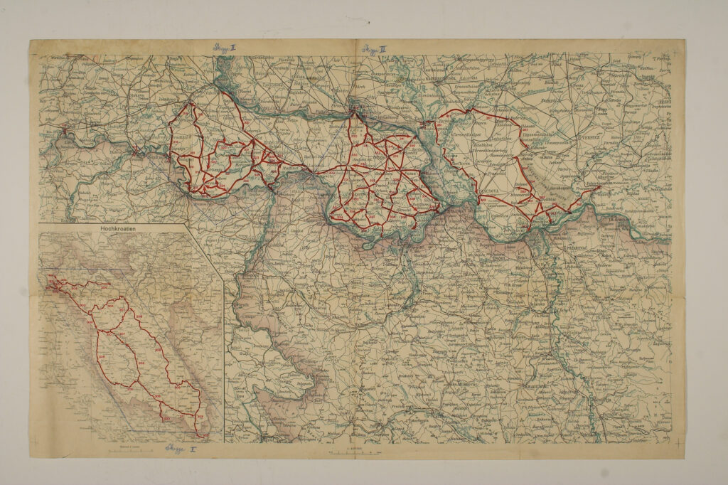
‘Route Sketch’ Map for the Southern Parts of the ‘Lands of the Holy Hungarian Crown’
Imperial and Royal Military Geographical Institute,
Vienna,
1913
Paper, full colour print; 52,5 × 82 cm;
scale: 1:400,000, scale of supplementary map: 1:750,000;
on reverse of map, u. l.: label: ‘Zu Erlass Abt. 5 Nr. 4685 res. V.1913.’; title on reverse of map: ‘Skizze zum Routenverzeichnits im Sudteile der Lander der heilig. Ung. Krone’ and indication of confidentiality (‘Streng geheim’); inscriptions above and below map in blue pencil: ‘Skizze I’, ‘Skizze II’, ‘Skizze III’
This map depicting the area of eastern Slavonia and part of today’s Vojvodina and Gorski Kotar and its smaller supplementary map depicting Lika and the Croatian Littoral have military routes marked on them. They were printed as an addendum to a Circular from 1913, of unknown content.
Izvori / literatura: Dadoh zlato za željezo: Prvi svjetski rat u zbirkama Hrvatskog povijesnog muzeja: 2011, p. 280
error: Sadržaj je zaštićen!
Hrvatski povijesni muzej
‘Route Sketch’ Map for the Southern Parts of the ‘Lands of the Holy Hungarian Crown’
Description:
This map depicting the area of eastern Slavonia and part of today’s Vojvodina and Gorski Kotar and its smaller supplementary map depicting Lika and the Croatian Littoral have military routes marked on them. They were printed as an addendum to a Circular from 1913, of unknown content.