Container: cardboard, glued; maps, paper on canvas, print; 43 × 54,5 cm; scale: 1:28,800; map title: ‘Umgebung / von / BRUCK an der LEITHA’; u. l.: labels for each map sheet: ‘No I’, ‘No II’, ‘No III’, ‘No IV’, ‘No V’, ‘No VI’, ‘No VII’, ‘No VIII’, ‘No IX’
Found in the Museum
HPM/PMH-9967 – HPM/PMH-9975
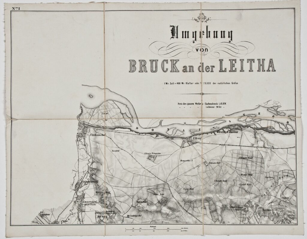
This topographic map, numbering nine sheets in total, depicts in detail the area of Bruck an der Leitha and its surroundings. The sheets are as follows:

This topographic map, numbering nine sheets in total, depicts in detail the area of Bruck an der Leitha and its surroundings. The sheets are as follows:
This topographic map, numbering nine sheets in total, depicts in detail the area of Bruck an der Leitha and its surroundings. The sheets are as follows:
This topographic map, numbering nine sheets in total, depicts in detail the area of Bruck an der Leitha and its surroundings. The sheets are as follows:
This topographic map, numbering nine sheets in total, depicts in detail the area of Bruck an der Leitha and its surroundings. The sheets are as follows:
This topographic map, numbering nine sheets in total, depicts in detail the area of Bruck an der Leitha and its surroundings. The sheets are as follows:
This topographic map, numbering nine sheets in total, depicts in detail the area of Bruck an der Leitha and its surroundings. The sheets are as follows:
This topographic map, numbering nine sheets in total, depicts in detail the area of Bruck an der Leitha and its surroundings. The sheets are as follows:
This topographic map, numbering nine sheets in total, depicts in detail the area of Bruck an der Leitha and its surroundings. The sheets are as follows:
This topographic map, numbering nine sheets in total, depicts in detail the area of Bruck an der Leitha and its surroundings. The sheets are as follows: