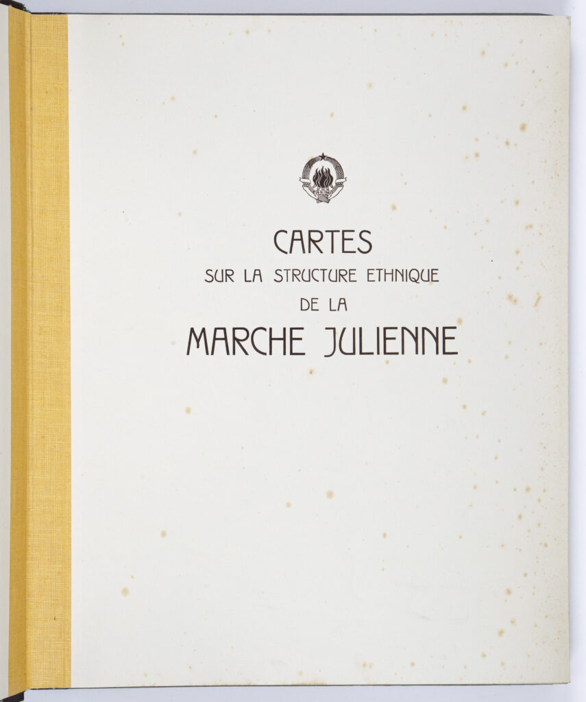
Cardboard, binding; paper, , full colour print; 47 x 37.5 cm, 19 pp.; scale: undefined; title and coat of arms of the Federal People’s Republic of Yugoslavia on the atlas’s cover sheet: ‘CARTES / SUR LA STRUCTURE ETHNIQUE / DA LE / MARCHE JULIENNE’; introductory text of atlas: ‘NOTE D'INTRODUCTION’; key: ‘TABLES DES MATIERES’
Purchased in 1998
HPM-33349
Atlas depicting the ethnic structure of the population in the Julian March area (Trieste, Gorizia, Gradisca d’ Isonzo, Istria with the islands Cres and Lošinj, and parts of Inner Carniola, Val Canale, and Rijeka) made at the Military Geographical Institute for the needs of the Paris peace conference held in 1946, during demarcation negotiations between Italy and the Federal People’s Republic of Yugoslavia after World War II. The atlas also contains several topical maps depicting the distribution of Slavic churches in the Julian March area, the presence of Slovenian and Croatian schools in the Julian March area during the Austro-Hungarian period, a map of Istria with a depiction of the survival of the Slavic liturgical language in Glagolitic script, and a depiction of the new administrative-territorial organisation in the 1909–1910 period as well as a facsimile of an authentic Italian document depicting Partisan sabotage on railways in the Julian March area in March 1943/1944. The atlas also includes an addendum in the form of three maps of the Julian March in English, Russian, and Italian by various publishers, showing the ethnic borders between the Slovene and Italian population according to the 1910/1911 census. The atlas was formerly the property of Vladimir Bakarić.

Atlas depicting the ethnic structure of the population in the Julian March area (Trieste, Gorizia, Gradisca d’ Isonzo, Istria with the islands Cres and Lošinj, and parts of Inner Carniola, Val Canale, and Rijeka) made at the Military Geographical Institute for the needs of the Paris peace conference held in 1946, during demarcation negotiations between Italy and the Federal People’s Republic of Yugoslavia after World War II. The atlas also contains several topical maps depicting the distribution of Slavic churches in the Julian March area, the presence of Slovenian and Croatian schools in the Julian March area during the Austro-Hungarian period, a map of Istria with a depiction of the survival of the Slavic liturgical language in Glagolitic script, and a depiction of the new administrative-territorial organisation in the 1909–1910 period as well as a facsimile of an authentic Italian document depicting Partisan sabotage on railways in the Julian March area in March 1943/1944. The atlas also includes an addendum in the form of three maps of the Julian March in English, Russian, and Italian by various publishers, showing the ethnic borders between the Slovene and Italian population according to the 1910/1911 census. The atlas was formerly the property of Vladimir Bakarić.
Atlas depicting the ethnic structure of the population in the Julian March area (Trieste, Gorizia, Gradisca d’ Isonzo, Istria with the islands Cres and Lošinj, and parts of Inner Carniola, Val Canale, and Rijeka) made at the Military Geographical Institute for the needs of the Paris peace conference held in 1946, during demarcation negotiations between Italy and the Federal People’s Republic of Yugoslavia after World War II. The atlas also contains several topical maps depicting the distribution of Slavic churches in the Julian March area, the presence of Slovenian and Croatian schools in the Julian March area during the Austro-Hungarian period, a map of Istria with a depiction of the survival of the Slavic liturgical language in Glagolitic script, and a depiction of the new administrative-territorial organisation in the 1909–1910 period as well as a facsimile of an authentic Italian document depicting Partisan sabotage on railways in the Julian March area in March 1943/1944. The atlas also includes an addendum in the form of three maps of the Julian March in English, Russian, and Italian by various publishers, showing the ethnic borders between the Slovene and Italian population according to the 1910/1911 census. The atlas was formerly the property of Vladimir Bakarić.
Atlas depicting the ethnic structure of the population in the Julian March area (Trieste, Gorizia, Gradisca d’ Isonzo, Istria with the islands Cres and Lošinj, and parts of Inner Carniola, Val Canale, and Rijeka) made at the Military Geographical Institute for the needs of the Paris peace conference held in 1946, during demarcation negotiations between Italy and the Federal People’s Republic of Yugoslavia after World War II. The atlas also contains several topical maps depicting the distribution of Slavic churches in the Julian March area, the presence of Slovenian and Croatian schools in the Julian March area during the Austro-Hungarian period, a map of Istria with a depiction of the survival of the Slavic liturgical language in Glagolitic script, and a depiction of the new administrative-territorial organisation in the 1909–1910 period as well as a facsimile of an authentic Italian document depicting Partisan sabotage on railways in the Julian March area in March 1943/1944. The atlas also includes an addendum in the form of three maps of the Julian March in English, Russian, and Italian by various publishers, showing the ethnic borders between the Slovene and Italian population according to the 1910/1911 census. The atlas was formerly the property of Vladimir Bakarić.
Atlas depicting the ethnic structure of the population in the Julian March area (Trieste, Gorizia, Gradisca d’ Isonzo, Istria with the islands Cres and Lošinj, and parts of Inner Carniola, Val Canale, and Rijeka) made at the Military Geographical Institute for the needs of the Paris peace conference held in 1946, during demarcation negotiations between Italy and the Federal People’s Republic of Yugoslavia after World War II. The atlas also contains several topical maps depicting the distribution of Slavic churches in the Julian March area, the presence of Slovenian and Croatian schools in the Julian March area during the Austro-Hungarian period, a map of Istria with a depiction of the survival of the Slavic liturgical language in Glagolitic script, and a depiction of the new administrative-territorial organisation in the 1909–1910 period as well as a facsimile of an authentic Italian document depicting Partisan sabotage on railways in the Julian March area in March 1943/1944. The atlas also includes an addendum in the form of three maps of the Julian March in English, Russian, and Italian by various publishers, showing the ethnic borders between the Slovene and Italian population according to the 1910/1911 census. The atlas was formerly the property of Vladimir Bakarić.
Atlas depicting the ethnic structure of the population in the Julian March area (Trieste, Gorizia, Gradisca d’ Isonzo, Istria with the islands Cres and Lošinj, and parts of Inner Carniola, Val Canale, and Rijeka) made at the Military Geographical Institute for the needs of the Paris peace conference held in 1946, during demarcation negotiations between Italy and the Federal People’s Republic of Yugoslavia after World War II. The atlas also contains several topical maps depicting the distribution of Slavic churches in the Julian March area, the presence of Slovenian and Croatian schools in the Julian March area during the Austro-Hungarian period, a map of Istria with a depiction of the survival of the Slavic liturgical language in Glagolitic script, and a depiction of the new administrative-territorial organisation in the 1909–1910 period as well as a facsimile of an authentic Italian document depicting Partisan sabotage on railways in the Julian March area in March 1943/1944. The atlas also includes an addendum in the form of three maps of the Julian March in English, Russian, and Italian by various publishers, showing the ethnic borders between the Slovene and Italian population according to the 1910/1911 census. The atlas was formerly the property of Vladimir Bakarić.
Atlas depicting the ethnic structure of the population in the Julian March area (Trieste, Gorizia, Gradisca d’ Isonzo, Istria with the islands Cres and Lošinj, and parts of Inner Carniola, Val Canale, and Rijeka) made at the Military Geographical Institute for the needs of the Paris peace conference held in 1946, during demarcation negotiations between Italy and the Federal People’s Republic of Yugoslavia after World War II. The atlas also contains several topical maps depicting the distribution of Slavic churches in the Julian March area, the presence of Slovenian and Croatian schools in the Julian March area during the Austro-Hungarian period, a map of Istria with a depiction of the survival of the Slavic liturgical language in Glagolitic script, and a depiction of the new administrative-territorial organisation in the 1909–1910 period as well as a facsimile of an authentic Italian document depicting Partisan sabotage on railways in the Julian March area in March 1943/1944. The atlas also includes an addendum in the form of three maps of the Julian March in English, Russian, and Italian by various publishers, showing the ethnic borders between the Slovene and Italian population according to the 1910/1911 census. The atlas was formerly the property of Vladimir Bakarić.
Atlas depicting the ethnic structure of the population in the Julian March area (Trieste, Gorizia, Gradisca d’ Isonzo, Istria with the islands Cres and Lošinj, and parts of Inner Carniola, Val Canale, and Rijeka) made at the Military Geographical Institute for the needs of the Paris peace conference held in 1946, during demarcation negotiations between Italy and the Federal People’s Republic of Yugoslavia after World War II. The atlas also contains several topical maps depicting the distribution of Slavic churches in the Julian March area, the presence of Slovenian and Croatian schools in the Julian March area during the Austro-Hungarian period, a map of Istria with a depiction of the survival of the Slavic liturgical language in Glagolitic script, and a depiction of the new administrative-territorial organisation in the 1909–1910 period as well as a facsimile of an authentic Italian document depicting Partisan sabotage on railways in the Julian March area in March 1943/1944. The atlas also includes an addendum in the form of three maps of the Julian March in English, Russian, and Italian by various publishers, showing the ethnic borders between the Slovene and Italian population according to the 1910/1911 census. The atlas was formerly the property of Vladimir Bakarić.
Atlas depicting the ethnic structure of the population in the Julian March area (Trieste, Gorizia, Gradisca d’ Isonzo, Istria with the islands Cres and Lošinj, and parts of Inner Carniola, Val Canale, and Rijeka) made at the Military Geographical Institute for the needs of the Paris peace conference held in 1946, during demarcation negotiations between Italy and the Federal People’s Republic of Yugoslavia after World War II. The atlas also contains several topical maps depicting the distribution of Slavic churches in the Julian March area, the presence of Slovenian and Croatian schools in the Julian March area during the Austro-Hungarian period, a map of Istria with a depiction of the survival of the Slavic liturgical language in Glagolitic script, and a depiction of the new administrative-territorial organisation in the 1909–1910 period as well as a facsimile of an authentic Italian document depicting Partisan sabotage on railways in the Julian March area in March 1943/1944. The atlas also includes an addendum in the form of three maps of the Julian March in English, Russian, and Italian by various publishers, showing the ethnic borders between the Slovene and Italian population according to the 1910/1911 census. The atlas was formerly the property of Vladimir Bakarić.
Atlas depicting the ethnic structure of the population in the Julian March area (Trieste, Gorizia, Gradisca d’ Isonzo, Istria with the islands Cres and Lošinj, and parts of Inner Carniola, Val Canale, and Rijeka) made at the Military Geographical Institute for the needs of the Paris peace conference held in 1946, during demarcation negotiations between Italy and the Federal People’s Republic of Yugoslavia after World War II. The atlas also contains several topical maps depicting the distribution of Slavic churches in the Julian March area, the presence of Slovenian and Croatian schools in the Julian March area during the Austro-Hungarian period, a map of Istria with a depiction of the survival of the Slavic liturgical language in Glagolitic script, and a depiction of the new administrative-territorial organisation in the 1909–1910 period as well as a facsimile of an authentic Italian document depicting Partisan sabotage on railways in the Julian March area in March 1943/1944. The atlas also includes an addendum in the form of three maps of the Julian March in English, Russian, and Italian by various publishers, showing the ethnic borders between the Slovene and Italian population according to the 1910/1911 census. The atlas was formerly the property of Vladimir Bakarić.
Atlas depicting the ethnic structure of the population in the Julian March area (Trieste, Gorizia, Gradisca d’ Isonzo, Istria with the islands Cres and Lošinj, and parts of Inner Carniola, Val Canale, and Rijeka) made at the Military Geographical Institute for the needs of the Paris peace conference held in 1946, during demarcation negotiations between Italy and the Federal People’s Republic of Yugoslavia after World War II. The atlas also contains several topical maps depicting the distribution of Slavic churches in the Julian March area, the presence of Slovenian and Croatian schools in the Julian March area during the Austro-Hungarian period, a map of Istria with a depiction of the survival of the Slavic liturgical language in Glagolitic script, and a depiction of the new administrative-territorial organisation in the 1909–1910 period as well as a facsimile of an authentic Italian document depicting Partisan sabotage on railways in the Julian March area in March 1943/1944. The atlas also includes an addendum in the form of three maps of the Julian March in English, Russian, and Italian by various publishers, showing the ethnic borders between the Slovene and Italian population according to the 1910/1911 census. The atlas was formerly the property of Vladimir Bakarić.
Atlas depicting the ethnic structure of the population in the Julian March area (Trieste, Gorizia, Gradisca d’ Isonzo, Istria with the islands Cres and Lošinj, and parts of Inner Carniola, Val Canale, and Rijeka) made at the Military Geographical Institute for the needs of the Paris peace conference held in 1946, during demarcation negotiations between Italy and the Federal People’s Republic of Yugoslavia after World War II. The atlas also contains several topical maps depicting the distribution of Slavic churches in the Julian March area, the presence of Slovenian and Croatian schools in the Julian March area during the Austro-Hungarian period, a map of Istria with a depiction of the survival of the Slavic liturgical language in Glagolitic script, and a depiction of the new administrative-territorial organisation in the 1909–1910 period as well as a facsimile of an authentic Italian document depicting Partisan sabotage on railways in the Julian March area in March 1943/1944. The atlas also includes an addendum in the form of three maps of the Julian March in English, Russian, and Italian by various publishers, showing the ethnic borders between the Slovene and Italian population according to the 1910/1911 census. The atlas was formerly the property of Vladimir Bakarić.
Atlas depicting the ethnic structure of the population in the Julian March area (Trieste, Gorizia, Gradisca d’ Isonzo, Istria with the islands Cres and Lošinj, and parts of Inner Carniola, Val Canale, and Rijeka) made at the Military Geographical Institute for the needs of the Paris peace conference held in 1946, during demarcation negotiations between Italy and the Federal People’s Republic of Yugoslavia after World War II. The atlas also contains several topical maps depicting the distribution of Slavic churches in the Julian March area, the presence of Slovenian and Croatian schools in the Julian March area during the Austro-Hungarian period, a map of Istria with a depiction of the survival of the Slavic liturgical language in Glagolitic script, and a depiction of the new administrative-territorial organisation in the 1909–1910 period as well as a facsimile of an authentic Italian document depicting Partisan sabotage on railways in the Julian March area in March 1943/1944. The atlas also includes an addendum in the form of three maps of the Julian March in English, Russian, and Italian by various publishers, showing the ethnic borders between the Slovene and Italian population according to the 1910/1911 census. The atlas was formerly the property of Vladimir Bakarić.
Atlas depicting the ethnic structure of the population in the Julian March area (Trieste, Gorizia, Gradisca d’ Isonzo, Istria with the islands Cres and Lošinj, and parts of Inner Carniola, Val Canale, and Rijeka) made at the Military Geographical Institute for the needs of the Paris peace conference held in 1946, during demarcation negotiations between Italy and the Federal People’s Republic of Yugoslavia after World War II. The atlas also contains several topical maps depicting the distribution of Slavic churches in the Julian March area, the presence of Slovenian and Croatian schools in the Julian March area during the Austro-Hungarian period, a map of Istria with a depiction of the survival of the Slavic liturgical language in Glagolitic script, and a depiction of the new administrative-territorial organisation in the 1909–1910 period as well as a facsimile of an authentic Italian document depicting Partisan sabotage on railways in the Julian March area in March 1943/1944. The atlas also includes an addendum in the form of three maps of the Julian March in English, Russian, and Italian by various publishers, showing the ethnic borders between the Slovene and Italian population according to the 1910/1911 census. The atlas was formerly the property of Vladimir Bakarić.
Atlas depicting the ethnic structure of the population in the Julian March area (Trieste, Gorizia, Gradisca d’ Isonzo, Istria with the islands Cres and Lošinj, and parts of Inner Carniola, Val Canale, and Rijeka) made at the Military Geographical Institute for the needs of the Paris peace conference held in 1946, during demarcation negotiations between Italy and the Federal People’s Republic of Yugoslavia after World War II. The atlas also contains several topical maps depicting the distribution of Slavic churches in the Julian March area, the presence of Slovenian and Croatian schools in the Julian March area during the Austro-Hungarian period, a map of Istria with a depiction of the survival of the Slavic liturgical language in Glagolitic script, and a depiction of the new administrative-territorial organisation in the 1909–1910 period as well as a facsimile of an authentic Italian document depicting Partisan sabotage on railways in the Julian March area in March 1943/1944. The atlas also includes an addendum in the form of three maps of the Julian March in English, Russian, and Italian by various publishers, showing the ethnic borders between the Slovene and Italian population according to the 1910/1911 census. The atlas was formerly the property of Vladimir Bakarić.
Atlas depicting the ethnic structure of the population in the Julian March area (Trieste, Gorizia, Gradisca d’ Isonzo, Istria with the islands Cres and Lošinj, and parts of Inner Carniola, Val Canale, and Rijeka) made at the Military Geographical Institute for the needs of the Paris peace conference held in 1946, during demarcation negotiations between Italy and the Federal People’s Republic of Yugoslavia after World War II. The atlas also contains several topical maps depicting the distribution of Slavic churches in the Julian March area, the presence of Slovenian and Croatian schools in the Julian March area during the Austro-Hungarian period, a map of Istria with a depiction of the survival of the Slavic liturgical language in Glagolitic script, and a depiction of the new administrative-territorial organisation in the 1909–1910 period as well as a facsimile of an authentic Italian document depicting Partisan sabotage on railways in the Julian March area in March 1943/1944. The atlas also includes an addendum in the form of three maps of the Julian March in English, Russian, and Italian by various publishers, showing the ethnic borders between the Slovene and Italian population according to the 1910/1911 census. The atlas was formerly the property of Vladimir Bakarić.
Atlas depicting the ethnic structure of the population in the Julian March area (Trieste, Gorizia, Gradisca d’ Isonzo, Istria with the islands Cres and Lošinj, and parts of Inner Carniola, Val Canale, and Rijeka) made at the Military Geographical Institute for the needs of the Paris peace conference held in 1946, during demarcation negotiations between Italy and the Federal People’s Republic of Yugoslavia after World War II. The atlas also contains several topical maps depicting the distribution of Slavic churches in the Julian March area, the presence of Slovenian and Croatian schools in the Julian March area during the Austro-Hungarian period, a map of Istria with a depiction of the survival of the Slavic liturgical language in Glagolitic script, and a depiction of the new administrative-territorial organisation in the 1909–1910 period as well as a facsimile of an authentic Italian document depicting Partisan sabotage on railways in the Julian March area in March 1943/1944. The atlas also includes an addendum in the form of three maps of the Julian March in English, Russian, and Italian by various publishers, showing the ethnic borders between the Slovene and Italian population according to the 1910/1911 census. The atlas was formerly the property of Vladimir Bakarić.
Atlas depicting the ethnic structure of the population in the Julian March area (Trieste, Gorizia, Gradisca d’ Isonzo, Istria with the islands Cres and Lošinj, and parts of Inner Carniola, Val Canale, and Rijeka) made at the Military Geographical Institute for the needs of the Paris peace conference held in 1946, during demarcation negotiations between Italy and the Federal People’s Republic of Yugoslavia after World War II. The atlas also contains several topical maps depicting the distribution of Slavic churches in the Julian March area, the presence of Slovenian and Croatian schools in the Julian March area during the Austro-Hungarian period, a map of Istria with a depiction of the survival of the Slavic liturgical language in Glagolitic script, and a depiction of the new administrative-territorial organisation in the 1909–1910 period as well as a facsimile of an authentic Italian document depicting Partisan sabotage on railways in the Julian March area in March 1943/1944. The atlas also includes an addendum in the form of three maps of the Julian March in English, Russian, and Italian by various publishers, showing the ethnic borders between the Slovene and Italian population according to the 1910/1911 census. The atlas was formerly the property of Vladimir Bakarić.
Atlas depicting the ethnic structure of the population in the Julian March area (Trieste, Gorizia, Gradisca d’ Isonzo, Istria with the islands Cres and Lošinj, and parts of Inner Carniola, Val Canale, and Rijeka) made at the Military Geographical Institute for the needs of the Paris peace conference held in 1946, during demarcation negotiations between Italy and the Federal People’s Republic of Yugoslavia after World War II. The atlas also contains several topical maps depicting the distribution of Slavic churches in the Julian March area, the presence of Slovenian and Croatian schools in the Julian March area during the Austro-Hungarian period, a map of Istria with a depiction of the survival of the Slavic liturgical language in Glagolitic script, and a depiction of the new administrative-territorial organisation in the 1909–1910 period as well as a facsimile of an authentic Italian document depicting Partisan sabotage on railways in the Julian March area in March 1943/1944. The atlas also includes an addendum in the form of three maps of the Julian March in English, Russian, and Italian by various publishers, showing the ethnic borders between the Slovene and Italian population according to the 1910/1911 census. The atlas was formerly the property of Vladimir Bakarić.
Atlas depicting the ethnic structure of the population in the Julian March area (Trieste, Gorizia, Gradisca d’ Isonzo, Istria with the islands Cres and Lošinj, and parts of Inner Carniola, Val Canale, and Rijeka) made at the Military Geographical Institute for the needs of the Paris peace conference held in 1946, during demarcation negotiations between Italy and the Federal People’s Republic of Yugoslavia after World War II. The atlas also contains several topical maps depicting the distribution of Slavic churches in the Julian March area, the presence of Slovenian and Croatian schools in the Julian March area during the Austro-Hungarian period, a map of Istria with a depiction of the survival of the Slavic liturgical language in Glagolitic script, and a depiction of the new administrative-territorial organisation in the 1909–1910 period as well as a facsimile of an authentic Italian document depicting Partisan sabotage on railways in the Julian March area in March 1943/1944. The atlas also includes an addendum in the form of three maps of the Julian March in English, Russian, and Italian by various publishers, showing the ethnic borders between the Slovene and Italian population according to the 1910/1911 census. The atlas was formerly the property of Vladimir Bakarić.
Atlas depicting the ethnic structure of the population in the Julian March area (Trieste, Gorizia, Gradisca d’ Isonzo, Istria with the islands Cres and Lošinj, and parts of Inner Carniola, Val Canale, and Rijeka) made at the Military Geographical Institute for the needs of the Paris peace conference held in 1946, during demarcation negotiations between Italy and the Federal People’s Republic of Yugoslavia after World War II. The atlas also contains several topical maps depicting the distribution of Slavic churches in the Julian March area, the presence of Slovenian and Croatian schools in the Julian March area during the Austro-Hungarian period, a map of Istria with a depiction of the survival of the Slavic liturgical language in Glagolitic script, and a depiction of the new administrative-territorial organisation in the 1909–1910 period as well as a facsimile of an authentic Italian document depicting Partisan sabotage on railways in the Julian March area in March 1943/1944. The atlas also includes an addendum in the form of three maps of the Julian March in English, Russian, and Italian by various publishers, showing the ethnic borders between the Slovene and Italian population according to the 1910/1911 census. The atlas was formerly the property of Vladimir Bakarić.
Atlas depicting the ethnic structure of the population in the Julian March area (Trieste, Gorizia, Gradisca d’ Isonzo, Istria with the islands Cres and Lošinj, and parts of Inner Carniola, Val Canale, and Rijeka) made at the Military Geographical Institute for the needs of the Paris peace conference held in 1946, during demarcation negotiations between Italy and the Federal People’s Republic of Yugoslavia after World War II. The atlas also contains several topical maps depicting the distribution of Slavic churches in the Julian March area, the presence of Slovenian and Croatian schools in the Julian March area during the Austro-Hungarian period, a map of Istria with a depiction of the survival of the Slavic liturgical language in Glagolitic script, and a depiction of the new administrative-territorial organisation in the 1909–1910 period as well as a facsimile of an authentic Italian document depicting Partisan sabotage on railways in the Julian March area in March 1943/1944. The atlas also includes an addendum in the form of three maps of the Julian March in English, Russian, and Italian by various publishers, showing the ethnic borders between the Slovene and Italian population according to the 1910/1911 census. The atlas was formerly the property of Vladimir Bakarić.
Atlas depicting the ethnic structure of the population in the Julian March area (Trieste, Gorizia, Gradisca d’ Isonzo, Istria with the islands Cres and Lošinj, and parts of Inner Carniola, Val Canale, and Rijeka) made at the Military Geographical Institute for the needs of the Paris peace conference held in 1946, during demarcation negotiations between Italy and the Federal People’s Republic of Yugoslavia after World War II. The atlas also contains several topical maps depicting the distribution of Slavic churches in the Julian March area, the presence of Slovenian and Croatian schools in the Julian March area during the Austro-Hungarian period, a map of Istria with a depiction of the survival of the Slavic liturgical language in Glagolitic script, and a depiction of the new administrative-territorial organisation in the 1909–1910 period as well as a facsimile of an authentic Italian document depicting Partisan sabotage on railways in the Julian March area in March 1943/1944. The atlas also includes an addendum in the form of three maps of the Julian March in English, Russian, and Italian by various publishers, showing the ethnic borders between the Slovene and Italian population according to the 1910/1911 census. The atlas was formerly the property of Vladimir Bakarić.
Atlas depicting the ethnic structure of the population in the Julian March area (Trieste, Gorizia, Gradisca d’ Isonzo, Istria with the islands Cres and Lošinj, and parts of Inner Carniola, Val Canale, and Rijeka) made at the Military Geographical Institute for the needs of the Paris peace conference held in 1946, during demarcation negotiations between Italy and the Federal People’s Republic of Yugoslavia after World War II. The atlas also contains several topical maps depicting the distribution of Slavic churches in the Julian March area, the presence of Slovenian and Croatian schools in the Julian March area during the Austro-Hungarian period, a map of Istria with a depiction of the survival of the Slavic liturgical language in Glagolitic script, and a depiction of the new administrative-territorial organisation in the 1909–1910 period as well as a facsimile of an authentic Italian document depicting Partisan sabotage on railways in the Julian March area in March 1943/1944. The atlas also includes an addendum in the form of three maps of the Julian March in English, Russian, and Italian by various publishers, showing the ethnic borders between the Slovene and Italian population according to the 1910/1911 census. The atlas was formerly the property of Vladimir Bakarić.
Atlas depicting the ethnic structure of the population in the Julian March area (Trieste, Gorizia, Gradisca d’ Isonzo, Istria with the islands Cres and Lošinj, and parts of Inner Carniola, Val Canale, and Rijeka) made at the Military Geographical Institute for the needs of the Paris peace conference held in 1946, during demarcation negotiations between Italy and the Federal People’s Republic of Yugoslavia after World War II. The atlas also contains several topical maps depicting the distribution of Slavic churches in the Julian March area, the presence of Slovenian and Croatian schools in the Julian March area during the Austro-Hungarian period, a map of Istria with a depiction of the survival of the Slavic liturgical language in Glagolitic script, and a depiction of the new administrative-territorial organisation in the 1909–1910 period as well as a facsimile of an authentic Italian document depicting Partisan sabotage on railways in the Julian March area in March 1943/1944. The atlas also includes an addendum in the form of three maps of the Julian March in English, Russian, and Italian by various publishers, showing the ethnic borders between the Slovene and Italian population according to the 1910/1911 census. The atlas was formerly the property of Vladimir Bakarić.
Atlas depicting the ethnic structure of the population in the Julian March area (Trieste, Gorizia, Gradisca d’ Isonzo, Istria with the islands Cres and Lošinj, and parts of Inner Carniola, Val Canale, and Rijeka) made at the Military Geographical Institute for the needs of the Paris peace conference held in 1946, during demarcation negotiations between Italy and the Federal People’s Republic of Yugoslavia after World War II. The atlas also contains several topical maps depicting the distribution of Slavic churches in the Julian March area, the presence of Slovenian and Croatian schools in the Julian March area during the Austro-Hungarian period, a map of Istria with a depiction of the survival of the Slavic liturgical language in Glagolitic script, and a depiction of the new administrative-territorial organisation in the 1909–1910 period as well as a facsimile of an authentic Italian document depicting Partisan sabotage on railways in the Julian March area in March 1943/1944. The atlas also includes an addendum in the form of three maps of the Julian March in English, Russian, and Italian by various publishers, showing the ethnic borders between the Slovene and Italian population according to the 1910/1911 census. The atlas was formerly the property of Vladimir Bakarić.
Atlas depicting the ethnic structure of the population in the Julian March area (Trieste, Gorizia, Gradisca d’ Isonzo, Istria with the islands Cres and Lošinj, and parts of Inner Carniola, Val Canale, and Rijeka) made at the Military Geographical Institute for the needs of the Paris peace conference held in 1946, during demarcation negotiations between Italy and the Federal People’s Republic of Yugoslavia after World War II. The atlas also contains several topical maps depicting the distribution of Slavic churches in the Julian March area, the presence of Slovenian and Croatian schools in the Julian March area during the Austro-Hungarian period, a map of Istria with a depiction of the survival of the Slavic liturgical language in Glagolitic script, and a depiction of the new administrative-territorial organisation in the 1909–1910 period as well as a facsimile of an authentic Italian document depicting Partisan sabotage on railways in the Julian March area in March 1943/1944. The atlas also includes an addendum in the form of three maps of the Julian March in English, Russian, and Italian by various publishers, showing the ethnic borders between the Slovene and Italian population according to the 1910/1911 census. The atlas was formerly the property of Vladimir Bakarić.
Atlas depicting the ethnic structure of the population in the Julian March area (Trieste, Gorizia, Gradisca d’ Isonzo, Istria with the islands Cres and Lošinj, and parts of Inner Carniola, Val Canale, and Rijeka) made at the Military Geographical Institute for the needs of the Paris peace conference held in 1946, during demarcation negotiations between Italy and the Federal People’s Republic of Yugoslavia after World War II. The atlas also contains several topical maps depicting the distribution of Slavic churches in the Julian March area, the presence of Slovenian and Croatian schools in the Julian March area during the Austro-Hungarian period, a map of Istria with a depiction of the survival of the Slavic liturgical language in Glagolitic script, and a depiction of the new administrative-territorial organisation in the 1909–1910 period as well as a facsimile of an authentic Italian document depicting Partisan sabotage on railways in the Julian March area in March 1943/1944. The atlas also includes an addendum in the form of three maps of the Julian March in English, Russian, and Italian by various publishers, showing the ethnic borders between the Slovene and Italian population according to the 1910/1911 census. The atlas was formerly the property of Vladimir Bakarić.
Atlas depicting the ethnic structure of the population in the Julian March area (Trieste, Gorizia, Gradisca d’ Isonzo, Istria with the islands Cres and Lošinj, and parts of Inner Carniola, Val Canale, and Rijeka) made at the Military Geographical Institute for the needs of the Paris peace conference held in 1946, during demarcation negotiations between Italy and the Federal People’s Republic of Yugoslavia after World War II. The atlas also contains several topical maps depicting the distribution of Slavic churches in the Julian March area, the presence of Slovenian and Croatian schools in the Julian March area during the Austro-Hungarian period, a map of Istria with a depiction of the survival of the Slavic liturgical language in Glagolitic script, and a depiction of the new administrative-territorial organisation in the 1909–1910 period as well as a facsimile of an authentic Italian document depicting Partisan sabotage on railways in the Julian March area in March 1943/1944. The atlas also includes an addendum in the form of three maps of the Julian March in English, Russian, and Italian by various publishers, showing the ethnic borders between the Slovene and Italian population according to the 1910/1911 census. The atlas was formerly the property of Vladimir Bakarić.
Atlas depicting the ethnic structure of the population in the Julian March area (Trieste, Gorizia, Gradisca d’ Isonzo, Istria with the islands Cres and Lošinj, and parts of Inner Carniola, Val Canale, and Rijeka) made at the Military Geographical Institute for the needs of the Paris peace conference held in 1946, during demarcation negotiations between Italy and the Federal People’s Republic of Yugoslavia after World War II. The atlas also contains several topical maps depicting the distribution of Slavic churches in the Julian March area, the presence of Slovenian and Croatian schools in the Julian March area during the Austro-Hungarian period, a map of Istria with a depiction of the survival of the Slavic liturgical language in Glagolitic script, and a depiction of the new administrative-territorial organisation in the 1909–1910 period as well as a facsimile of an authentic Italian document depicting Partisan sabotage on railways in the Julian March area in March 1943/1944. The atlas also includes an addendum in the form of three maps of the Julian March in English, Russian, and Italian by various publishers, showing the ethnic borders between the Slovene and Italian population according to the 1910/1911 census. The atlas was formerly the property of Vladimir Bakarić.
Atlas depicting the ethnic structure of the population in the Julian March area (Trieste, Gorizia, Gradisca d’ Isonzo, Istria with the islands Cres and Lošinj, and parts of Inner Carniola, Val Canale, and Rijeka) made at the Military Geographical Institute for the needs of the Paris peace conference held in 1946, during demarcation negotiations between Italy and the Federal People’s Republic of Yugoslavia after World War II. The atlas also contains several topical maps depicting the distribution of Slavic churches in the Julian March area, the presence of Slovenian and Croatian schools in the Julian March area during the Austro-Hungarian period, a map of Istria with a depiction of the survival of the Slavic liturgical language in Glagolitic script, and a depiction of the new administrative-territorial organisation in the 1909–1910 period as well as a facsimile of an authentic Italian document depicting Partisan sabotage on railways in the Julian March area in March 1943/1944. The atlas also includes an addendum in the form of three maps of the Julian March in English, Russian, and Italian by various publishers, showing the ethnic borders between the Slovene and Italian population according to the 1910/1911 census. The atlas was formerly the property of Vladimir Bakarić.
Atlas depicting the ethnic structure of the population in the Julian March area (Trieste, Gorizia, Gradisca d’ Isonzo, Istria with the islands Cres and Lošinj, and parts of Inner Carniola, Val Canale, and Rijeka) made at the Military Geographical Institute for the needs of the Paris peace conference held in 1946, during demarcation negotiations between Italy and the Federal People’s Republic of Yugoslavia after World War II. The atlas also contains several topical maps depicting the distribution of Slavic churches in the Julian March area, the presence of Slovenian and Croatian schools in the Julian March area during the Austro-Hungarian period, a map of Istria with a depiction of the survival of the Slavic liturgical language in Glagolitic script, and a depiction of the new administrative-territorial organisation in the 1909–1910 period as well as a facsimile of an authentic Italian document depicting Partisan sabotage on railways in the Julian March area in March 1943/1944. The atlas also includes an addendum in the form of three maps of the Julian March in English, Russian, and Italian by various publishers, showing the ethnic borders between the Slovene and Italian population according to the 1910/1911 census. The atlas was formerly the property of Vladimir Bakarić.
Atlas depicting the ethnic structure of the population in the Julian March area (Trieste, Gorizia, Gradisca d’ Isonzo, Istria with the islands Cres and Lošinj, and parts of Inner Carniola, Val Canale, and Rijeka) made at the Military Geographical Institute for the needs of the Paris peace conference held in 1946, during demarcation negotiations between Italy and the Federal People’s Republic of Yugoslavia after World War II. The atlas also contains several topical maps depicting the distribution of Slavic churches in the Julian March area, the presence of Slovenian and Croatian schools in the Julian March area during the Austro-Hungarian period, a map of Istria with a depiction of the survival of the Slavic liturgical language in Glagolitic script, and a depiction of the new administrative-territorial organisation in the 1909–1910 period as well as a facsimile of an authentic Italian document depicting Partisan sabotage on railways in the Julian March area in March 1943/1944. The atlas also includes an addendum in the form of three maps of the Julian March in English, Russian, and Italian by various publishers, showing the ethnic borders between the Slovene and Italian population according to the 1910/1911 census. The atlas was formerly the property of Vladimir Bakarić.
Atlas depicting the ethnic structure of the population in the Julian March area (Trieste, Gorizia, Gradisca d’ Isonzo, Istria with the islands Cres and Lošinj, and parts of Inner Carniola, Val Canale, and Rijeka) made at the Military Geographical Institute for the needs of the Paris peace conference held in 1946, during demarcation negotiations between Italy and the Federal People’s Republic of Yugoslavia after World War II. The atlas also contains several topical maps depicting the distribution of Slavic churches in the Julian March area, the presence of Slovenian and Croatian schools in the Julian March area during the Austro-Hungarian period, a map of Istria with a depiction of the survival of the Slavic liturgical language in Glagolitic script, and a depiction of the new administrative-territorial organisation in the 1909–1910 period as well as a facsimile of an authentic Italian document depicting Partisan sabotage on railways in the Julian March area in March 1943/1944. The atlas also includes an addendum in the form of three maps of the Julian March in English, Russian, and Italian by various publishers, showing the ethnic borders between the Slovene and Italian population according to the 1910/1911 census. The atlas was formerly the property of Vladimir Bakarić.
Atlas depicting the ethnic structure of the population in the Julian March area (Trieste, Gorizia, Gradisca d’ Isonzo, Istria with the islands Cres and Lošinj, and parts of Inner Carniola, Val Canale, and Rijeka) made at the Military Geographical Institute for the needs of the Paris peace conference held in 1946, during demarcation negotiations between Italy and the Federal People’s Republic of Yugoslavia after World War II. The atlas also contains several topical maps depicting the distribution of Slavic churches in the Julian March area, the presence of Slovenian and Croatian schools in the Julian March area during the Austro-Hungarian period, a map of Istria with a depiction of the survival of the Slavic liturgical language in Glagolitic script, and a depiction of the new administrative-territorial organisation in the 1909–1910 period as well as a facsimile of an authentic Italian document depicting Partisan sabotage on railways in the Julian March area in March 1943/1944. The atlas also includes an addendum in the form of three maps of the Julian March in English, Russian, and Italian by various publishers, showing the ethnic borders between the Slovene and Italian population according to the 1910/1911 census. The atlas was formerly the property of Vladimir Bakarić.
Atlas depicting the ethnic structure of the population in the Julian March area (Trieste, Gorizia, Gradisca d’ Isonzo, Istria with the islands Cres and Lošinj, and parts of Inner Carniola, Val Canale, and Rijeka) made at the Military Geographical Institute for the needs of the Paris peace conference held in 1946, during demarcation negotiations between Italy and the Federal People’s Republic of Yugoslavia after World War II. The atlas also contains several topical maps depicting the distribution of Slavic churches in the Julian March area, the presence of Slovenian and Croatian schools in the Julian March area during the Austro-Hungarian period, a map of Istria with a depiction of the survival of the Slavic liturgical language in Glagolitic script, and a depiction of the new administrative-territorial organisation in the 1909–1910 period as well as a facsimile of an authentic Italian document depicting Partisan sabotage on railways in the Julian March area in March 1943/1944. The atlas also includes an addendum in the form of three maps of the Julian March in English, Russian, and Italian by various publishers, showing the ethnic borders between the Slovene and Italian population according to the 1910/1911 census. The atlas was formerly the property of Vladimir Bakarić.
Atlas depicting the ethnic structure of the population in the Julian March area (Trieste, Gorizia, Gradisca d’ Isonzo, Istria with the islands Cres and Lošinj, and parts of Inner Carniola, Val Canale, and Rijeka) made at the Military Geographical Institute for the needs of the Paris peace conference held in 1946, during demarcation negotiations between Italy and the Federal People’s Republic of Yugoslavia after World War II. The atlas also contains several topical maps depicting the distribution of Slavic churches in the Julian March area, the presence of Slovenian and Croatian schools in the Julian March area during the Austro-Hungarian period, a map of Istria with a depiction of the survival of the Slavic liturgical language in Glagolitic script, and a depiction of the new administrative-territorial organisation in the 1909–1910 period as well as a facsimile of an authentic Italian document depicting Partisan sabotage on railways in the Julian March area in March 1943/1944. The atlas also includes an addendum in the form of three maps of the Julian March in English, Russian, and Italian by various publishers, showing the ethnic borders between the Slovene and Italian population according to the 1910/1911 census. The atlas was formerly the property of Vladimir Bakarić.
Atlas depicting the ethnic structure of the population in the Julian March area (Trieste, Gorizia, Gradisca d’ Isonzo, Istria with the islands Cres and Lošinj, and parts of Inner Carniola, Val Canale, and Rijeka) made at the Military Geographical Institute for the needs of the Paris peace conference held in 1946, during demarcation negotiations between Italy and the Federal People’s Republic of Yugoslavia after World War II. The atlas also contains several topical maps depicting the distribution of Slavic churches in the Julian March area, the presence of Slovenian and Croatian schools in the Julian March area during the Austro-Hungarian period, a map of Istria with a depiction of the survival of the Slavic liturgical language in Glagolitic script, and a depiction of the new administrative-territorial organisation in the 1909–1910 period as well as a facsimile of an authentic Italian document depicting Partisan sabotage on railways in the Julian March area in March 1943/1944. The atlas also includes an addendum in the form of three maps of the Julian March in English, Russian, and Italian by various publishers, showing the ethnic borders between the Slovene and Italian population according to the 1910/1911 census. The atlas was formerly the property of Vladimir Bakarić.
Atlas depicting the ethnic structure of the population in the Julian March area (Trieste, Gorizia, Gradisca d’ Isonzo, Istria with the islands Cres and Lošinj, and parts of Inner Carniola, Val Canale, and Rijeka) made at the Military Geographical Institute for the needs of the Paris peace conference held in 1946, during demarcation negotiations between Italy and the Federal People’s Republic of Yugoslavia after World War II. The atlas also contains several topical maps depicting the distribution of Slavic churches in the Julian March area, the presence of Slovenian and Croatian schools in the Julian March area during the Austro-Hungarian period, a map of Istria with a depiction of the survival of the Slavic liturgical language in Glagolitic script, and a depiction of the new administrative-territorial organisation in the 1909–1910 period as well as a facsimile of an authentic Italian document depicting Partisan sabotage on railways in the Julian March area in March 1943/1944. The atlas also includes an addendum in the form of three maps of the Julian March in English, Russian, and Italian by various publishers, showing the ethnic borders between the Slovene and Italian population according to the 1910/1911 census. The atlas was formerly the property of Vladimir Bakarić.
Atlas depicting the ethnic structure of the population in the Julian March area (Trieste, Gorizia, Gradisca d’ Isonzo, Istria with the islands Cres and Lošinj, and parts of Inner Carniola, Val Canale, and Rijeka) made at the Military Geographical Institute for the needs of the Paris peace conference held in 1946, during demarcation negotiations between Italy and the Federal People’s Republic of Yugoslavia after World War II. The atlas also contains several topical maps depicting the distribution of Slavic churches in the Julian March area, the presence of Slovenian and Croatian schools in the Julian March area during the Austro-Hungarian period, a map of Istria with a depiction of the survival of the Slavic liturgical language in Glagolitic script, and a depiction of the new administrative-territorial organisation in the 1909–1910 period as well as a facsimile of an authentic Italian document depicting Partisan sabotage on railways in the Julian March area in March 1943/1944. The atlas also includes an addendum in the form of three maps of the Julian March in English, Russian, and Italian by various publishers, showing the ethnic borders between the Slovene and Italian population according to the 1910/1911 census. The atlas was formerly the property of Vladimir Bakarić.
Atlas depicting the ethnic structure of the population in the Julian March area (Trieste, Gorizia, Gradisca d’ Isonzo, Istria with the islands Cres and Lošinj, and parts of Inner Carniola, Val Canale, and Rijeka) made at the Military Geographical Institute for the needs of the Paris peace conference held in 1946, during demarcation negotiations between Italy and the Federal People’s Republic of Yugoslavia after World War II. The atlas also contains several topical maps depicting the distribution of Slavic churches in the Julian March area, the presence of Slovenian and Croatian schools in the Julian March area during the Austro-Hungarian period, a map of Istria with a depiction of the survival of the Slavic liturgical language in Glagolitic script, and a depiction of the new administrative-territorial organisation in the 1909–1910 period as well as a facsimile of an authentic Italian document depicting Partisan sabotage on railways in the Julian March area in March 1943/1944. The atlas also includes an addendum in the form of three maps of the Julian March in English, Russian, and Italian by various publishers, showing the ethnic borders between the Slovene and Italian population according to the 1910/1911 census. The atlas was formerly the property of Vladimir Bakarić.
Atlas depicting the ethnic structure of the population in the Julian March area (Trieste, Gorizia, Gradisca d’ Isonzo, Istria with the islands Cres and Lošinj, and parts of Inner Carniola, Val Canale, and Rijeka) made at the Military Geographical Institute for the needs of the Paris peace conference held in 1946, during demarcation negotiations between Italy and the Federal People’s Republic of Yugoslavia after World War II. The atlas also contains several topical maps depicting the distribution of Slavic churches in the Julian March area, the presence of Slovenian and Croatian schools in the Julian March area during the Austro-Hungarian period, a map of Istria with a depiction of the survival of the Slavic liturgical language in Glagolitic script, and a depiction of the new administrative-territorial organisation in the 1909–1910 period as well as a facsimile of an authentic Italian document depicting Partisan sabotage on railways in the Julian March area in March 1943/1944. The atlas also includes an addendum in the form of three maps of the Julian March in English, Russian, and Italian by various publishers, showing the ethnic borders between the Slovene and Italian population according to the 1910/1911 census. The atlas was formerly the property of Vladimir Bakarić.
Atlas depicting the ethnic structure of the population in the Julian March area (Trieste, Gorizia, Gradisca d’ Isonzo, Istria with the islands Cres and Lošinj, and parts of Inner Carniola, Val Canale, and Rijeka) made at the Military Geographical Institute for the needs of the Paris peace conference held in 1946, during demarcation negotiations between Italy and the Federal People’s Republic of Yugoslavia after World War II. The atlas also contains several topical maps depicting the distribution of Slavic churches in the Julian March area, the presence of Slovenian and Croatian schools in the Julian March area during the Austro-Hungarian period, a map of Istria with a depiction of the survival of the Slavic liturgical language in Glagolitic script, and a depiction of the new administrative-territorial organisation in the 1909–1910 period as well as a facsimile of an authentic Italian document depicting Partisan sabotage on railways in the Julian March area in March 1943/1944. The atlas also includes an addendum in the form of three maps of the Julian March in English, Russian, and Italian by various publishers, showing the ethnic borders between the Slovene and Italian population according to the 1910/1911 census. The atlas was formerly the property of Vladimir Bakarić.
Atlas depicting the ethnic structure of the population in the Julian March area (Trieste, Gorizia, Gradisca d’ Isonzo, Istria with the islands Cres and Lošinj, and parts of Inner Carniola, Val Canale, and Rijeka) made at the Military Geographical Institute for the needs of the Paris peace conference held in 1946, during demarcation negotiations between Italy and the Federal People’s Republic of Yugoslavia after World War II. The atlas also contains several topical maps depicting the distribution of Slavic churches in the Julian March area, the presence of Slovenian and Croatian schools in the Julian March area during the Austro-Hungarian period, a map of Istria with a depiction of the survival of the Slavic liturgical language in Glagolitic script, and a depiction of the new administrative-territorial organisation in the 1909–1910 period as well as a facsimile of an authentic Italian document depicting Partisan sabotage on railways in the Julian March area in March 1943/1944. The atlas also includes an addendum in the form of three maps of the Julian March in English, Russian, and Italian by various publishers, showing the ethnic borders between the Slovene and Italian population according to the 1910/1911 census. The atlas was formerly the property of Vladimir Bakarić.
Atlas depicting the ethnic structure of the population in the Julian March area (Trieste, Gorizia, Gradisca d’ Isonzo, Istria with the islands Cres and Lošinj, and parts of Inner Carniola, Val Canale, and Rijeka) made at the Military Geographical Institute for the needs of the Paris peace conference held in 1946, during demarcation negotiations between Italy and the Federal People’s Republic of Yugoslavia after World War II. The atlas also contains several topical maps depicting the distribution of Slavic churches in the Julian March area, the presence of Slovenian and Croatian schools in the Julian March area during the Austro-Hungarian period, a map of Istria with a depiction of the survival of the Slavic liturgical language in Glagolitic script, and a depiction of the new administrative-territorial organisation in the 1909–1910 period as well as a facsimile of an authentic Italian document depicting Partisan sabotage on railways in the Julian March area in March 1943/1944. The atlas also includes an addendum in the form of three maps of the Julian March in English, Russian, and Italian by various publishers, showing the ethnic borders between the Slovene and Italian population according to the 1910/1911 census. The atlas was formerly the property of Vladimir Bakarić.
Atlas depicting the ethnic structure of the population in the Julian March area (Trieste, Gorizia, Gradisca d’ Isonzo, Istria with the islands Cres and Lošinj, and parts of Inner Carniola, Val Canale, and Rijeka) made at the Military Geographical Institute for the needs of the Paris peace conference held in 1946, during demarcation negotiations between Italy and the Federal People’s Republic of Yugoslavia after World War II. The atlas also contains several topical maps depicting the distribution of Slavic churches in the Julian March area, the presence of Slovenian and Croatian schools in the Julian March area during the Austro-Hungarian period, a map of Istria with a depiction of the survival of the Slavic liturgical language in Glagolitic script, and a depiction of the new administrative-territorial organisation in the 1909–1910 period as well as a facsimile of an authentic Italian document depicting Partisan sabotage on railways in the Julian March area in March 1943/1944. The atlas also includes an addendum in the form of three maps of the Julian March in English, Russian, and Italian by various publishers, showing the ethnic borders between the Slovene and Italian population according to the 1910/1911 census. The atlas was formerly the property of Vladimir Bakarić.
Atlas depicting the ethnic structure of the population in the Julian March area (Trieste, Gorizia, Gradisca d’ Isonzo, Istria with the islands Cres and Lošinj, and parts of Inner Carniola, Val Canale, and Rijeka) made at the Military Geographical Institute for the needs of the Paris peace conference held in 1946, during demarcation negotiations between Italy and the Federal People’s Republic of Yugoslavia after World War II. The atlas also contains several topical maps depicting the distribution of Slavic churches in the Julian March area, the presence of Slovenian and Croatian schools in the Julian March area during the Austro-Hungarian period, a map of Istria with a depiction of the survival of the Slavic liturgical language in Glagolitic script, and a depiction of the new administrative-territorial organisation in the 1909–1910 period as well as a facsimile of an authentic Italian document depicting Partisan sabotage on railways in the Julian March area in March 1943/1944. The atlas also includes an addendum in the form of three maps of the Julian March in English, Russian, and Italian by various publishers, showing the ethnic borders between the Slovene and Italian population according to the 1910/1911 census. The atlas was formerly the property of Vladimir Bakarić.