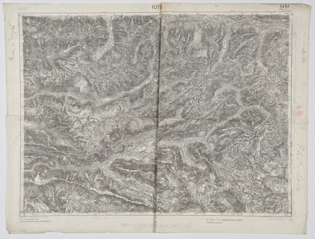
Zagreb–Bovec’ Sheet of the Special Map of the Austro-Hungarian Monarchy
Imperial and Royal Military Geographical Institute, Vienna, 1916,
Vienna,
1916
Paper, print; 43.1 x 56 cm;
scale: 1:75,000;
nomenclature and sheet title on u. l. and centre: ‘ZONE 22 KOL. XIV. ZAGREB’ (side a); ‘FLITSCH’ (side b); u. l.: designation as invalid map: ‘Ungültig’ (side a); u. r.: section number: ‘5656’ (side a), ‘5451’ (side b); l. l.: production data with date: ‘Geripp: J. Mugerauer. / Nach Zeichenschlüssel 1894’ (side a), ‘Geripp. Assist. K. Melichar u. Aspir. R. Vogl. / Nach Zeichenschlüssel 1904 / Schrift der Wohnorte analog der Generalkarte.’ (side b); l. r.: information on terrain depiction with partial map corrections: ‘Terrain: Oberlt. Sachs / Teilweise berichtigt bis 14 I 1914’ (side a), ‘Terrain: Oblt. Zd. Hofrichter, Felsen; Offiz. F. Simon / Teilweise berichtigt bis 3.II.1916.’ (side b).
Two-sided special (topographic) map in 1:75,000 scale printed during World War I, with the sheets ‘Zagreb’ and ‘Bovec’. The topographic depiction of Zagreb is incorrect, and that map sheet was annulled using two lines forming an X.
Izvori / literatura: first publication
error: Sadržaj je zaštićen!
Hrvatski povijesni muzej
Zagreb–Bovec’ Sheet of the Special Map of the Austro-Hungarian Monarchy
Description:
Two-sided special (topographic) map in 1:75,000 scale printed during World War I, with the sheets ‘Zagreb’ and ‘Bovec’. The topographic depiction of Zagreb is incorrect, and that map sheet was annulled using two lines forming an X.
Inventory number:
HPM/PMH-7464
Zagreb–Bovec’ Sheet of the Special Map of the Austro-Hungarian Monarchy
Description:
Two-sided special (topographic) map in 1:75,000 scale printed during World War I, with the sheets ‘Zagreb’ and ‘Bovec’. The topographic depiction of Zagreb is incorrect, and that map sheet was annulled using two lines forming an X.