Marked on this detailed map of the Socialist Federal Republic of Yugoslavia are: national borders, socialist republic borders, autonomous province borders, smaller and larger settlements according to population, and the hydrographical network (swamps, rivers, canals, canals under construction).
Izvori / literatura: first publication
error: Sadržaj je zaštićen!
Hrvatski povijesni muzej
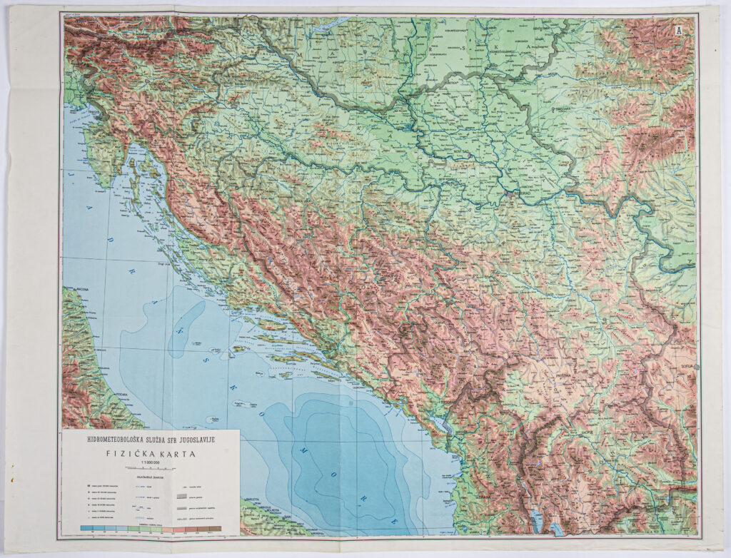
Map: ‘HYDROMETEOROLOGICAL SERVICE OF THE SFRY / PHYSICAL MAP’
Description:
Marked on this detailed map of the Socialist Federal Republic of Yugoslavia are: national borders, socialist republic borders, autonomous province borders, smaller and larger settlements according to population, and the hydrographical network (swamps, rivers, canals, canals under construction).