Imperial and Royal Military Geographical Institute,
Vienna,
from 1801 to 1900
Paper, print; 33.6 x 47.1 cm;
scale: 1:288,000;
l. r.: written by hand: ‘Gospić’; stamp with provenance on reverse of map: ‘ARHEOL.-HISTOR. / NAR. MUZEJ / ZAGREB’.
Inherited from the Archaeology and History Department of the National Museum in Zagreb
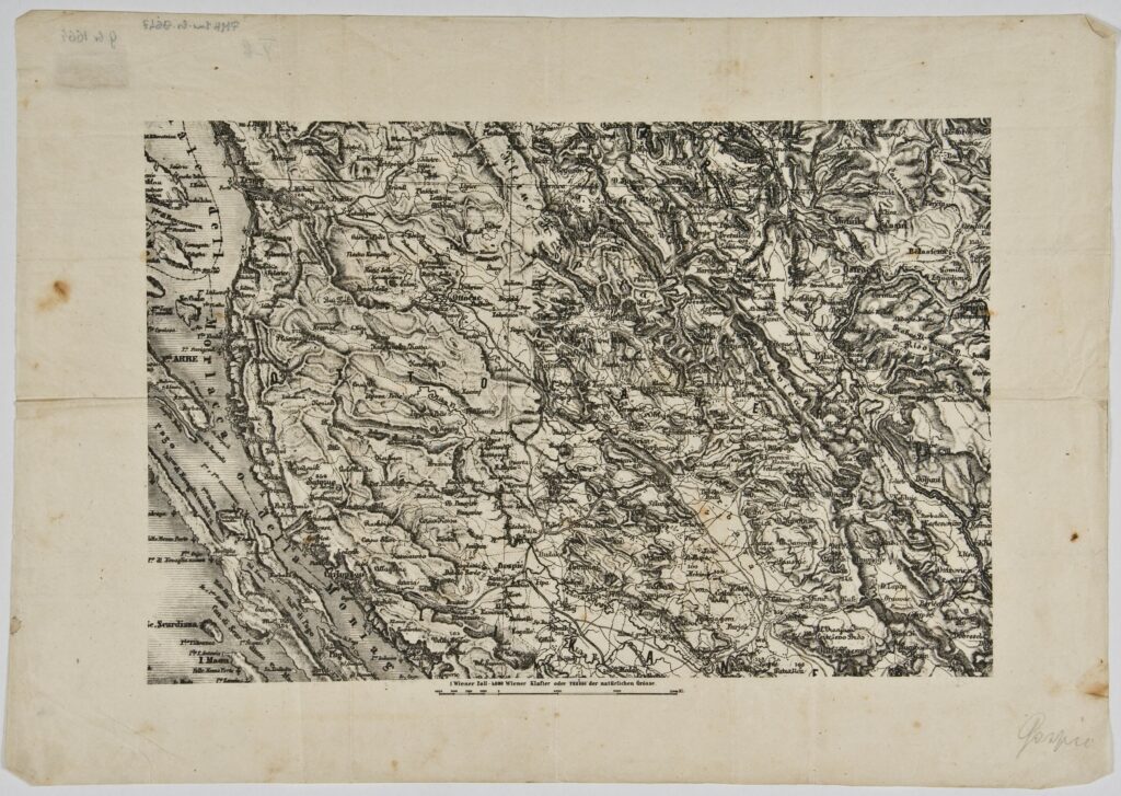
The map depicts a part of the Croatian Littoral (Senj–Karlobag route) and central Lika, with the road network and a part of the Josephina road, the Senj–Jezerane route. The Josephina road, which was 113 km long and named after the Holy Roman emperor Joseph II, was built from 1770 to 1779, with the basic goal of connecting the towns Karlovac and Senj via Duga Resa, Generalski Stol, Josipdol, Jezerane, Brinje, and the Vratnik pass on Mount Velebit.
Sources / literature: Jozefinska cesta. Hrvatska enciklopedija, mrežno izdanje. Leksikografski zavod Miroslav Krleža, 2020, URL: http://www.enciklopedija.hr/Natuknica.aspx?ID=29402 (29 April 2021)
error: Sadržaj je zaštićen!
Hrvatski povijesni muzej
Map of the Croatian Littoral and Lika
Description:
The map depicts a part of the Croatian Littoral (Senj–Karlobag route) and central Lika, with the road network and a part of the Josephina road, the Senj–Jezerane route. The Josephina road, which was 113 km long and named after the Holy Roman emperor Joseph II, was built from 1770 to 1779, with the basic goal of connecting the towns Karlovac and Senj via Duga Resa, Generalski Stol, Josipdol, Jezerane, Brinje, and the Vratnik pass on Mount Velebit.
Inventory number:
HPM/PMH-9647
Croatian History Museum
Map of the Croatian Littoral and Lika
Description:
The map depicts a part of the Croatian Littoral (Senj–Karlobag route) and central Lika, with the road network and a part of the Josephina road, the Senj–Jezerane route. The Josephina road, which was 113 km long and named after the Holy Roman emperor Joseph II, was built from 1770 to 1779, with the basic goal of connecting the towns Karlovac and Senj via Duga Resa, Generalski Stol, Josipdol, Jezerane, Brinje, and the Vratnik pass on Mount Velebit.