Publisher: Rudolf Lechner, Wilhelm Müller; production and commission edition: Imperial and Royal Military Geographical Institute,
Vienna,
1914
Paper, full colour lithographic print; 93.5 x 70.5 cm;
scale: 1:500,000;
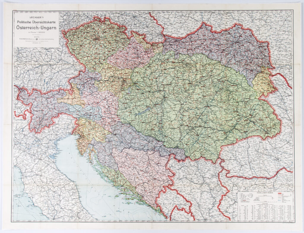
u. l.: map title with publisher and production data: ‘Lechner’s / Politische Übersichtskarte / von / Österreich – Ungarn im Masse 1: 1.500.000 / Wien / R. Lechner (Wilh. Müller) K.u.K. Hof - Universitäts Buchhandlung / Kommissions – Verlag des K.u.K. milgeograph Institutes / graben 31’; l. r.: map key
On the eve of World War I, an overview map of the Austro-Hungarian Monarchy was published. Marked on it were state borders (the outer borders of the Monarchy as a whole), land/province borders, and county and district borders. The Austrian part of the Monarchy, Cisleithania, included 17 lands, among them the territory of Istria and the Kingdom of Dalmatia (the Austrian Littoral), while Transleithania, the Hungarian part of the Monarchy, included Hungary with Transylvania and the Kingdoms of Croatia and Slavonia as well as Rijeka and its surrounding area. Until the collapse of the Dual Monarchy in 1918, the Triune Kingdom of Croatia, Slavonia and Dalmatia was divided between these two state entities. After the annexation of Bosnia and Herzegovina in 1908, that country came under the joint administration of the Austrian and the Hungarian parts of the Monarchy.
Izvori / literatura: Dadoh zlato za željezo: Prvi svjetski rat u zbirkama Hrvatskog povijesnog muzeja: 2011, p. 280; Slava Saboru, 1997, p. 34
error: Sadržaj je zaštićen!
Hrvatski povijesni muzej
Overview Map of the Austro-Hungarian Monarchy
Description:
On the eve of World War I, an overview map of the Austro-Hungarian Monarchy was published. Marked on it were state borders (the outer borders of the Monarchy as a whole), land/province borders, and county and district borders. The Austrian part of the Monarchy, Cisleithania, included 17 lands, among them the territory of Istria and the Kingdom of Dalmatia (the Austrian Littoral), while Transleithania, the Hungarian part of the Monarchy, included Hungary with Transylvania and the Kingdoms of Croatia and Slavonia as well as Rijeka and its surrounding area. Until the collapse of the Dual Monarchy in 1918, the Triune Kingdom of Croatia, Slavonia and Dalmatia was divided between these two state entities. After the annexation of Bosnia and Herzegovina in 1908, that country came under the joint administration of the Austrian and the Hungarian parts of the Monarchy.