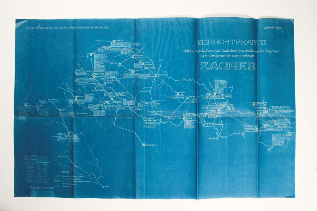
Overview Map of the Positions of Military Units in the Area of the XIII Corps of the Zagreb Military Command
Imperial and Royal Military Geographical Institute,
Vienna,
1918
Paper, drawing, reproduction; 47 × 63 cm;
scale: undefined;
u. l.: note: ‘K.K.MILITARBAUABTEILUNG DES MILITARKOMMANDOS IN ZAGREB’; u. r.: map title: ‘ÜBERSICHTKARTE / über die Dislokations und Unterkunftsverhällnisse der Truppen / IM MILITARKOMMANDOBEREICHE / ZAGREB’, publication year: ‘JAHR:1918.’; l. l.: statistical table, note: ‘Zagreb, im März 1917.’ and map key
Overview map of the positions and deployment of units in the area of the XIII Corps of the Zagreb Military Command in 1918. County borders and railways on the territory of the Kingdoms of Croatia and Slavonia are also marked on the map. As an addendum of sorts, the map contains a brief statistical table with a list of locations relevant for maintaining hygiene and disinfection. The XIII Zagreb Corps, based in Zagreb, was formed in 1883 as part of a reorganisation of the Austro-Hungarian Army. It covered the area of the Kingdoms of Croatia and Slavonia, together with the Kvarner islands and Rijeka.
Izvori / literatura: Houška, Mačković: 2014, p. 21
error: Sadržaj je zaštićen!
Hrvatski povijesni muzej
Overview Map of the Positions of Military Units in the Area of the XIII Corps of the Zagreb Military Command
Description:
Overview map of the positions and deployment of units in the area of the XIII Corps of the Zagreb Military Command in 1918. County borders and railways on the territory of the Kingdoms of Croatia and Slavonia are also marked on the map. As an addendum of sorts, the map contains a brief statistical table with a list of locations relevant for maintaining hygiene and disinfection. The XIII Zagreb Corps, based in Zagreb, was formed in 1883 as part of a reorganisation of the Austro-Hungarian Army. It covered the area of the Kingdoms of Croatia and Slavonia, together with the Kvarner islands and Rijeka.