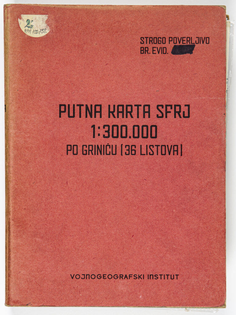
Container: cardboard, paper, glued, map: paper, full colour print; 48.7 x 68.5 cm, 36 sheets; scale: 1:300,000; title on map case: ‘PUTNA KARTA SFRJ / 1:300.000 / PO GRINIČU (36 LISTOVA)’; u. r.: note: ‘STROGO POVERLJIVO / BR. EVID.’; lower middle: number covered with black marker pen: ‘VOJNOGEOGRAFSKI INSTITUT’; instruction glued to inner side of map case: ‘Korišćenje i čuvanje / Putne karte SFRJ / 1:300.000.’ with date (21 November 1964), seal of the Military Geographical Institute and signature of the Chief of the General Staff, Lieutenant General Rade Hamović; on each sheet: sheet title and nomenclature, sheet number, note ‘Highly Confidential’, map key, overview sketch made using the Gauss-Krüger projection, and publication data: ‘Izdanje Vojnogeografskog instituta 1962. g. sa delimično / unetim podacima o izgrađenim putovima u 1963. godini.’
Purchased in 2001
HPM-102758
Road map of the Socialist Federal Republic of Yugoslavia containing 36 sheets showing towns, cities, and the island of Korčula, with detailed depictions of traffic routes and hubs as well as symbols, from ‘motorway’ to ‘serpentine on route’; ‘route distances in km’; from ‘bridges below 8 tons’ to ‘revetment wall over 5 m tall’; springs; fountains; cisterns and wells; petrol stations, and repair workshops. Cities and towns shown on the road map include: Ljubljana, Maribor, Kaposvár, Pécs, Subotica, Trieste, Zagreb, Bjelovar, Osijek, Novi Sad, Timişoara, Zadar, Banja Luka, Pula, Tuzla, Belgrade, Požarevac, Craiova, Split, Mostar, Sarajevo, Kraljevo, Niš, Vidin, Korčula, Titograd (today Podgorica), Prizren, Pristina, Sofia, Durrës, Tirana, Skopje, Strumica, Korçë, Florina, and Thessalonica.

Road map of the Socialist Federal Republic of Yugoslavia containing 36 sheets showing towns, cities, and the island of Korčula, with detailed depictions of traffic routes and hubs as well as symbols, from ‘motorway’ to ‘serpentine on route’; ‘route distances in km’; from ‘bridges below 8 tons’ to ‘revetment wall over 5 m tall’; springs; fountains; cisterns and wells; petrol stations, and repair workshops. Cities and towns shown on the road map include: Ljubljana, Maribor, Kaposvár, Pécs, Subotica, Trieste, Zagreb, Bjelovar, Osijek, Novi Sad, Timişoara, Zadar, Banja Luka, Pula, Tuzla, Belgrade, Požarevac, Craiova, Split, Mostar, Sarajevo, Kraljevo, Niš, Vidin, Korčula, Titograd (today Podgorica), Prizren, Pristina, Sofia, Durrës, Tirana, Skopje, Strumica, Korçë, Florina, and Thessalonica.
Road map of the Socialist Federal Republic of Yugoslavia containing 36 sheets showing towns, cities, and the island of Korčula, with detailed depictions of traffic routes and hubs as well as symbols, from ‘motorway’ to ‘serpentine on route’; ‘route distances in km’; from ‘bridges below 8 tons’ to ‘revetment wall over 5 m tall’; springs; fountains; cisterns and wells; petrol stations, and repair workshops. Cities and towns shown on the road map include: Ljubljana, Maribor, Kaposvár, Pécs, Subotica, Trieste, Zagreb, Bjelovar, Osijek, Novi Sad, Timişoara, Zadar, Banja Luka, Pula, Tuzla, Belgrade, Požarevac, Craiova, Split, Mostar, Sarajevo, Kraljevo, Niš, Vidin, Korčula, Titograd (today Podgorica), Prizren, Pristina, Sofia, Durrës, Tirana, Skopje, Strumica, Korçë, Florina, and Thessalonica.
Road map of the Socialist Federal Republic of Yugoslavia containing 36 sheets showing towns, cities, and the island of Korčula, with detailed depictions of traffic routes and hubs as well as symbols, from ‘motorway’ to ‘serpentine on route’; ‘route distances in km’; from ‘bridges below 8 tons’ to ‘revetment wall over 5 m tall’; springs; fountains; cisterns and wells; petrol stations, and repair workshops. Cities and towns shown on the road map include: Ljubljana, Maribor, Kaposvár, Pécs, Subotica, Trieste, Zagreb, Bjelovar, Osijek, Novi Sad, Timişoara, Zadar, Banja Luka, Pula, Tuzla, Belgrade, Požarevac, Craiova, Split, Mostar, Sarajevo, Kraljevo, Niš, Vidin, Korčula, Titograd (today Podgorica), Prizren, Pristina, Sofia, Durrës, Tirana, Skopje, Strumica, Korçë, Florina, and Thessalonica.
Road map of the Socialist Federal Republic of Yugoslavia containing 36 sheets showing towns, cities, and the island of Korčula, with detailed depictions of traffic routes and hubs as well as symbols, from ‘motorway’ to ‘serpentine on route’; ‘route distances in km’; from ‘bridges below 8 tons’ to ‘revetment wall over 5 m tall’; springs; fountains; cisterns and wells; petrol stations, and repair workshops. Cities and towns shown on the road map include: Ljubljana, Maribor, Kaposvár, Pécs, Subotica, Trieste, Zagreb, Bjelovar, Osijek, Novi Sad, Timişoara, Zadar, Banja Luka, Pula, Tuzla, Belgrade, Požarevac, Craiova, Split, Mostar, Sarajevo, Kraljevo, Niš, Vidin, Korčula, Titograd (today Podgorica), Prizren, Pristina, Sofia, Durrës, Tirana, Skopje, Strumica, Korçë, Florina, and Thessalonica.
Road map of the Socialist Federal Republic of Yugoslavia containing 36 sheets showing towns, cities, and the island of Korčula, with detailed depictions of traffic routes and hubs as well as symbols, from ‘motorway’ to ‘serpentine on route’; ‘route distances in km’; from ‘bridges below 8 tons’ to ‘revetment wall over 5 m tall’; springs; fountains; cisterns and wells; petrol stations, and repair workshops. Cities and towns shown on the road map include: Ljubljana, Maribor, Kaposvár, Pécs, Subotica, Trieste, Zagreb, Bjelovar, Osijek, Novi Sad, Timişoara, Zadar, Banja Luka, Pula, Tuzla, Belgrade, Požarevac, Craiova, Split, Mostar, Sarajevo, Kraljevo, Niš, Vidin, Korčula, Titograd (today Podgorica), Prizren, Pristina, Sofia, Durrës, Tirana, Skopje, Strumica, Korçë, Florina, and Thessalonica.
Road map of the Socialist Federal Republic of Yugoslavia containing 36 sheets showing towns, cities, and the island of Korčula, with detailed depictions of traffic routes and hubs as well as symbols, from ‘motorway’ to ‘serpentine on route’; ‘route distances in km’; from ‘bridges below 8 tons’ to ‘revetment wall over 5 m tall’; springs; fountains; cisterns and wells; petrol stations, and repair workshops. Cities and towns shown on the road map include: Ljubljana, Maribor, Kaposvár, Pécs, Subotica, Trieste, Zagreb, Bjelovar, Osijek, Novi Sad, Timişoara, Zadar, Banja Luka, Pula, Tuzla, Belgrade, Požarevac, Craiova, Split, Mostar, Sarajevo, Kraljevo, Niš, Vidin, Korčula, Titograd (today Podgorica), Prizren, Pristina, Sofia, Durrës, Tirana, Skopje, Strumica, Korçë, Florina, and Thessalonica.
Road map of the Socialist Federal Republic of Yugoslavia containing 36 sheets showing towns, cities, and the island of Korčula, with detailed depictions of traffic routes and hubs as well as symbols, from ‘motorway’ to ‘serpentine on route’; ‘route distances in km’; from ‘bridges below 8 tons’ to ‘revetment wall over 5 m tall’; springs; fountains; cisterns and wells; petrol stations, and repair workshops. Cities and towns shown on the road map include: Ljubljana, Maribor, Kaposvár, Pécs, Subotica, Trieste, Zagreb, Bjelovar, Osijek, Novi Sad, Timişoara, Zadar, Banja Luka, Pula, Tuzla, Belgrade, Požarevac, Craiova, Split, Mostar, Sarajevo, Kraljevo, Niš, Vidin, Korčula, Titograd (today Podgorica), Prizren, Pristina, Sofia, Durrës, Tirana, Skopje, Strumica, Korçë, Florina, and Thessalonica.
Road map of the Socialist Federal Republic of Yugoslavia containing 36 sheets showing towns, cities, and the island of Korčula, with detailed depictions of traffic routes and hubs as well as symbols, from ‘motorway’ to ‘serpentine on route’; ‘route distances in km’; from ‘bridges below 8 tons’ to ‘revetment wall over 5 m tall’; springs; fountains; cisterns and wells; petrol stations, and repair workshops. Cities and towns shown on the road map include: Ljubljana, Maribor, Kaposvár, Pécs, Subotica, Trieste, Zagreb, Bjelovar, Osijek, Novi Sad, Timişoara, Zadar, Banja Luka, Pula, Tuzla, Belgrade, Požarevac, Craiova, Split, Mostar, Sarajevo, Kraljevo, Niš, Vidin, Korčula, Titograd (today Podgorica), Prizren, Pristina, Sofia, Durrës, Tirana, Skopje, Strumica, Korçë, Florina, and Thessalonica.
Road map of the Socialist Federal Republic of Yugoslavia containing 36 sheets showing towns, cities, and the island of Korčula, with detailed depictions of traffic routes and hubs as well as symbols, from ‘motorway’ to ‘serpentine on route’; ‘route distances in km’; from ‘bridges below 8 tons’ to ‘revetment wall over 5 m tall’; springs; fountains; cisterns and wells; petrol stations, and repair workshops. Cities and towns shown on the road map include: Ljubljana, Maribor, Kaposvár, Pécs, Subotica, Trieste, Zagreb, Bjelovar, Osijek, Novi Sad, Timişoara, Zadar, Banja Luka, Pula, Tuzla, Belgrade, Požarevac, Craiova, Split, Mostar, Sarajevo, Kraljevo, Niš, Vidin, Korčula, Titograd (today Podgorica), Prizren, Pristina, Sofia, Durrës, Tirana, Skopje, Strumica, Korçë, Florina, and Thessalonica.
Road map of the Socialist Federal Republic of Yugoslavia containing 36 sheets showing towns, cities, and the island of Korčula, with detailed depictions of traffic routes and hubs as well as symbols, from ‘motorway’ to ‘serpentine on route’; ‘route distances in km’; from ‘bridges below 8 tons’ to ‘revetment wall over 5 m tall’; springs; fountains; cisterns and wells; petrol stations, and repair workshops. Cities and towns shown on the road map include: Ljubljana, Maribor, Kaposvár, Pécs, Subotica, Trieste, Zagreb, Bjelovar, Osijek, Novi Sad, Timişoara, Zadar, Banja Luka, Pula, Tuzla, Belgrade, Požarevac, Craiova, Split, Mostar, Sarajevo, Kraljevo, Niš, Vidin, Korčula, Titograd (today Podgorica), Prizren, Pristina, Sofia, Durrës, Tirana, Skopje, Strumica, Korçë, Florina, and Thessalonica.
Road map of the Socialist Federal Republic of Yugoslavia containing 36 sheets showing towns, cities, and the island of Korčula, with detailed depictions of traffic routes and hubs as well as symbols, from ‘motorway’ to ‘serpentine on route’; ‘route distances in km’; from ‘bridges below 8 tons’ to ‘revetment wall over 5 m tall’; springs; fountains; cisterns and wells; petrol stations, and repair workshops. Cities and towns shown on the road map include: Ljubljana, Maribor, Kaposvár, Pécs, Subotica, Trieste, Zagreb, Bjelovar, Osijek, Novi Sad, Timişoara, Zadar, Banja Luka, Pula, Tuzla, Belgrade, Požarevac, Craiova, Split, Mostar, Sarajevo, Kraljevo, Niš, Vidin, Korčula, Titograd (today Podgorica), Prizren, Pristina, Sofia, Durrës, Tirana, Skopje, Strumica, Korçë, Florina, and Thessalonica.
Road map of the Socialist Federal Republic of Yugoslavia containing 36 sheets showing towns, cities, and the island of Korčula, with detailed depictions of traffic routes and hubs as well as symbols, from ‘motorway’ to ‘serpentine on route’; ‘route distances in km’; from ‘bridges below 8 tons’ to ‘revetment wall over 5 m tall’; springs; fountains; cisterns and wells; petrol stations, and repair workshops. Cities and towns shown on the road map include: Ljubljana, Maribor, Kaposvár, Pécs, Subotica, Trieste, Zagreb, Bjelovar, Osijek, Novi Sad, Timişoara, Zadar, Banja Luka, Pula, Tuzla, Belgrade, Požarevac, Craiova, Split, Mostar, Sarajevo, Kraljevo, Niš, Vidin, Korčula, Titograd (today Podgorica), Prizren, Pristina, Sofia, Durrës, Tirana, Skopje, Strumica, Korçë, Florina, and Thessalonica.
Road map of the Socialist Federal Republic of Yugoslavia containing 36 sheets showing towns, cities, and the island of Korčula, with detailed depictions of traffic routes and hubs as well as symbols, from ‘motorway’ to ‘serpentine on route’; ‘route distances in km’; from ‘bridges below 8 tons’ to ‘revetment wall over 5 m tall’; springs; fountains; cisterns and wells; petrol stations, and repair workshops. Cities and towns shown on the road map include: Ljubljana, Maribor, Kaposvár, Pécs, Subotica, Trieste, Zagreb, Bjelovar, Osijek, Novi Sad, Timişoara, Zadar, Banja Luka, Pula, Tuzla, Belgrade, Požarevac, Craiova, Split, Mostar, Sarajevo, Kraljevo, Niš, Vidin, Korčula, Titograd (today Podgorica), Prizren, Pristina, Sofia, Durrës, Tirana, Skopje, Strumica, Korçë, Florina, and Thessalonica.
Road map of the Socialist Federal Republic of Yugoslavia containing 36 sheets showing towns, cities, and the island of Korčula, with detailed depictions of traffic routes and hubs as well as symbols, from ‘motorway’ to ‘serpentine on route’; ‘route distances in km’; from ‘bridges below 8 tons’ to ‘revetment wall over 5 m tall’; springs; fountains; cisterns and wells; petrol stations, and repair workshops. Cities and towns shown on the road map include: Ljubljana, Maribor, Kaposvár, Pécs, Subotica, Trieste, Zagreb, Bjelovar, Osijek, Novi Sad, Timişoara, Zadar, Banja Luka, Pula, Tuzla, Belgrade, Požarevac, Craiova, Split, Mostar, Sarajevo, Kraljevo, Niš, Vidin, Korčula, Titograd (today Podgorica), Prizren, Pristina, Sofia, Durrës, Tirana, Skopje, Strumica, Korçë, Florina, and Thessalonica.
Road map of the Socialist Federal Republic of Yugoslavia containing 36 sheets showing towns, cities, and the island of Korčula, with detailed depictions of traffic routes and hubs as well as symbols, from ‘motorway’ to ‘serpentine on route’; ‘route distances in km’; from ‘bridges below 8 tons’ to ‘revetment wall over 5 m tall’; springs; fountains; cisterns and wells; petrol stations, and repair workshops. Cities and towns shown on the road map include: Ljubljana, Maribor, Kaposvár, Pécs, Subotica, Trieste, Zagreb, Bjelovar, Osijek, Novi Sad, Timişoara, Zadar, Banja Luka, Pula, Tuzla, Belgrade, Požarevac, Craiova, Split, Mostar, Sarajevo, Kraljevo, Niš, Vidin, Korčula, Titograd (today Podgorica), Prizren, Pristina, Sofia, Durrës, Tirana, Skopje, Strumica, Korçë, Florina, and Thessalonica.
Road map of the Socialist Federal Republic of Yugoslavia containing 36 sheets showing towns, cities, and the island of Korčula, with detailed depictions of traffic routes and hubs as well as symbols, from ‘motorway’ to ‘serpentine on route’; ‘route distances in km’; from ‘bridges below 8 tons’ to ‘revetment wall over 5 m tall’; springs; fountains; cisterns and wells; petrol stations, and repair workshops. Cities and towns shown on the road map include: Ljubljana, Maribor, Kaposvár, Pécs, Subotica, Trieste, Zagreb, Bjelovar, Osijek, Novi Sad, Timişoara, Zadar, Banja Luka, Pula, Tuzla, Belgrade, Požarevac, Craiova, Split, Mostar, Sarajevo, Kraljevo, Niš, Vidin, Korčula, Titograd (today Podgorica), Prizren, Pristina, Sofia, Durrës, Tirana, Skopje, Strumica, Korçë, Florina, and Thessalonica.
Road map of the Socialist Federal Republic of Yugoslavia containing 36 sheets showing towns, cities, and the island of Korčula, with detailed depictions of traffic routes and hubs as well as symbols, from ‘motorway’ to ‘serpentine on route’; ‘route distances in km’; from ‘bridges below 8 tons’ to ‘revetment wall over 5 m tall’; springs; fountains; cisterns and wells; petrol stations, and repair workshops. Cities and towns shown on the road map include: Ljubljana, Maribor, Kaposvár, Pécs, Subotica, Trieste, Zagreb, Bjelovar, Osijek, Novi Sad, Timişoara, Zadar, Banja Luka, Pula, Tuzla, Belgrade, Požarevac, Craiova, Split, Mostar, Sarajevo, Kraljevo, Niš, Vidin, Korčula, Titograd (today Podgorica), Prizren, Pristina, Sofia, Durrës, Tirana, Skopje, Strumica, Korçë, Florina, and Thessalonica.
Road map of the Socialist Federal Republic of Yugoslavia containing 36 sheets showing towns, cities, and the island of Korčula, with detailed depictions of traffic routes and hubs as well as symbols, from ‘motorway’ to ‘serpentine on route’; ‘route distances in km’; from ‘bridges below 8 tons’ to ‘revetment wall over 5 m tall’; springs; fountains; cisterns and wells; petrol stations, and repair workshops. Cities and towns shown on the road map include: Ljubljana, Maribor, Kaposvár, Pécs, Subotica, Trieste, Zagreb, Bjelovar, Osijek, Novi Sad, Timişoara, Zadar, Banja Luka, Pula, Tuzla, Belgrade, Požarevac, Craiova, Split, Mostar, Sarajevo, Kraljevo, Niš, Vidin, Korčula, Titograd (today Podgorica), Prizren, Pristina, Sofia, Durrës, Tirana, Skopje, Strumica, Korçë, Florina, and Thessalonica.
Road map of the Socialist Federal Republic of Yugoslavia containing 36 sheets showing towns, cities, and the island of Korčula, with detailed depictions of traffic routes and hubs as well as symbols, from ‘motorway’ to ‘serpentine on route’; ‘route distances in km’; from ‘bridges below 8 tons’ to ‘revetment wall over 5 m tall’; springs; fountains; cisterns and wells; petrol stations, and repair workshops. Cities and towns shown on the road map include: Ljubljana, Maribor, Kaposvár, Pécs, Subotica, Trieste, Zagreb, Bjelovar, Osijek, Novi Sad, Timişoara, Zadar, Banja Luka, Pula, Tuzla, Belgrade, Požarevac, Craiova, Split, Mostar, Sarajevo, Kraljevo, Niš, Vidin, Korčula, Titograd (today Podgorica), Prizren, Pristina, Sofia, Durrës, Tirana, Skopje, Strumica, Korçë, Florina, and Thessalonica.
Road map of the Socialist Federal Republic of Yugoslavia containing 36 sheets showing towns, cities, and the island of Korčula, with detailed depictions of traffic routes and hubs as well as symbols, from ‘motorway’ to ‘serpentine on route’; ‘route distances in km’; from ‘bridges below 8 tons’ to ‘revetment wall over 5 m tall’; springs; fountains; cisterns and wells; petrol stations, and repair workshops. Cities and towns shown on the road map include: Ljubljana, Maribor, Kaposvár, Pécs, Subotica, Trieste, Zagreb, Bjelovar, Osijek, Novi Sad, Timişoara, Zadar, Banja Luka, Pula, Tuzla, Belgrade, Požarevac, Craiova, Split, Mostar, Sarajevo, Kraljevo, Niš, Vidin, Korčula, Titograd (today Podgorica), Prizren, Pristina, Sofia, Durrës, Tirana, Skopje, Strumica, Korçë, Florina, and Thessalonica.
Road map of the Socialist Federal Republic of Yugoslavia containing 36 sheets showing towns, cities, and the island of Korčula, with detailed depictions of traffic routes and hubs as well as symbols, from ‘motorway’ to ‘serpentine on route’; ‘route distances in km’; from ‘bridges below 8 tons’ to ‘revetment wall over 5 m tall’; springs; fountains; cisterns and wells; petrol stations, and repair workshops. Cities and towns shown on the road map include: Ljubljana, Maribor, Kaposvár, Pécs, Subotica, Trieste, Zagreb, Bjelovar, Osijek, Novi Sad, Timişoara, Zadar, Banja Luka, Pula, Tuzla, Belgrade, Požarevac, Craiova, Split, Mostar, Sarajevo, Kraljevo, Niš, Vidin, Korčula, Titograd (today Podgorica), Prizren, Pristina, Sofia, Durrës, Tirana, Skopje, Strumica, Korçë, Florina, and Thessalonica.
Road map of the Socialist Federal Republic of Yugoslavia containing 36 sheets showing towns, cities, and the island of Korčula, with detailed depictions of traffic routes and hubs as well as symbols, from ‘motorway’ to ‘serpentine on route’; ‘route distances in km’; from ‘bridges below 8 tons’ to ‘revetment wall over 5 m tall’; springs; fountains; cisterns and wells; petrol stations, and repair workshops. Cities and towns shown on the road map include: Ljubljana, Maribor, Kaposvár, Pécs, Subotica, Trieste, Zagreb, Bjelovar, Osijek, Novi Sad, Timişoara, Zadar, Banja Luka, Pula, Tuzla, Belgrade, Požarevac, Craiova, Split, Mostar, Sarajevo, Kraljevo, Niš, Vidin, Korčula, Titograd (today Podgorica), Prizren, Pristina, Sofia, Durrës, Tirana, Skopje, Strumica, Korçë, Florina, and Thessalonica.
Road map of the Socialist Federal Republic of Yugoslavia containing 36 sheets showing towns, cities, and the island of Korčula, with detailed depictions of traffic routes and hubs as well as symbols, from ‘motorway’ to ‘serpentine on route’; ‘route distances in km’; from ‘bridges below 8 tons’ to ‘revetment wall over 5 m tall’; springs; fountains; cisterns and wells; petrol stations, and repair workshops. Cities and towns shown on the road map include: Ljubljana, Maribor, Kaposvár, Pécs, Subotica, Trieste, Zagreb, Bjelovar, Osijek, Novi Sad, Timişoara, Zadar, Banja Luka, Pula, Tuzla, Belgrade, Požarevac, Craiova, Split, Mostar, Sarajevo, Kraljevo, Niš, Vidin, Korčula, Titograd (today Podgorica), Prizren, Pristina, Sofia, Durrës, Tirana, Skopje, Strumica, Korçë, Florina, and Thessalonica.
Road map of the Socialist Federal Republic of Yugoslavia containing 36 sheets showing towns, cities, and the island of Korčula, with detailed depictions of traffic routes and hubs as well as symbols, from ‘motorway’ to ‘serpentine on route’; ‘route distances in km’; from ‘bridges below 8 tons’ to ‘revetment wall over 5 m tall’; springs; fountains; cisterns and wells; petrol stations, and repair workshops. Cities and towns shown on the road map include: Ljubljana, Maribor, Kaposvár, Pécs, Subotica, Trieste, Zagreb, Bjelovar, Osijek, Novi Sad, Timişoara, Zadar, Banja Luka, Pula, Tuzla, Belgrade, Požarevac, Craiova, Split, Mostar, Sarajevo, Kraljevo, Niš, Vidin, Korčula, Titograd (today Podgorica), Prizren, Pristina, Sofia, Durrës, Tirana, Skopje, Strumica, Korçë, Florina, and Thessalonica.
Road map of the Socialist Federal Republic of Yugoslavia containing 36 sheets showing towns, cities, and the island of Korčula, with detailed depictions of traffic routes and hubs as well as symbols, from ‘motorway’ to ‘serpentine on route’; ‘route distances in km’; from ‘bridges below 8 tons’ to ‘revetment wall over 5 m tall’; springs; fountains; cisterns and wells; petrol stations, and repair workshops. Cities and towns shown on the road map include: Ljubljana, Maribor, Kaposvár, Pécs, Subotica, Trieste, Zagreb, Bjelovar, Osijek, Novi Sad, Timişoara, Zadar, Banja Luka, Pula, Tuzla, Belgrade, Požarevac, Craiova, Split, Mostar, Sarajevo, Kraljevo, Niš, Vidin, Korčula, Titograd (today Podgorica), Prizren, Pristina, Sofia, Durrës, Tirana, Skopje, Strumica, Korçë, Florina, and Thessalonica.
Road map of the Socialist Federal Republic of Yugoslavia containing 36 sheets showing towns, cities, and the island of Korčula, with detailed depictions of traffic routes and hubs as well as symbols, from ‘motorway’ to ‘serpentine on route’; ‘route distances in km’; from ‘bridges below 8 tons’ to ‘revetment wall over 5 m tall’; springs; fountains; cisterns and wells; petrol stations, and repair workshops. Cities and towns shown on the road map include: Ljubljana, Maribor, Kaposvár, Pécs, Subotica, Trieste, Zagreb, Bjelovar, Osijek, Novi Sad, Timişoara, Zadar, Banja Luka, Pula, Tuzla, Belgrade, Požarevac, Craiova, Split, Mostar, Sarajevo, Kraljevo, Niš, Vidin, Korčula, Titograd (today Podgorica), Prizren, Pristina, Sofia, Durrës, Tirana, Skopje, Strumica, Korçë, Florina, and Thessalonica.
Road map of the Socialist Federal Republic of Yugoslavia containing 36 sheets showing towns, cities, and the island of Korčula, with detailed depictions of traffic routes and hubs as well as symbols, from ‘motorway’ to ‘serpentine on route’; ‘route distances in km’; from ‘bridges below 8 tons’ to ‘revetment wall over 5 m tall’; springs; fountains; cisterns and wells; petrol stations, and repair workshops. Cities and towns shown on the road map include: Ljubljana, Maribor, Kaposvár, Pécs, Subotica, Trieste, Zagreb, Bjelovar, Osijek, Novi Sad, Timişoara, Zadar, Banja Luka, Pula, Tuzla, Belgrade, Požarevac, Craiova, Split, Mostar, Sarajevo, Kraljevo, Niš, Vidin, Korčula, Titograd (today Podgorica), Prizren, Pristina, Sofia, Durrës, Tirana, Skopje, Strumica, Korçë, Florina, and Thessalonica.
Road map of the Socialist Federal Republic of Yugoslavia containing 36 sheets showing towns, cities, and the island of Korčula, with detailed depictions of traffic routes and hubs as well as symbols, from ‘motorway’ to ‘serpentine on route’; ‘route distances in km’; from ‘bridges below 8 tons’ to ‘revetment wall over 5 m tall’; springs; fountains; cisterns and wells; petrol stations, and repair workshops. Cities and towns shown on the road map include: Ljubljana, Maribor, Kaposvár, Pécs, Subotica, Trieste, Zagreb, Bjelovar, Osijek, Novi Sad, Timişoara, Zadar, Banja Luka, Pula, Tuzla, Belgrade, Požarevac, Craiova, Split, Mostar, Sarajevo, Kraljevo, Niš, Vidin, Korčula, Titograd (today Podgorica), Prizren, Pristina, Sofia, Durrës, Tirana, Skopje, Strumica, Korçë, Florina, and Thessalonica.
Road map of the Socialist Federal Republic of Yugoslavia containing 36 sheets showing towns, cities, and the island of Korčula, with detailed depictions of traffic routes and hubs as well as symbols, from ‘motorway’ to ‘serpentine on route’; ‘route distances in km’; from ‘bridges below 8 tons’ to ‘revetment wall over 5 m tall’; springs; fountains; cisterns and wells; petrol stations, and repair workshops. Cities and towns shown on the road map include: Ljubljana, Maribor, Kaposvár, Pécs, Subotica, Trieste, Zagreb, Bjelovar, Osijek, Novi Sad, Timişoara, Zadar, Banja Luka, Pula, Tuzla, Belgrade, Požarevac, Craiova, Split, Mostar, Sarajevo, Kraljevo, Niš, Vidin, Korčula, Titograd (today Podgorica), Prizren, Pristina, Sofia, Durrës, Tirana, Skopje, Strumica, Korçë, Florina, and Thessalonica.
Road map of the Socialist Federal Republic of Yugoslavia containing 36 sheets showing towns, cities, and the island of Korčula, with detailed depictions of traffic routes and hubs as well as symbols, from ‘motorway’ to ‘serpentine on route’; ‘route distances in km’; from ‘bridges below 8 tons’ to ‘revetment wall over 5 m tall’; springs; fountains; cisterns and wells; petrol stations, and repair workshops. Cities and towns shown on the road map include: Ljubljana, Maribor, Kaposvár, Pécs, Subotica, Trieste, Zagreb, Bjelovar, Osijek, Novi Sad, Timişoara, Zadar, Banja Luka, Pula, Tuzla, Belgrade, Požarevac, Craiova, Split, Mostar, Sarajevo, Kraljevo, Niš, Vidin, Korčula, Titograd (today Podgorica), Prizren, Pristina, Sofia, Durrës, Tirana, Skopje, Strumica, Korçë, Florina, and Thessalonica.
Road map of the Socialist Federal Republic of Yugoslavia containing 36 sheets showing towns, cities, and the island of Korčula, with detailed depictions of traffic routes and hubs as well as symbols, from ‘motorway’ to ‘serpentine on route’; ‘route distances in km’; from ‘bridges below 8 tons’ to ‘revetment wall over 5 m tall’; springs; fountains; cisterns and wells; petrol stations, and repair workshops. Cities and towns shown on the road map include: Ljubljana, Maribor, Kaposvár, Pécs, Subotica, Trieste, Zagreb, Bjelovar, Osijek, Novi Sad, Timişoara, Zadar, Banja Luka, Pula, Tuzla, Belgrade, Požarevac, Craiova, Split, Mostar, Sarajevo, Kraljevo, Niš, Vidin, Korčula, Titograd (today Podgorica), Prizren, Pristina, Sofia, Durrës, Tirana, Skopje, Strumica, Korçë, Florina, and Thessalonica.
Road map of the Socialist Federal Republic of Yugoslavia containing 36 sheets showing towns, cities, and the island of Korčula, with detailed depictions of traffic routes and hubs as well as symbols, from ‘motorway’ to ‘serpentine on route’; ‘route distances in km’; from ‘bridges below 8 tons’ to ‘revetment wall over 5 m tall’; springs; fountains; cisterns and wells; petrol stations, and repair workshops. Cities and towns shown on the road map include: Ljubljana, Maribor, Kaposvár, Pécs, Subotica, Trieste, Zagreb, Bjelovar, Osijek, Novi Sad, Timişoara, Zadar, Banja Luka, Pula, Tuzla, Belgrade, Požarevac, Craiova, Split, Mostar, Sarajevo, Kraljevo, Niš, Vidin, Korčula, Titograd (today Podgorica), Prizren, Pristina, Sofia, Durrës, Tirana, Skopje, Strumica, Korçë, Florina, and Thessalonica.
Road map of the Socialist Federal Republic of Yugoslavia containing 36 sheets showing towns, cities, and the island of Korčula, with detailed depictions of traffic routes and hubs as well as symbols, from ‘motorway’ to ‘serpentine on route’; ‘route distances in km’; from ‘bridges below 8 tons’ to ‘revetment wall over 5 m tall’; springs; fountains; cisterns and wells; petrol stations, and repair workshops. Cities and towns shown on the road map include: Ljubljana, Maribor, Kaposvár, Pécs, Subotica, Trieste, Zagreb, Bjelovar, Osijek, Novi Sad, Timişoara, Zadar, Banja Luka, Pula, Tuzla, Belgrade, Požarevac, Craiova, Split, Mostar, Sarajevo, Kraljevo, Niš, Vidin, Korčula, Titograd (today Podgorica), Prizren, Pristina, Sofia, Durrës, Tirana, Skopje, Strumica, Korçë, Florina, and Thessalonica.
Road map of the Socialist Federal Republic of Yugoslavia containing 36 sheets showing towns, cities, and the island of Korčula, with detailed depictions of traffic routes and hubs as well as symbols, from ‘motorway’ to ‘serpentine on route’; ‘route distances in km’; from ‘bridges below 8 tons’ to ‘revetment wall over 5 m tall’; springs; fountains; cisterns and wells; petrol stations, and repair workshops. Cities and towns shown on the road map include: Ljubljana, Maribor, Kaposvár, Pécs, Subotica, Trieste, Zagreb, Bjelovar, Osijek, Novi Sad, Timişoara, Zadar, Banja Luka, Pula, Tuzla, Belgrade, Požarevac, Craiova, Split, Mostar, Sarajevo, Kraljevo, Niš, Vidin, Korčula, Titograd (today Podgorica), Prizren, Pristina, Sofia, Durrës, Tirana, Skopje, Strumica, Korçë, Florina, and Thessalonica.
Road map of the Socialist Federal Republic of Yugoslavia containing 36 sheets showing towns, cities, and the island of Korčula, with detailed depictions of traffic routes and hubs as well as symbols, from ‘motorway’ to ‘serpentine on route’; ‘route distances in km’; from ‘bridges below 8 tons’ to ‘revetment wall over 5 m tall’; springs; fountains; cisterns and wells; petrol stations, and repair workshops. Cities and towns shown on the road map include: Ljubljana, Maribor, Kaposvár, Pécs, Subotica, Trieste, Zagreb, Bjelovar, Osijek, Novi Sad, Timişoara, Zadar, Banja Luka, Pula, Tuzla, Belgrade, Požarevac, Craiova, Split, Mostar, Sarajevo, Kraljevo, Niš, Vidin, Korčula, Titograd (today Podgorica), Prizren, Pristina, Sofia, Durrës, Tirana, Skopje, Strumica, Korçë, Florina, and Thessalonica.
Road map of the Socialist Federal Republic of Yugoslavia containing 36 sheets showing towns, cities, and the island of Korčula, with detailed depictions of traffic routes and hubs as well as symbols, from ‘motorway’ to ‘serpentine on route’; ‘route distances in km’; from ‘bridges below 8 tons’ to ‘revetment wall over 5 m tall’; springs; fountains; cisterns and wells; petrol stations, and repair workshops. Cities and towns shown on the road map include: Ljubljana, Maribor, Kaposvár, Pécs, Subotica, Trieste, Zagreb, Bjelovar, Osijek, Novi Sad, Timişoara, Zadar, Banja Luka, Pula, Tuzla, Belgrade, Požarevac, Craiova, Split, Mostar, Sarajevo, Kraljevo, Niš, Vidin, Korčula, Titograd (today Podgorica), Prizren, Pristina, Sofia, Durrës, Tirana, Skopje, Strumica, Korçë, Florina, and Thessalonica.
Road map of the Socialist Federal Republic of Yugoslavia containing 36 sheets showing towns, cities, and the island of Korčula, with detailed depictions of traffic routes and hubs as well as symbols, from ‘motorway’ to ‘serpentine on route’; ‘route distances in km’; from ‘bridges below 8 tons’ to ‘revetment wall over 5 m tall’; springs; fountains; cisterns and wells; petrol stations, and repair workshops. Cities and towns shown on the road map include: Ljubljana, Maribor, Kaposvár, Pécs, Subotica, Trieste, Zagreb, Bjelovar, Osijek, Novi Sad, Timişoara, Zadar, Banja Luka, Pula, Tuzla, Belgrade, Požarevac, Craiova, Split, Mostar, Sarajevo, Kraljevo, Niš, Vidin, Korčula, Titograd (today Podgorica), Prizren, Pristina, Sofia, Durrës, Tirana, Skopje, Strumica, Korçë, Florina, and Thessalonica.
Road map of the Socialist Federal Republic of Yugoslavia containing 36 sheets showing towns, cities, and the island of Korčula, with detailed depictions of traffic routes and hubs as well as symbols, from ‘motorway’ to ‘serpentine on route’; ‘route distances in km’; from ‘bridges below 8 tons’ to ‘revetment wall over 5 m tall’; springs; fountains; cisterns and wells; petrol stations, and repair workshops. Cities and towns shown on the road map include: Ljubljana, Maribor, Kaposvár, Pécs, Subotica, Trieste, Zagreb, Bjelovar, Osijek, Novi Sad, Timişoara, Zadar, Banja Luka, Pula, Tuzla, Belgrade, Požarevac, Craiova, Split, Mostar, Sarajevo, Kraljevo, Niš, Vidin, Korčula, Titograd (today Podgorica), Prizren, Pristina, Sofia, Durrës, Tirana, Skopje, Strumica, Korçë, Florina, and Thessalonica.
Road map of the Socialist Federal Republic of Yugoslavia containing 36 sheets showing towns, cities, and the island of Korčula, with detailed depictions of traffic routes and hubs as well as symbols, from ‘motorway’ to ‘serpentine on route’; ‘route distances in km’; from ‘bridges below 8 tons’ to ‘revetment wall over 5 m tall’; springs; fountains; cisterns and wells; petrol stations, and repair workshops. Cities and towns shown on the road map include: Ljubljana, Maribor, Kaposvár, Pécs, Subotica, Trieste, Zagreb, Bjelovar, Osijek, Novi Sad, Timişoara, Zadar, Banja Luka, Pula, Tuzla, Belgrade, Požarevac, Craiova, Split, Mostar, Sarajevo, Kraljevo, Niš, Vidin, Korčula, Titograd (today Podgorica), Prizren, Pristina, Sofia, Durrës, Tirana, Skopje, Strumica, Korçë, Florina, and Thessalonica.
Road map of the Socialist Federal Republic of Yugoslavia containing 36 sheets showing towns, cities, and the island of Korčula, with detailed depictions of traffic routes and hubs as well as symbols, from ‘motorway’ to ‘serpentine on route’; ‘route distances in km’; from ‘bridges below 8 tons’ to ‘revetment wall over 5 m tall’; springs; fountains; cisterns and wells; petrol stations, and repair workshops. Cities and towns shown on the road map include: Ljubljana, Maribor, Kaposvár, Pécs, Subotica, Trieste, Zagreb, Bjelovar, Osijek, Novi Sad, Timişoara, Zadar, Banja Luka, Pula, Tuzla, Belgrade, Požarevac, Craiova, Split, Mostar, Sarajevo, Kraljevo, Niš, Vidin, Korčula, Titograd (today Podgorica), Prizren, Pristina, Sofia, Durrës, Tirana, Skopje, Strumica, Korçë, Florina, and Thessalonica.
Road map of the Socialist Federal Republic of Yugoslavia containing 36 sheets showing towns, cities, and the island of Korčula, with detailed depictions of traffic routes and hubs as well as symbols, from ‘motorway’ to ‘serpentine on route’; ‘route distances in km’; from ‘bridges below 8 tons’ to ‘revetment wall over 5 m tall’; springs; fountains; cisterns and wells; petrol stations, and repair workshops. Cities and towns shown on the road map include: Ljubljana, Maribor, Kaposvár, Pécs, Subotica, Trieste, Zagreb, Bjelovar, Osijek, Novi Sad, Timişoara, Zadar, Banja Luka, Pula, Tuzla, Belgrade, Požarevac, Craiova, Split, Mostar, Sarajevo, Kraljevo, Niš, Vidin, Korčula, Titograd (today Podgorica), Prizren, Pristina, Sofia, Durrës, Tirana, Skopje, Strumica, Korçë, Florina, and Thessalonica.
Road map of the Socialist Federal Republic of Yugoslavia containing 36 sheets showing towns, cities, and the island of Korčula, with detailed depictions of traffic routes and hubs as well as symbols, from ‘motorway’ to ‘serpentine on route’; ‘route distances in km’; from ‘bridges below 8 tons’ to ‘revetment wall over 5 m tall’; springs; fountains; cisterns and wells; petrol stations, and repair workshops. Cities and towns shown on the road map include: Ljubljana, Maribor, Kaposvár, Pécs, Subotica, Trieste, Zagreb, Bjelovar, Osijek, Novi Sad, Timişoara, Zadar, Banja Luka, Pula, Tuzla, Belgrade, Požarevac, Craiova, Split, Mostar, Sarajevo, Kraljevo, Niš, Vidin, Korčula, Titograd (today Podgorica), Prizren, Pristina, Sofia, Durrës, Tirana, Skopje, Strumica, Korçë, Florina, and Thessalonica.
Road map of the Socialist Federal Republic of Yugoslavia containing 36 sheets showing towns, cities, and the island of Korčula, with detailed depictions of traffic routes and hubs as well as symbols, from ‘motorway’ to ‘serpentine on route’; ‘route distances in km’; from ‘bridges below 8 tons’ to ‘revetment wall over 5 m tall’; springs; fountains; cisterns and wells; petrol stations, and repair workshops. Cities and towns shown on the road map include: Ljubljana, Maribor, Kaposvár, Pécs, Subotica, Trieste, Zagreb, Bjelovar, Osijek, Novi Sad, Timişoara, Zadar, Banja Luka, Pula, Tuzla, Belgrade, Požarevac, Craiova, Split, Mostar, Sarajevo, Kraljevo, Niš, Vidin, Korčula, Titograd (today Podgorica), Prizren, Pristina, Sofia, Durrës, Tirana, Skopje, Strumica, Korçë, Florina, and Thessalonica.
Road map of the Socialist Federal Republic of Yugoslavia containing 36 sheets showing towns, cities, and the island of Korčula, with detailed depictions of traffic routes and hubs as well as symbols, from ‘motorway’ to ‘serpentine on route’; ‘route distances in km’; from ‘bridges below 8 tons’ to ‘revetment wall over 5 m tall’; springs; fountains; cisterns and wells; petrol stations, and repair workshops. Cities and towns shown on the road map include: Ljubljana, Maribor, Kaposvár, Pécs, Subotica, Trieste, Zagreb, Bjelovar, Osijek, Novi Sad, Timişoara, Zadar, Banja Luka, Pula, Tuzla, Belgrade, Požarevac, Craiova, Split, Mostar, Sarajevo, Kraljevo, Niš, Vidin, Korčula, Titograd (today Podgorica), Prizren, Pristina, Sofia, Durrës, Tirana, Skopje, Strumica, Korçë, Florina, and Thessalonica.
Road map of the Socialist Federal Republic of Yugoslavia containing 36 sheets showing towns, cities, and the island of Korčula, with detailed depictions of traffic routes and hubs as well as symbols, from ‘motorway’ to ‘serpentine on route’; ‘route distances in km’; from ‘bridges below 8 tons’ to ‘revetment wall over 5 m tall’; springs; fountains; cisterns and wells; petrol stations, and repair workshops. Cities and towns shown on the road map include: Ljubljana, Maribor, Kaposvár, Pécs, Subotica, Trieste, Zagreb, Bjelovar, Osijek, Novi Sad, Timişoara, Zadar, Banja Luka, Pula, Tuzla, Belgrade, Požarevac, Craiova, Split, Mostar, Sarajevo, Kraljevo, Niš, Vidin, Korčula, Titograd (today Podgorica), Prizren, Pristina, Sofia, Durrës, Tirana, Skopje, Strumica, Korçë, Florina, and Thessalonica.
Road map of the Socialist Federal Republic of Yugoslavia containing 36 sheets showing towns, cities, and the island of Korčula, with detailed depictions of traffic routes and hubs as well as symbols, from ‘motorway’ to ‘serpentine on route’; ‘route distances in km’; from ‘bridges below 8 tons’ to ‘revetment wall over 5 m tall’; springs; fountains; cisterns and wells; petrol stations, and repair workshops. Cities and towns shown on the road map include: Ljubljana, Maribor, Kaposvár, Pécs, Subotica, Trieste, Zagreb, Bjelovar, Osijek, Novi Sad, Timişoara, Zadar, Banja Luka, Pula, Tuzla, Belgrade, Požarevac, Craiova, Split, Mostar, Sarajevo, Kraljevo, Niš, Vidin, Korčula, Titograd (today Podgorica), Prizren, Pristina, Sofia, Durrës, Tirana, Skopje, Strumica, Korçë, Florina, and Thessalonica.
Road map of the Socialist Federal Republic of Yugoslavia containing 36 sheets showing towns, cities, and the island of Korčula, with detailed depictions of traffic routes and hubs as well as symbols, from ‘motorway’ to ‘serpentine on route’; ‘route distances in km’; from ‘bridges below 8 tons’ to ‘revetment wall over 5 m tall’; springs; fountains; cisterns and wells; petrol stations, and repair workshops. Cities and towns shown on the road map include: Ljubljana, Maribor, Kaposvár, Pécs, Subotica, Trieste, Zagreb, Bjelovar, Osijek, Novi Sad, Timişoara, Zadar, Banja Luka, Pula, Tuzla, Belgrade, Požarevac, Craiova, Split, Mostar, Sarajevo, Kraljevo, Niš, Vidin, Korčula, Titograd (today Podgorica), Prizren, Pristina, Sofia, Durrës, Tirana, Skopje, Strumica, Korçë, Florina, and Thessalonica.
Road map of the Socialist Federal Republic of Yugoslavia containing 36 sheets showing towns, cities, and the island of Korčula, with detailed depictions of traffic routes and hubs as well as symbols, from ‘motorway’ to ‘serpentine on route’; ‘route distances in km’; from ‘bridges below 8 tons’ to ‘revetment wall over 5 m tall’; springs; fountains; cisterns and wells; petrol stations, and repair workshops. Cities and towns shown on the road map include: Ljubljana, Maribor, Kaposvár, Pécs, Subotica, Trieste, Zagreb, Bjelovar, Osijek, Novi Sad, Timişoara, Zadar, Banja Luka, Pula, Tuzla, Belgrade, Požarevac, Craiova, Split, Mostar, Sarajevo, Kraljevo, Niš, Vidin, Korčula, Titograd (today Podgorica), Prizren, Pristina, Sofia, Durrës, Tirana, Skopje, Strumica, Korçë, Florina, and Thessalonica.
Road map of the Socialist Federal Republic of Yugoslavia containing 36 sheets showing towns, cities, and the island of Korčula, with detailed depictions of traffic routes and hubs as well as symbols, from ‘motorway’ to ‘serpentine on route’; ‘route distances in km’; from ‘bridges below 8 tons’ to ‘revetment wall over 5 m tall’; springs; fountains; cisterns and wells; petrol stations, and repair workshops. Cities and towns shown on the road map include: Ljubljana, Maribor, Kaposvár, Pécs, Subotica, Trieste, Zagreb, Bjelovar, Osijek, Novi Sad, Timişoara, Zadar, Banja Luka, Pula, Tuzla, Belgrade, Požarevac, Craiova, Split, Mostar, Sarajevo, Kraljevo, Niš, Vidin, Korčula, Titograd (today Podgorica), Prizren, Pristina, Sofia, Durrës, Tirana, Skopje, Strumica, Korçë, Florina, and Thessalonica.
Road map of the Socialist Federal Republic of Yugoslavia containing 36 sheets showing towns, cities, and the island of Korčula, with detailed depictions of traffic routes and hubs as well as symbols, from ‘motorway’ to ‘serpentine on route’; ‘route distances in km’; from ‘bridges below 8 tons’ to ‘revetment wall over 5 m tall’; springs; fountains; cisterns and wells; petrol stations, and repair workshops. Cities and towns shown on the road map include: Ljubljana, Maribor, Kaposvár, Pécs, Subotica, Trieste, Zagreb, Bjelovar, Osijek, Novi Sad, Timişoara, Zadar, Banja Luka, Pula, Tuzla, Belgrade, Požarevac, Craiova, Split, Mostar, Sarajevo, Kraljevo, Niš, Vidin, Korčula, Titograd (today Podgorica), Prizren, Pristina, Sofia, Durrës, Tirana, Skopje, Strumica, Korçë, Florina, and Thessalonica.
Road map of the Socialist Federal Republic of Yugoslavia containing 36 sheets showing towns, cities, and the island of Korčula, with detailed depictions of traffic routes and hubs as well as symbols, from ‘motorway’ to ‘serpentine on route’; ‘route distances in km’; from ‘bridges below 8 tons’ to ‘revetment wall over 5 m tall’; springs; fountains; cisterns and wells; petrol stations, and repair workshops. Cities and towns shown on the road map include: Ljubljana, Maribor, Kaposvár, Pécs, Subotica, Trieste, Zagreb, Bjelovar, Osijek, Novi Sad, Timişoara, Zadar, Banja Luka, Pula, Tuzla, Belgrade, Požarevac, Craiova, Split, Mostar, Sarajevo, Kraljevo, Niš, Vidin, Korčula, Titograd (today Podgorica), Prizren, Pristina, Sofia, Durrës, Tirana, Skopje, Strumica, Korçë, Florina, and Thessalonica.
Road map of the Socialist Federal Republic of Yugoslavia containing 36 sheets showing towns, cities, and the island of Korčula, with detailed depictions of traffic routes and hubs as well as symbols, from ‘motorway’ to ‘serpentine on route’; ‘route distances in km’; from ‘bridges below 8 tons’ to ‘revetment wall over 5 m tall’; springs; fountains; cisterns and wells; petrol stations, and repair workshops. Cities and towns shown on the road map include: Ljubljana, Maribor, Kaposvár, Pécs, Subotica, Trieste, Zagreb, Bjelovar, Osijek, Novi Sad, Timişoara, Zadar, Banja Luka, Pula, Tuzla, Belgrade, Požarevac, Craiova, Split, Mostar, Sarajevo, Kraljevo, Niš, Vidin, Korčula, Titograd (today Podgorica), Prizren, Pristina, Sofia, Durrës, Tirana, Skopje, Strumica, Korçë, Florina, and Thessalonica.
Road map of the Socialist Federal Republic of Yugoslavia containing 36 sheets showing towns, cities, and the island of Korčula, with detailed depictions of traffic routes and hubs as well as symbols, from ‘motorway’ to ‘serpentine on route’; ‘route distances in km’; from ‘bridges below 8 tons’ to ‘revetment wall over 5 m tall’; springs; fountains; cisterns and wells; petrol stations, and repair workshops. Cities and towns shown on the road map include: Ljubljana, Maribor, Kaposvár, Pécs, Subotica, Trieste, Zagreb, Bjelovar, Osijek, Novi Sad, Timişoara, Zadar, Banja Luka, Pula, Tuzla, Belgrade, Požarevac, Craiova, Split, Mostar, Sarajevo, Kraljevo, Niš, Vidin, Korčula, Titograd (today Podgorica), Prizren, Pristina, Sofia, Durrës, Tirana, Skopje, Strumica, Korçë, Florina, and Thessalonica.
Road map of the Socialist Federal Republic of Yugoslavia containing 36 sheets showing towns, cities, and the island of Korčula, with detailed depictions of traffic routes and hubs as well as symbols, from ‘motorway’ to ‘serpentine on route’; ‘route distances in km’; from ‘bridges below 8 tons’ to ‘revetment wall over 5 m tall’; springs; fountains; cisterns and wells; petrol stations, and repair workshops. Cities and towns shown on the road map include: Ljubljana, Maribor, Kaposvár, Pécs, Subotica, Trieste, Zagreb, Bjelovar, Osijek, Novi Sad, Timişoara, Zadar, Banja Luka, Pula, Tuzla, Belgrade, Požarevac, Craiova, Split, Mostar, Sarajevo, Kraljevo, Niš, Vidin, Korčula, Titograd (today Podgorica), Prizren, Pristina, Sofia, Durrës, Tirana, Skopje, Strumica, Korçë, Florina, and Thessalonica.
Road map of the Socialist Federal Republic of Yugoslavia containing 36 sheets showing towns, cities, and the island of Korčula, with detailed depictions of traffic routes and hubs as well as symbols, from ‘motorway’ to ‘serpentine on route’; ‘route distances in km’; from ‘bridges below 8 tons’ to ‘revetment wall over 5 m tall’; springs; fountains; cisterns and wells; petrol stations, and repair workshops. Cities and towns shown on the road map include: Ljubljana, Maribor, Kaposvár, Pécs, Subotica, Trieste, Zagreb, Bjelovar, Osijek, Novi Sad, Timişoara, Zadar, Banja Luka, Pula, Tuzla, Belgrade, Požarevac, Craiova, Split, Mostar, Sarajevo, Kraljevo, Niš, Vidin, Korčula, Titograd (today Podgorica), Prizren, Pristina, Sofia, Durrës, Tirana, Skopje, Strumica, Korçë, Florina, and Thessalonica.
Road map of the Socialist Federal Republic of Yugoslavia containing 36 sheets showing towns, cities, and the island of Korčula, with detailed depictions of traffic routes and hubs as well as symbols, from ‘motorway’ to ‘serpentine on route’; ‘route distances in km’; from ‘bridges below 8 tons’ to ‘revetment wall over 5 m tall’; springs; fountains; cisterns and wells; petrol stations, and repair workshops. Cities and towns shown on the road map include: Ljubljana, Maribor, Kaposvár, Pécs, Subotica, Trieste, Zagreb, Bjelovar, Osijek, Novi Sad, Timişoara, Zadar, Banja Luka, Pula, Tuzla, Belgrade, Požarevac, Craiova, Split, Mostar, Sarajevo, Kraljevo, Niš, Vidin, Korčula, Titograd (today Podgorica), Prizren, Pristina, Sofia, Durrës, Tirana, Skopje, Strumica, Korçë, Florina, and Thessalonica.
Road map of the Socialist Federal Republic of Yugoslavia containing 36 sheets showing towns, cities, and the island of Korčula, with detailed depictions of traffic routes and hubs as well as symbols, from ‘motorway’ to ‘serpentine on route’; ‘route distances in km’; from ‘bridges below 8 tons’ to ‘revetment wall over 5 m tall’; springs; fountains; cisterns and wells; petrol stations, and repair workshops. Cities and towns shown on the road map include: Ljubljana, Maribor, Kaposvár, Pécs, Subotica, Trieste, Zagreb, Bjelovar, Osijek, Novi Sad, Timişoara, Zadar, Banja Luka, Pula, Tuzla, Belgrade, Požarevac, Craiova, Split, Mostar, Sarajevo, Kraljevo, Niš, Vidin, Korčula, Titograd (today Podgorica), Prizren, Pristina, Sofia, Durrës, Tirana, Skopje, Strumica, Korçë, Florina, and Thessalonica.
Road map of the Socialist Federal Republic of Yugoslavia containing 36 sheets showing towns, cities, and the island of Korčula, with detailed depictions of traffic routes and hubs as well as symbols, from ‘motorway’ to ‘serpentine on route’; ‘route distances in km’; from ‘bridges below 8 tons’ to ‘revetment wall over 5 m tall’; springs; fountains; cisterns and wells; petrol stations, and repair workshops. Cities and towns shown on the road map include: Ljubljana, Maribor, Kaposvár, Pécs, Subotica, Trieste, Zagreb, Bjelovar, Osijek, Novi Sad, Timişoara, Zadar, Banja Luka, Pula, Tuzla, Belgrade, Požarevac, Craiova, Split, Mostar, Sarajevo, Kraljevo, Niš, Vidin, Korčula, Titograd (today Podgorica), Prizren, Pristina, Sofia, Durrës, Tirana, Skopje, Strumica, Korçë, Florina, and Thessalonica.
Road map of the Socialist Federal Republic of Yugoslavia containing 36 sheets showing towns, cities, and the island of Korčula, with detailed depictions of traffic routes and hubs as well as symbols, from ‘motorway’ to ‘serpentine on route’; ‘route distances in km’; from ‘bridges below 8 tons’ to ‘revetment wall over 5 m tall’; springs; fountains; cisterns and wells; petrol stations, and repair workshops. Cities and towns shown on the road map include: Ljubljana, Maribor, Kaposvár, Pécs, Subotica, Trieste, Zagreb, Bjelovar, Osijek, Novi Sad, Timişoara, Zadar, Banja Luka, Pula, Tuzla, Belgrade, Požarevac, Craiova, Split, Mostar, Sarajevo, Kraljevo, Niš, Vidin, Korčula, Titograd (today Podgorica), Prizren, Pristina, Sofia, Durrës, Tirana, Skopje, Strumica, Korçë, Florina, and Thessalonica.
Road map of the Socialist Federal Republic of Yugoslavia containing 36 sheets showing towns, cities, and the island of Korčula, with detailed depictions of traffic routes and hubs as well as symbols, from ‘motorway’ to ‘serpentine on route’; ‘route distances in km’; from ‘bridges below 8 tons’ to ‘revetment wall over 5 m tall’; springs; fountains; cisterns and wells; petrol stations, and repair workshops. Cities and towns shown on the road map include: Ljubljana, Maribor, Kaposvár, Pécs, Subotica, Trieste, Zagreb, Bjelovar, Osijek, Novi Sad, Timişoara, Zadar, Banja Luka, Pula, Tuzla, Belgrade, Požarevac, Craiova, Split, Mostar, Sarajevo, Kraljevo, Niš, Vidin, Korčula, Titograd (today Podgorica), Prizren, Pristina, Sofia, Durrës, Tirana, Skopje, Strumica, Korçë, Florina, and Thessalonica.
Road map of the Socialist Federal Republic of Yugoslavia containing 36 sheets showing towns, cities, and the island of Korčula, with detailed depictions of traffic routes and hubs as well as symbols, from ‘motorway’ to ‘serpentine on route’; ‘route distances in km’; from ‘bridges below 8 tons’ to ‘revetment wall over 5 m tall’; springs; fountains; cisterns and wells; petrol stations, and repair workshops. Cities and towns shown on the road map include: Ljubljana, Maribor, Kaposvár, Pécs, Subotica, Trieste, Zagreb, Bjelovar, Osijek, Novi Sad, Timişoara, Zadar, Banja Luka, Pula, Tuzla, Belgrade, Požarevac, Craiova, Split, Mostar, Sarajevo, Kraljevo, Niš, Vidin, Korčula, Titograd (today Podgorica), Prizren, Pristina, Sofia, Durrës, Tirana, Skopje, Strumica, Korçë, Florina, and Thessalonica.
Road map of the Socialist Federal Republic of Yugoslavia containing 36 sheets showing towns, cities, and the island of Korčula, with detailed depictions of traffic routes and hubs as well as symbols, from ‘motorway’ to ‘serpentine on route’; ‘route distances in km’; from ‘bridges below 8 tons’ to ‘revetment wall over 5 m tall’; springs; fountains; cisterns and wells; petrol stations, and repair workshops. Cities and towns shown on the road map include: Ljubljana, Maribor, Kaposvár, Pécs, Subotica, Trieste, Zagreb, Bjelovar, Osijek, Novi Sad, Timişoara, Zadar, Banja Luka, Pula, Tuzla, Belgrade, Požarevac, Craiova, Split, Mostar, Sarajevo, Kraljevo, Niš, Vidin, Korčula, Titograd (today Podgorica), Prizren, Pristina, Sofia, Durrës, Tirana, Skopje, Strumica, Korçë, Florina, and Thessalonica.
Road map of the Socialist Federal Republic of Yugoslavia containing 36 sheets showing towns, cities, and the island of Korčula, with detailed depictions of traffic routes and hubs as well as symbols, from ‘motorway’ to ‘serpentine on route’; ‘route distances in km’; from ‘bridges below 8 tons’ to ‘revetment wall over 5 m tall’; springs; fountains; cisterns and wells; petrol stations, and repair workshops. Cities and towns shown on the road map include: Ljubljana, Maribor, Kaposvár, Pécs, Subotica, Trieste, Zagreb, Bjelovar, Osijek, Novi Sad, Timişoara, Zadar, Banja Luka, Pula, Tuzla, Belgrade, Požarevac, Craiova, Split, Mostar, Sarajevo, Kraljevo, Niš, Vidin, Korčula, Titograd (today Podgorica), Prizren, Pristina, Sofia, Durrës, Tirana, Skopje, Strumica, Korçë, Florina, and Thessalonica.
Road map of the Socialist Federal Republic of Yugoslavia containing 36 sheets showing towns, cities, and the island of Korčula, with detailed depictions of traffic routes and hubs as well as symbols, from ‘motorway’ to ‘serpentine on route’; ‘route distances in km’; from ‘bridges below 8 tons’ to ‘revetment wall over 5 m tall’; springs; fountains; cisterns and wells; petrol stations, and repair workshops. Cities and towns shown on the road map include: Ljubljana, Maribor, Kaposvár, Pécs, Subotica, Trieste, Zagreb, Bjelovar, Osijek, Novi Sad, Timişoara, Zadar, Banja Luka, Pula, Tuzla, Belgrade, Požarevac, Craiova, Split, Mostar, Sarajevo, Kraljevo, Niš, Vidin, Korčula, Titograd (today Podgorica), Prizren, Pristina, Sofia, Durrës, Tirana, Skopje, Strumica, Korçë, Florina, and Thessalonica.
Road map of the Socialist Federal Republic of Yugoslavia containing 36 sheets showing towns, cities, and the island of Korčula, with detailed depictions of traffic routes and hubs as well as symbols, from ‘motorway’ to ‘serpentine on route’; ‘route distances in km’; from ‘bridges below 8 tons’ to ‘revetment wall over 5 m tall’; springs; fountains; cisterns and wells; petrol stations, and repair workshops. Cities and towns shown on the road map include: Ljubljana, Maribor, Kaposvár, Pécs, Subotica, Trieste, Zagreb, Bjelovar, Osijek, Novi Sad, Timişoara, Zadar, Banja Luka, Pula, Tuzla, Belgrade, Požarevac, Craiova, Split, Mostar, Sarajevo, Kraljevo, Niš, Vidin, Korčula, Titograd (today Podgorica), Prizren, Pristina, Sofia, Durrës, Tirana, Skopje, Strumica, Korçë, Florina, and Thessalonica.
Road map of the Socialist Federal Republic of Yugoslavia containing 36 sheets showing towns, cities, and the island of Korčula, with detailed depictions of traffic routes and hubs as well as symbols, from ‘motorway’ to ‘serpentine on route’; ‘route distances in km’; from ‘bridges below 8 tons’ to ‘revetment wall over 5 m tall’; springs; fountains; cisterns and wells; petrol stations, and repair workshops. Cities and towns shown on the road map include: Ljubljana, Maribor, Kaposvár, Pécs, Subotica, Trieste, Zagreb, Bjelovar, Osijek, Novi Sad, Timişoara, Zadar, Banja Luka, Pula, Tuzla, Belgrade, Požarevac, Craiova, Split, Mostar, Sarajevo, Kraljevo, Niš, Vidin, Korčula, Titograd (today Podgorica), Prizren, Pristina, Sofia, Durrës, Tirana, Skopje, Strumica, Korçë, Florina, and Thessalonica.
Road map of the Socialist Federal Republic of Yugoslavia containing 36 sheets showing towns, cities, and the island of Korčula, with detailed depictions of traffic routes and hubs as well as symbols, from ‘motorway’ to ‘serpentine on route’; ‘route distances in km’; from ‘bridges below 8 tons’ to ‘revetment wall over 5 m tall’; springs; fountains; cisterns and wells; petrol stations, and repair workshops. Cities and towns shown on the road map include: Ljubljana, Maribor, Kaposvár, Pécs, Subotica, Trieste, Zagreb, Bjelovar, Osijek, Novi Sad, Timişoara, Zadar, Banja Luka, Pula, Tuzla, Belgrade, Požarevac, Craiova, Split, Mostar, Sarajevo, Kraljevo, Niš, Vidin, Korčula, Titograd (today Podgorica), Prizren, Pristina, Sofia, Durrës, Tirana, Skopje, Strumica, Korçë, Florina, and Thessalonica.
Road map of the Socialist Federal Republic of Yugoslavia containing 36 sheets showing towns, cities, and the island of Korčula, with detailed depictions of traffic routes and hubs as well as symbols, from ‘motorway’ to ‘serpentine on route’; ‘route distances in km’; from ‘bridges below 8 tons’ to ‘revetment wall over 5 m tall’; springs; fountains; cisterns and wells; petrol stations, and repair workshops. Cities and towns shown on the road map include: Ljubljana, Maribor, Kaposvár, Pécs, Subotica, Trieste, Zagreb, Bjelovar, Osijek, Novi Sad, Timişoara, Zadar, Banja Luka, Pula, Tuzla, Belgrade, Požarevac, Craiova, Split, Mostar, Sarajevo, Kraljevo, Niš, Vidin, Korčula, Titograd (today Podgorica), Prizren, Pristina, Sofia, Durrës, Tirana, Skopje, Strumica, Korçë, Florina, and Thessalonica.
Road map of the Socialist Federal Republic of Yugoslavia containing 36 sheets showing towns, cities, and the island of Korčula, with detailed depictions of traffic routes and hubs as well as symbols, from ‘motorway’ to ‘serpentine on route’; ‘route distances in km’; from ‘bridges below 8 tons’ to ‘revetment wall over 5 m tall’; springs; fountains; cisterns and wells; petrol stations, and repair workshops. Cities and towns shown on the road map include: Ljubljana, Maribor, Kaposvár, Pécs, Subotica, Trieste, Zagreb, Bjelovar, Osijek, Novi Sad, Timişoara, Zadar, Banja Luka, Pula, Tuzla, Belgrade, Požarevac, Craiova, Split, Mostar, Sarajevo, Kraljevo, Niš, Vidin, Korčula, Titograd (today Podgorica), Prizren, Pristina, Sofia, Durrës, Tirana, Skopje, Strumica, Korçë, Florina, and Thessalonica.
Road map of the Socialist Federal Republic of Yugoslavia containing 36 sheets showing towns, cities, and the island of Korčula, with detailed depictions of traffic routes and hubs as well as symbols, from ‘motorway’ to ‘serpentine on route’; ‘route distances in km’; from ‘bridges below 8 tons’ to ‘revetment wall over 5 m tall’; springs; fountains; cisterns and wells; petrol stations, and repair workshops. Cities and towns shown on the road map include: Ljubljana, Maribor, Kaposvár, Pécs, Subotica, Trieste, Zagreb, Bjelovar, Osijek, Novi Sad, Timişoara, Zadar, Banja Luka, Pula, Tuzla, Belgrade, Požarevac, Craiova, Split, Mostar, Sarajevo, Kraljevo, Niš, Vidin, Korčula, Titograd (today Podgorica), Prizren, Pristina, Sofia, Durrës, Tirana, Skopje, Strumica, Korçë, Florina, and Thessalonica.
Road map of the Socialist Federal Republic of Yugoslavia containing 36 sheets showing towns, cities, and the island of Korčula, with detailed depictions of traffic routes and hubs as well as symbols, from ‘motorway’ to ‘serpentine on route’; ‘route distances in km’; from ‘bridges below 8 tons’ to ‘revetment wall over 5 m tall’; springs; fountains; cisterns and wells; petrol stations, and repair workshops. Cities and towns shown on the road map include: Ljubljana, Maribor, Kaposvár, Pécs, Subotica, Trieste, Zagreb, Bjelovar, Osijek, Novi Sad, Timişoara, Zadar, Banja Luka, Pula, Tuzla, Belgrade, Požarevac, Craiova, Split, Mostar, Sarajevo, Kraljevo, Niš, Vidin, Korčula, Titograd (today Podgorica), Prizren, Pristina, Sofia, Durrës, Tirana, Skopje, Strumica, Korçë, Florina, and Thessalonica.
Road map of the Socialist Federal Republic of Yugoslavia containing 36 sheets showing towns, cities, and the island of Korčula, with detailed depictions of traffic routes and hubs as well as symbols, from ‘motorway’ to ‘serpentine on route’; ‘route distances in km’; from ‘bridges below 8 tons’ to ‘revetment wall over 5 m tall’; springs; fountains; cisterns and wells; petrol stations, and repair workshops. Cities and towns shown on the road map include: Ljubljana, Maribor, Kaposvár, Pécs, Subotica, Trieste, Zagreb, Bjelovar, Osijek, Novi Sad, Timişoara, Zadar, Banja Luka, Pula, Tuzla, Belgrade, Požarevac, Craiova, Split, Mostar, Sarajevo, Kraljevo, Niš, Vidin, Korčula, Titograd (today Podgorica), Prizren, Pristina, Sofia, Durrës, Tirana, Skopje, Strumica, Korçë, Florina, and Thessalonica.
Road map of the Socialist Federal Republic of Yugoslavia containing 36 sheets showing towns, cities, and the island of Korčula, with detailed depictions of traffic routes and hubs as well as symbols, from ‘motorway’ to ‘serpentine on route’; ‘route distances in km’; from ‘bridges below 8 tons’ to ‘revetment wall over 5 m tall’; springs; fountains; cisterns and wells; petrol stations, and repair workshops. Cities and towns shown on the road map include: Ljubljana, Maribor, Kaposvár, Pécs, Subotica, Trieste, Zagreb, Bjelovar, Osijek, Novi Sad, Timişoara, Zadar, Banja Luka, Pula, Tuzla, Belgrade, Požarevac, Craiova, Split, Mostar, Sarajevo, Kraljevo, Niš, Vidin, Korčula, Titograd (today Podgorica), Prizren, Pristina, Sofia, Durrës, Tirana, Skopje, Strumica, Korçë, Florina, and Thessalonica.
Road map of the Socialist Federal Republic of Yugoslavia containing 36 sheets showing towns, cities, and the island of Korčula, with detailed depictions of traffic routes and hubs as well as symbols, from ‘motorway’ to ‘serpentine on route’; ‘route distances in km’; from ‘bridges below 8 tons’ to ‘revetment wall over 5 m tall’; springs; fountains; cisterns and wells; petrol stations, and repair workshops. Cities and towns shown on the road map include: Ljubljana, Maribor, Kaposvár, Pécs, Subotica, Trieste, Zagreb, Bjelovar, Osijek, Novi Sad, Timişoara, Zadar, Banja Luka, Pula, Tuzla, Belgrade, Požarevac, Craiova, Split, Mostar, Sarajevo, Kraljevo, Niš, Vidin, Korčula, Titograd (today Podgorica), Prizren, Pristina, Sofia, Durrës, Tirana, Skopje, Strumica, Korçë, Florina, and Thessalonica.
Road map of the Socialist Federal Republic of Yugoslavia containing 36 sheets showing towns, cities, and the island of Korčula, with detailed depictions of traffic routes and hubs as well as symbols, from ‘motorway’ to ‘serpentine on route’; ‘route distances in km’; from ‘bridges below 8 tons’ to ‘revetment wall over 5 m tall’; springs; fountains; cisterns and wells; petrol stations, and repair workshops. Cities and towns shown on the road map include: Ljubljana, Maribor, Kaposvár, Pécs, Subotica, Trieste, Zagreb, Bjelovar, Osijek, Novi Sad, Timişoara, Zadar, Banja Luka, Pula, Tuzla, Belgrade, Požarevac, Craiova, Split, Mostar, Sarajevo, Kraljevo, Niš, Vidin, Korčula, Titograd (today Podgorica), Prizren, Pristina, Sofia, Durrës, Tirana, Skopje, Strumica, Korçë, Florina, and Thessalonica.
Road map of the Socialist Federal Republic of Yugoslavia containing 36 sheets showing towns, cities, and the island of Korčula, with detailed depictions of traffic routes and hubs as well as symbols, from ‘motorway’ to ‘serpentine on route’; ‘route distances in km’; from ‘bridges below 8 tons’ to ‘revetment wall over 5 m tall’; springs; fountains; cisterns and wells; petrol stations, and repair workshops. Cities and towns shown on the road map include: Ljubljana, Maribor, Kaposvár, Pécs, Subotica, Trieste, Zagreb, Bjelovar, Osijek, Novi Sad, Timişoara, Zadar, Banja Luka, Pula, Tuzla, Belgrade, Požarevac, Craiova, Split, Mostar, Sarajevo, Kraljevo, Niš, Vidin, Korčula, Titograd (today Podgorica), Prizren, Pristina, Sofia, Durrës, Tirana, Skopje, Strumica, Korçë, Florina, and Thessalonica.