Paper, full colour print; 106,5 × 71 cm; scale: 1:500,000; u. l.: ‘Razmer 1:500 000’, sheet nomenclature: ‘1’; graphic depiction of the position of sheet ‘1’ in the lower right corner of map: ‘Položaj lista br.1 putne karte 1:500 000 u odnosu na deo preglednog lista opšte karte 1:500 000’; l. r.: ‘Izdanje VGI 1974. g.’
Found in the Museum
HPM-102649
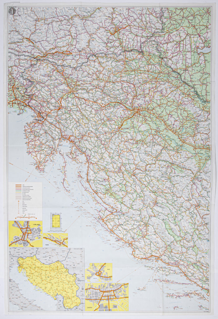
Sheet ‘1’ is one of two sheets of the road map of the Socialist Federal Republic of Yugoslavia in 1:500,000 scale, entitled ‘Road map / SFRY’. The map sheet shows the western part of Socialist Republic of Croatia, to Staro Petrovo Selo east of Nova Gradiška. Elements marked on the sheet include border crossings, locations of all types of routes with distances between settlements, railways, ports and harbours for ships and ferries, airports, motels, camps, petrol stations, and repair stations. The sheet also contains a supplementary map of Yugoslavia entitled ‘Main Routes in the SFRY’ and city plans with the main roads: ‘Ljubljana’, ‘Zagreb’, ‘Rijeka’, and ‘Split’. The map was formerly the property of Andrija Rašeta.

Sheet ‘1’ is one of two sheets of the road map of the Socialist Federal Republic of Yugoslavia in 1:500,000 scale, entitled ‘Road map / SFRY’. The map sheet shows the western part of Socialist Republic of Croatia, to Staro Petrovo Selo east of Nova Gradiška. Elements marked on the sheet include border crossings, locations of all types of routes with distances between settlements, railways, ports and harbours for ships and ferries, airports, motels, camps, petrol stations, and repair stations. The sheet also contains a supplementary map of Yugoslavia entitled ‘Main Routes in the SFRY’ and city plans with the main roads: ‘Ljubljana’, ‘Zagreb’, ‘Rijeka’, and ‘Split’. The map was formerly the property of Andrija Rašeta.
Sheet ‘1’ is one of two sheets of the road map of the Socialist Federal Republic of Yugoslavia in 1:500,000 scale, entitled ‘Road map / SFRY’. The map sheet shows the western part of Socialist Republic of Croatia, to Staro Petrovo Selo east of Nova Gradiška. Elements marked on the sheet include border crossings, locations of all types of routes with distances between settlements, railways, ports and harbours for ships and ferries, airports, motels, camps, petrol stations, and repair stations. The sheet also contains a supplementary map of Yugoslavia entitled ‘Main Routes in the SFRY’ and city plans with the main roads: ‘Ljubljana’, ‘Zagreb’, ‘Rijeka’, and ‘Split’. The map was formerly the property of Andrija Rašeta.