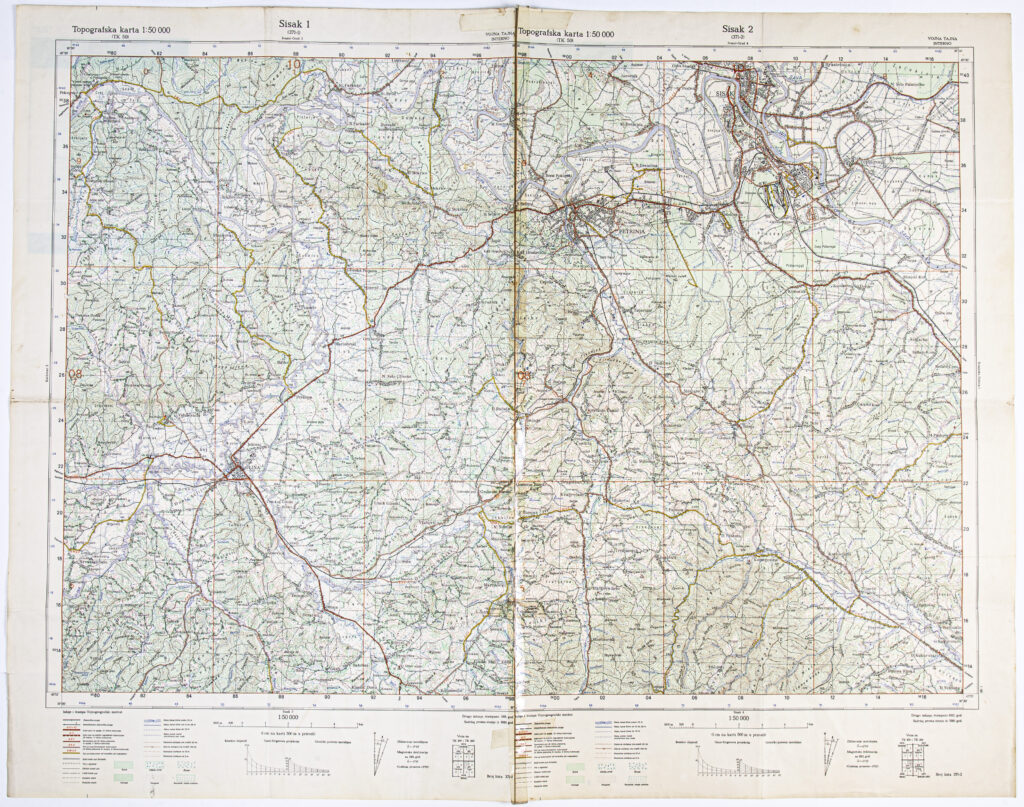
Detailed topographic map in 1:50,000 scale made for the needs of the Yugoslav People’s Army by gluing together the sheets ‘Sisak 1’ (published in 1981) and ‘Sisak 2’ (published in 1982). The map covers the area of Sisak, Petrinja, Glina, from Pokupsko in the west to the mouth of the river Kupa into the river Sava, from Hrvatsko Selo in the southwestern and Kukuruzari in the southeastern. All types of road and railway routes, from motorways to pedestrian paths, are marked on the map, as are the hydrographic network (rivers, streams, canals with width) and vegetation (forests, orchards, maquis, shrubland, vineyards, nurseries, young seedlings).
Izvori / literatura: first publication
error: Sadržaj je zaštićen!
Hrvatski povijesni muzej
‘Sisak’ Detailed Topographic Map
Description:
Detailed topographic map in 1:50,000 scale made for the needs of the Yugoslav People’s Army by gluing together the sheets ‘Sisak 1’ (published in 1981) and ‘Sisak 2’ (published in 1982). The map covers the area of Sisak, Petrinja, Glina, from Pokupsko in the west to the mouth of the river Kupa into the river Sava, from Hrvatsko Selo in the southwestern and Kukuruzari in the southeastern. All types of road and railway routes, from motorways to pedestrian paths, are marked on the map, as are the hydrographic network (rivers, streams, canals with width) and vegetation (forests, orchards, maquis, shrubland, vineyards, nurseries, young seedlings).