Imperial and Royal Military Geographical Institute,
Vienna,
1881
Paper, lithography; 60 × 73 cm;
scale: 1:75,000;
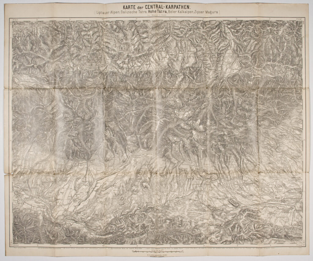
title above frame: ‘KARTE der CENTRAL - KARPATEN. / (Liptauer Alpen, Galizische Tátra, Hohen Tátra, Béler Kalkalpen, Zipser Magura) / Im Masse 1: 75000’; l. l. and l. r.: notes: ‘Preis schwarz 90 kr.’, ‘Preis colorirt 1 fl 30kr.’; below map frame: ‘K. k. militär. Geografisches Institut. / Vervielfältigung vorbehalten.’; data on reverse of map: map title, publisher, and scales.
This special (topographic) map was created from four topical map sheets, a hypsometric map of the central Carpathians in 1:100,000 scale (‘Die Hypsometrische Karte der Central-Karpathen – 1:100000’), and a general map of the High Tatras in 1:40,000 scale (‘Die Karte der Hohen Tátra 1:40000’). It depicts the mountain range of the central Carpathians on the territory of the Austro-Hungarian Monarchy: the Western Tatras, Galician Tatras, High Tatras, Belianske Tatras, and the Spiš Magura area.
Izvori / literatura: first publication
error: Sadržaj je zaštićen!
Hrvatski povijesni muzej
Topographic Map of the Central Carpathians
Description:
This special (topographic) map was created from four topical map sheets, a hypsometric map of the central Carpathians in 1:100,000 scale (‘Die Hypsometrische Karte der Central-Karpathen – 1:100000’), and a general map of the High Tatras in 1:40,000 scale (‘Die Karte der Hohen Tátra 1:40000’). It depicts the mountain range of the central Carpathians on the territory of the Austro-Hungarian Monarchy: the Western Tatras, Galician Tatras, High Tatras, Belianske Tatras, and the Spiš Magura area.