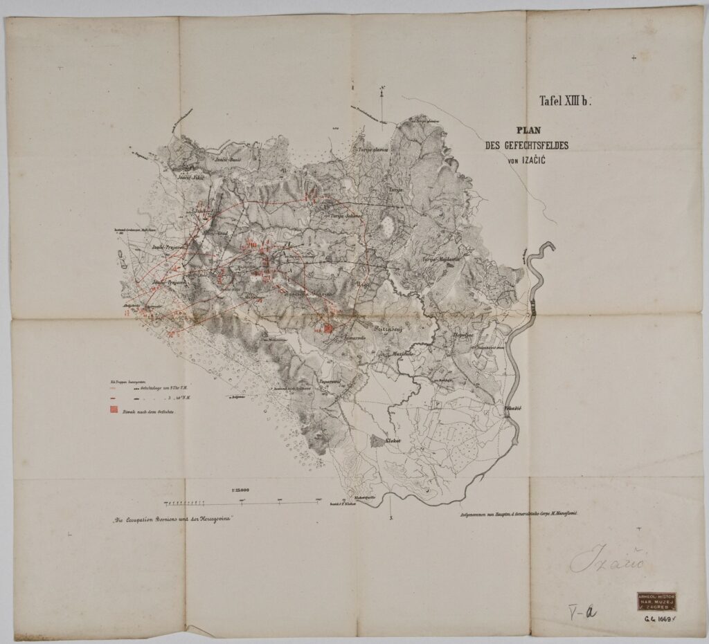
Plan of the Battlefield Near the Village Izačić in 1878
Recorded by: Mile Manojlović,
publisher: Imperial and Royal Military Geographical Institute,
Vienna,
from 1850 to 1900
Paper, scale: 1:25,000; ; 48,7 × 54 cm;
scale: 1:25,000;
u. r.: plan title: ‘PLAN / DES GEFECHTSFELDES / VON IZAČIĆ’; sheet label: ‘Tafel XIII b.’; plan key along left edge; l. l.: note: ‘Die Occupation Bosniens und der Hercegovina’; l. r.: author information: ‘Aufgenommen von Hauptm. d. Generalstabs-Corps M. Manojlović.’; stamp with provenance: ‘ARHEOL.-HISTOR. / NAR. MUZEJ / ZAGREB’
Inherited from the Archaeology and History Department of the National Museum in Zagreb
The plan of the battlefield near the village of Izačić on the Una river with marked positions of Austro-Hungarian and rebel army units. During the Austro-Hungarian occupation of Bosnia and Herzegovina in 1878, some of the hardest engagements were fought near the villages Izačić and Križove in northern Bosnia. After the Austro-Hungarian capture of Izačić, 800 rebels were driven back towards the neighbouring village of Baljevac, located next to the country’s border.
Izvori / literatura: Tominac: 2020, p. 262
error: Sadržaj je zaštićen!
Hrvatski povijesni muzej
Plan of the Battlefield Near the Village Izačić in 1878
Description:
The plan of the battlefield near the village of Izačić on the Una river with marked positions of Austro-Hungarian and rebel army units. During the Austro-Hungarian occupation of Bosnia and Herzegovina in 1878, some of the hardest engagements were fought near the villages Izačić and Križove in northern Bosnia. After the Austro-Hungarian capture of Izačić, 800 rebels were driven back towards the neighbouring village of Baljevac, located next to the country’s border.